Thorsmork - The Best Hiking in Iceland!
Thorsmork (Þórsmörk in the native tongue) valley is a world class hiking destination nestled just off of the Icelandic ring road in between the Tindfjallajökull and Eyjafjallajökull glacier.
The valley is named after Thor, the god of thunder, while most places would struggle to live up to a name like that Thorsmork goes above and beyond to do it justice!
This is everything you need to know!
Thorsmork Valley From Above
Where is Thorsmork?
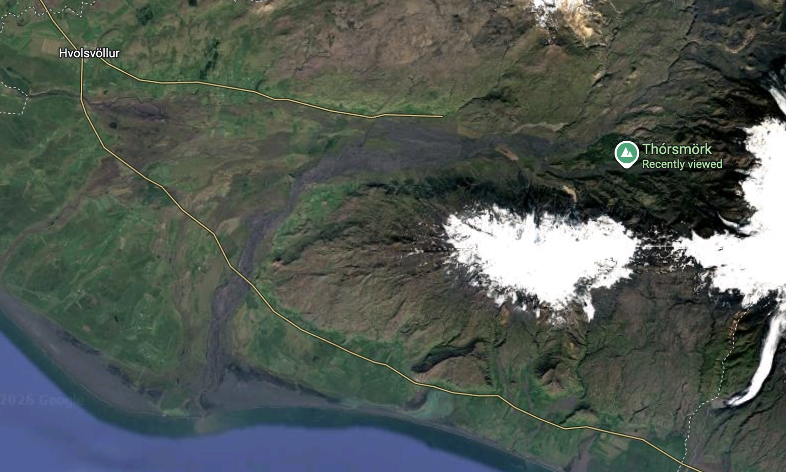
The Thorsmork valley is about 50 km from Hvolsvöllur just north of the Icelandic ring road in the south of the island. Heading inland on one of Icland’s most notorious F Roads, the F249, brings you to the best access point sandwiched between Tindfjallajökull and Eyjafjallajökull glacier.
What Time of Year to Visit Thorsmork?
Even though it is possible to visit Thorsmork in the winter months you’ll get much more out of your trip if you aim for summer. From around the end of May/start of June until end of September you’ll find the best weather, more overnight options and a wide range of easy hiking.
During the winter the road is only accessible via modified 4×4 Superjeeps as part of a guided day tour.
How to Get to Thorsmork?
Now getting to Thorsmork is definitely a little more challenging than you might think and some of these ways are definitely not for the faint hearted! The only access road is the notorious F249 - a very challenging backcountry road.
One of the main challenges you’ll come across are river crossings that get deeper and wider as you venture further in to the valley until you hit the Krossá River. This river is notoriously dangerous and difficult to cross and in most cases it isn’t recommended that you even attempt it on your own!
Self Drive To Thorsmork
Now I know my first thought was that self driving must be the best option. It gives you freedom to go where you please, when you please. However after some research we quickly realised that it just wasn’t a realistic option for where we wanted to go.
First thing to note is that a lot of rental companies won’t even allow you to drive the F249 in a rented vehicle and for good reason.
As mentioned before the river crossings are plentiful and deep and a normal 4WD won’t cut it. To get all the way into the valley you’ll need a raised 4WD vehicle with a generous ground clearance and a snorkel to not flood your engine.
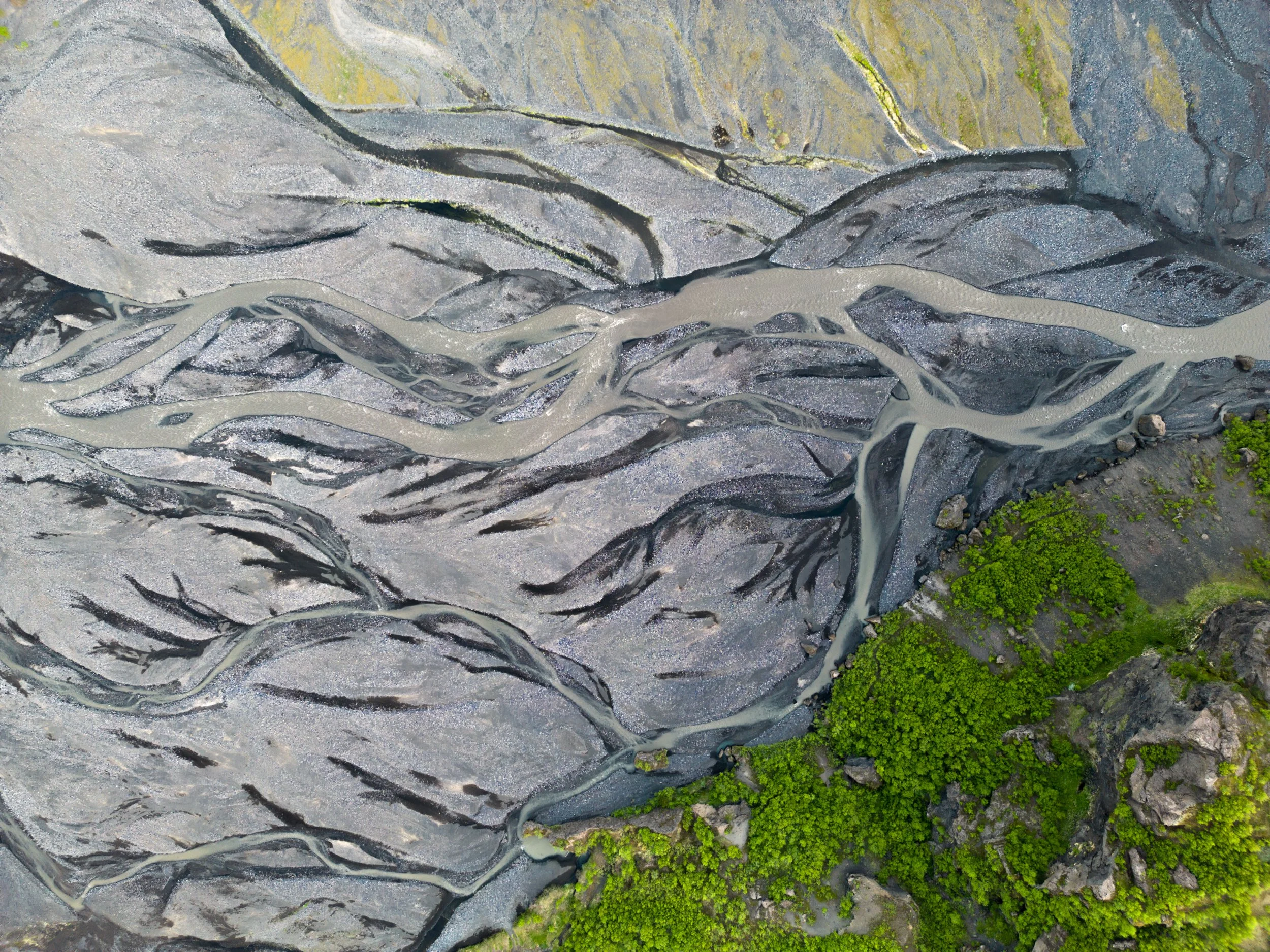
Some of the many rivers that flow threw the Thorsmork valley.
On top of that it’s worth having some 4WD experience, travel in a convoy and have some self rescue equipment incase you do get stuck.
Stop before the Krossá River
The majority of self drivers will still stop and park up before the Krossá River (and you should too!) and take a specialised 4WD bus the last few kilometres or hike in to their chosen campsite or accommodation from this point.
In all honesty the bus in really is the better choice!
Note: You can’t self drive the F249 in winter!
If you’re looking to rent a car or camper van 4WD or not I recommend using Northbound to compare prices and get the best deal!
Hike To Thorsmork
During the peak of summer this is a fantastic option for the more adventurous but does of course take a bit of planning.
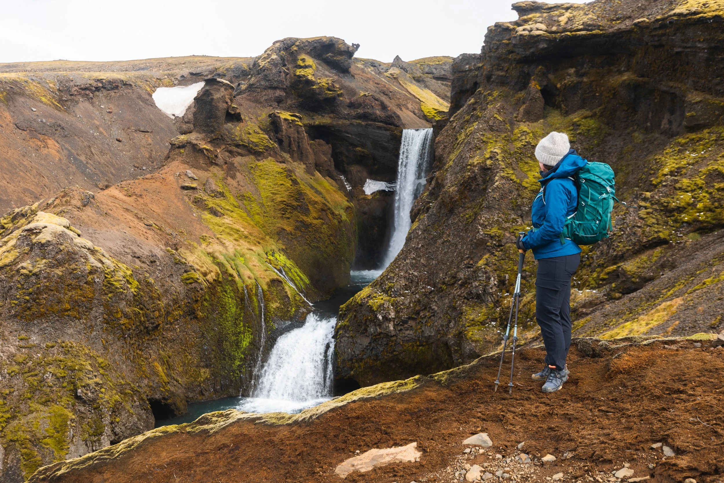
The Fimmvörðuháls Trail goes from Skógar (Skógafoss waterfall) to Þórsmörk (Thorsmork) passing endless waterfalls and alien like landscape.
Hiking the first section from Skógar
This 25 km trail is one of the most famous in Iceland with over 26 waterfalls on trail whilst covering 1250 metres of elevation gain.
However during early summer or periods of bad weather it’s common for the highest part of this trail to be difficult to cross or even impassable due to snow load - this was the case when we were in the area.
So to complete the best sections of this trail we actually hiked each end as a short out and back. From Skógar we hiked up past Skógafoss and followed mossy green landscape through canyons and along rivers. Then once we got closer to the snow line we turned around and headed back to our camper van.
The start of the Fimmvörðuháls Trail.
Later on in our trip we did the other end starting and ending in Thorsmork. This way we got the best of the views without having to struggle through deep snow that we weren’t properly prepared for.
Take The Bus To Thorsmork
Now if I’m honest this is honestly the way to go! It takes all the hassle out of driving, guarantees a safe river crossing and pulls up in the heart of Thorsmork right outside the best accommodation options.
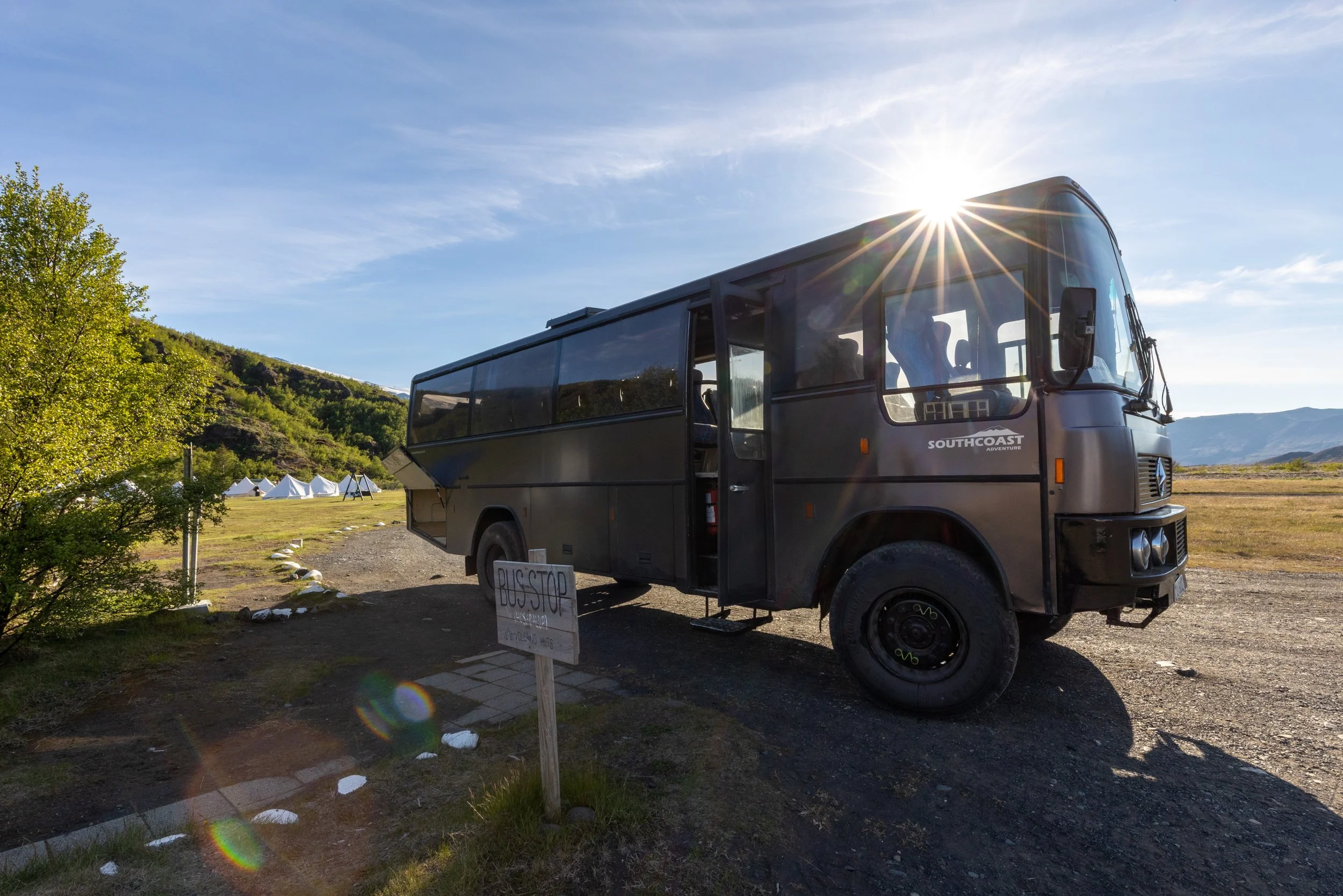
A large 4WD bus arrives in Thorsmork Valley
We rode the very bus above on our trip in to Thorsmork and didn’t regret it. Looking out the window seeing the water levels rise as we crossed deeper and deeper rivers made me very glad I wasn’t the one driving!
There are several companies that run these buses and offer pick ups from multiple locations.
We traveled with Southcoast Adventure and were very happy with it!
These guys will drop you off at Húsadalur (the Volcano huts), Básar or Langidalur Hut/campsite - your main accommodation options.
Where to Stay in Thorsmork?
There are really 3 main areas to stay at when visiting Thorsmork - Húsadalur (the Volcano huts), Langidalur or Básar.
All are accessible via specialised 4WD bus or by self driving and parking before the Krossá River and hiking the remaining distance to your camp.
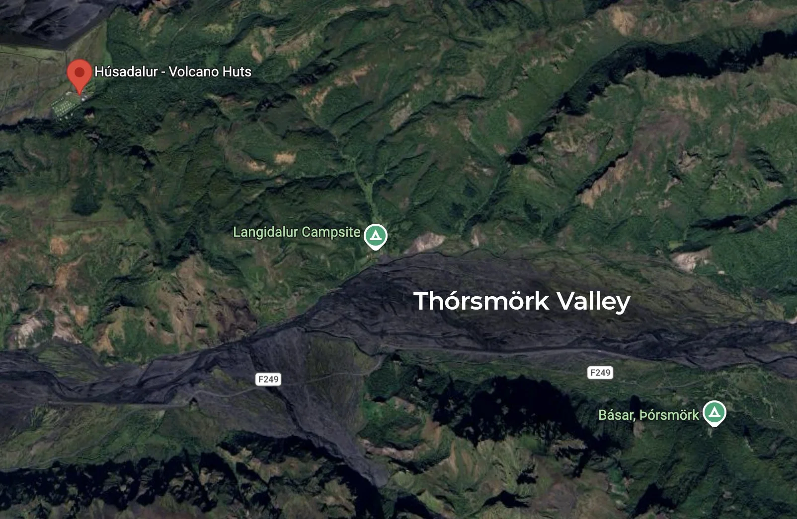
Courtesy of Google maps
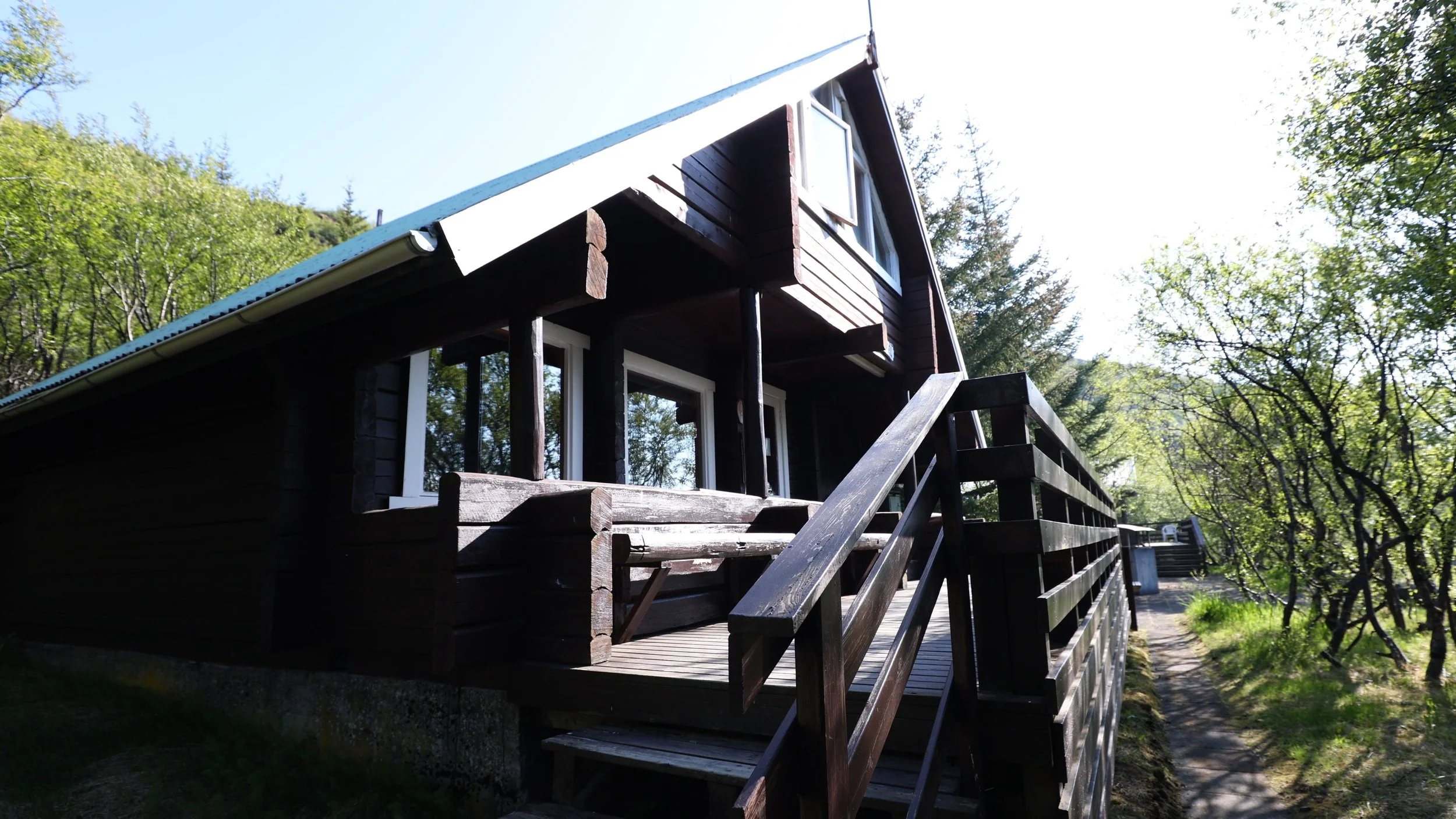
Langidalur Campsite and Hut
At this campsite nestled in to the edge of Thorsmork valley you have the choice of bringing your own tent or staying in the large mountain hut.
Langidalur is the true end of the Laugavegur Trail as well as the official start/end of the Fimmvörðuháls Trail.
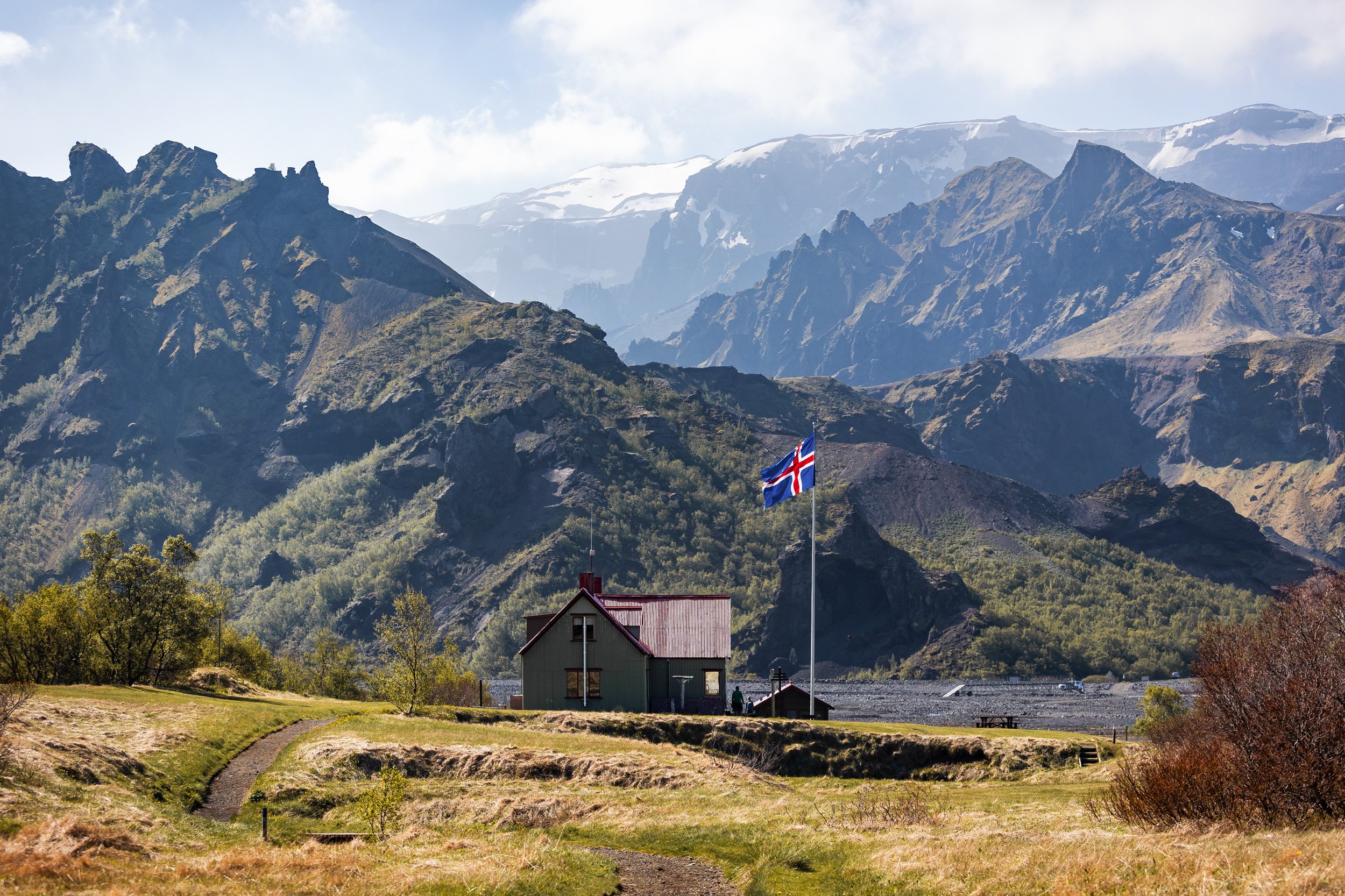
Langidalur hut
The Hut
This is a true mountain style hiking hut that houses up to 73 guests over two floors in shared accommodation.
For your money you’ll get a basic bed, two kitchens with utensils and running water, dining hall and a large patio. There’s even a small shop to grab an after hike beer!
At ISK 17,000 per person, per night it is a pricier option and there’s even an extra fee of ISK 1,100 to use the showers!
Camping
The camping is much more reasonable at ISK 3,400/night for an adult however there are additional fees for the showers and other facilities.
Ferðafélag Íslands (The Iceland Touring Association, FÍ) owns and operates the hut. Both the hut and the campground can be booked here.
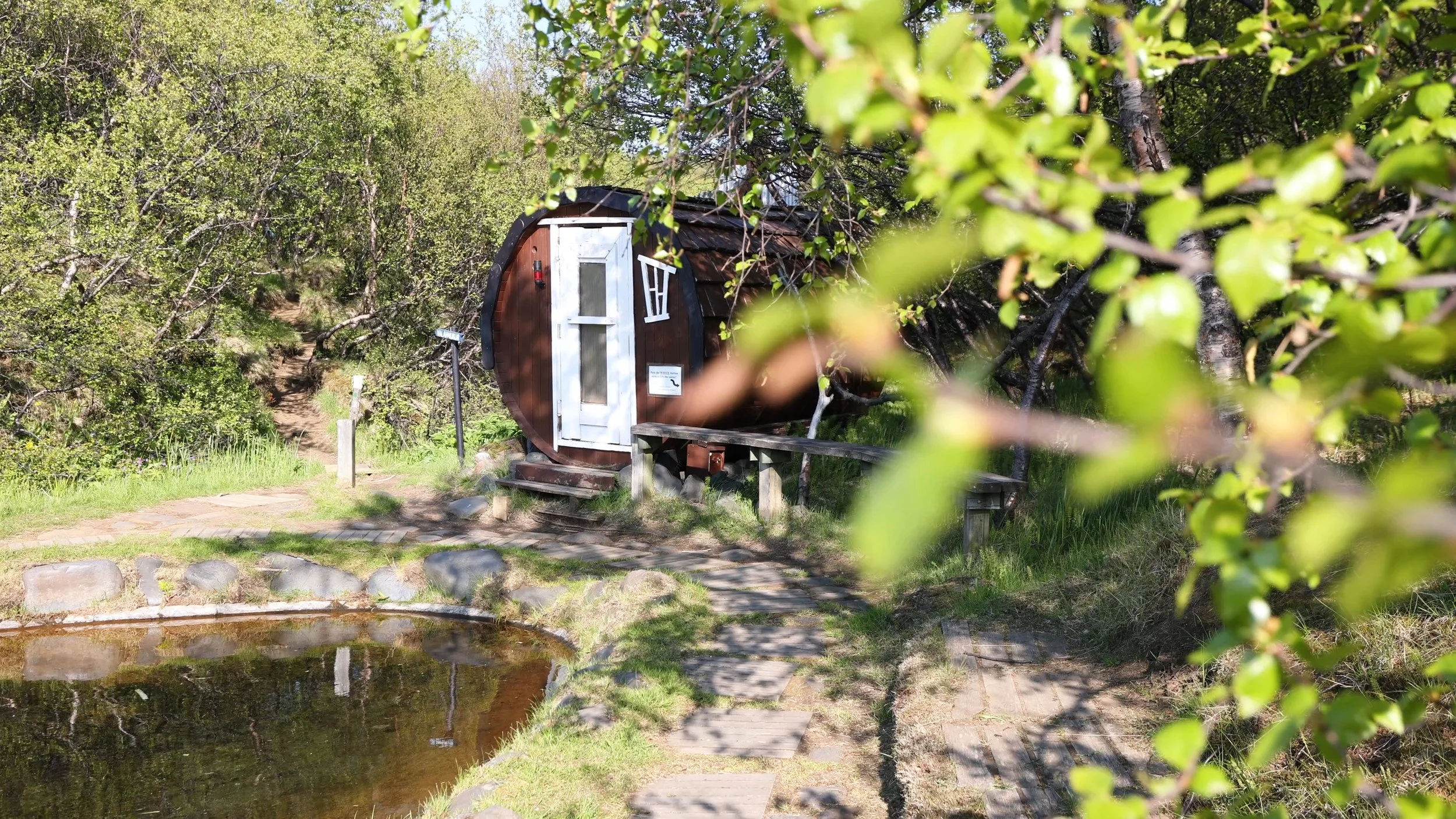
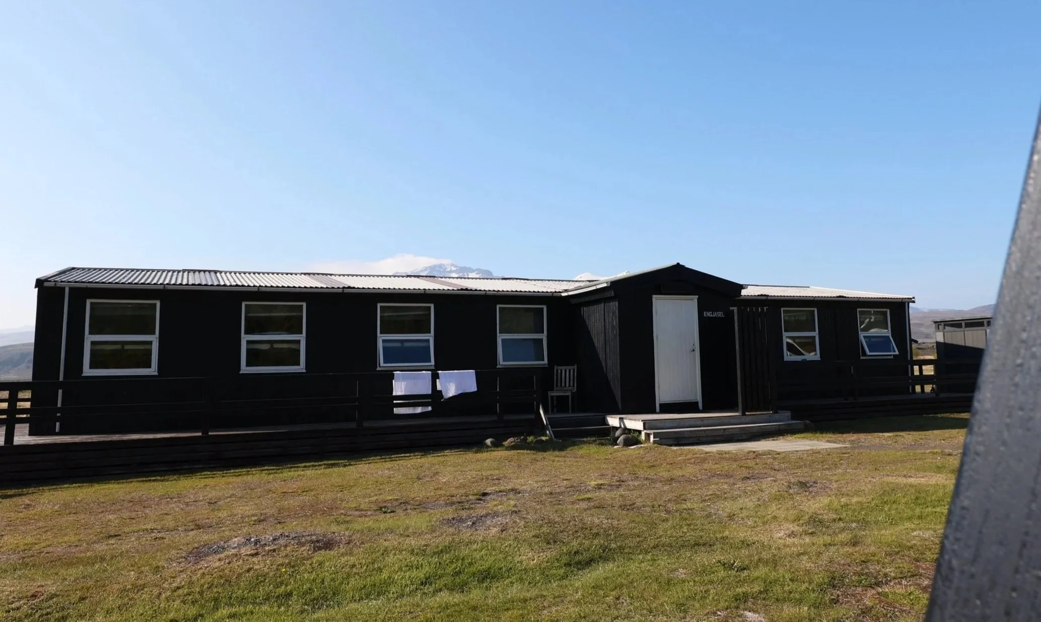
Básar Hut and Campsite
At Básar the campground is paid for on arrival and offers bathroom facilities and a nightly bonfire, weather permitting.
There are two huts on offer one sleeps 55 and the other smaller hut just 16 at a cost of ISK16,800 per night. There’s also an on site restaurant providing light snacks, refreshments and of course beer.
The website is a little scarce on information but the huts can be booked here.
Volcano Trails
When it comes to staying overnight in Thorsmork Volcano Trails in Húsadaluris is pretty hard to beat.
They have the widest variety of accommodation options which cater for pretty much every budget and every level of luxury. This is where we opted to stay on our visit. After having spent a good ten days in our small campervan we felt like splashing out on a little extra creature comfort!
Camping
For the budget traveller the bring your own tent camping is a fantastic option. For just ISK 3,660 per night, per person you get space to pitch your tent as well as access to showers, the sauna, free Wifi in the main building and a kitchen shelter. For Iceland, especially for somewhere this remote, it isn’t a bad deal!
The onsite sauna included in your camping fee.
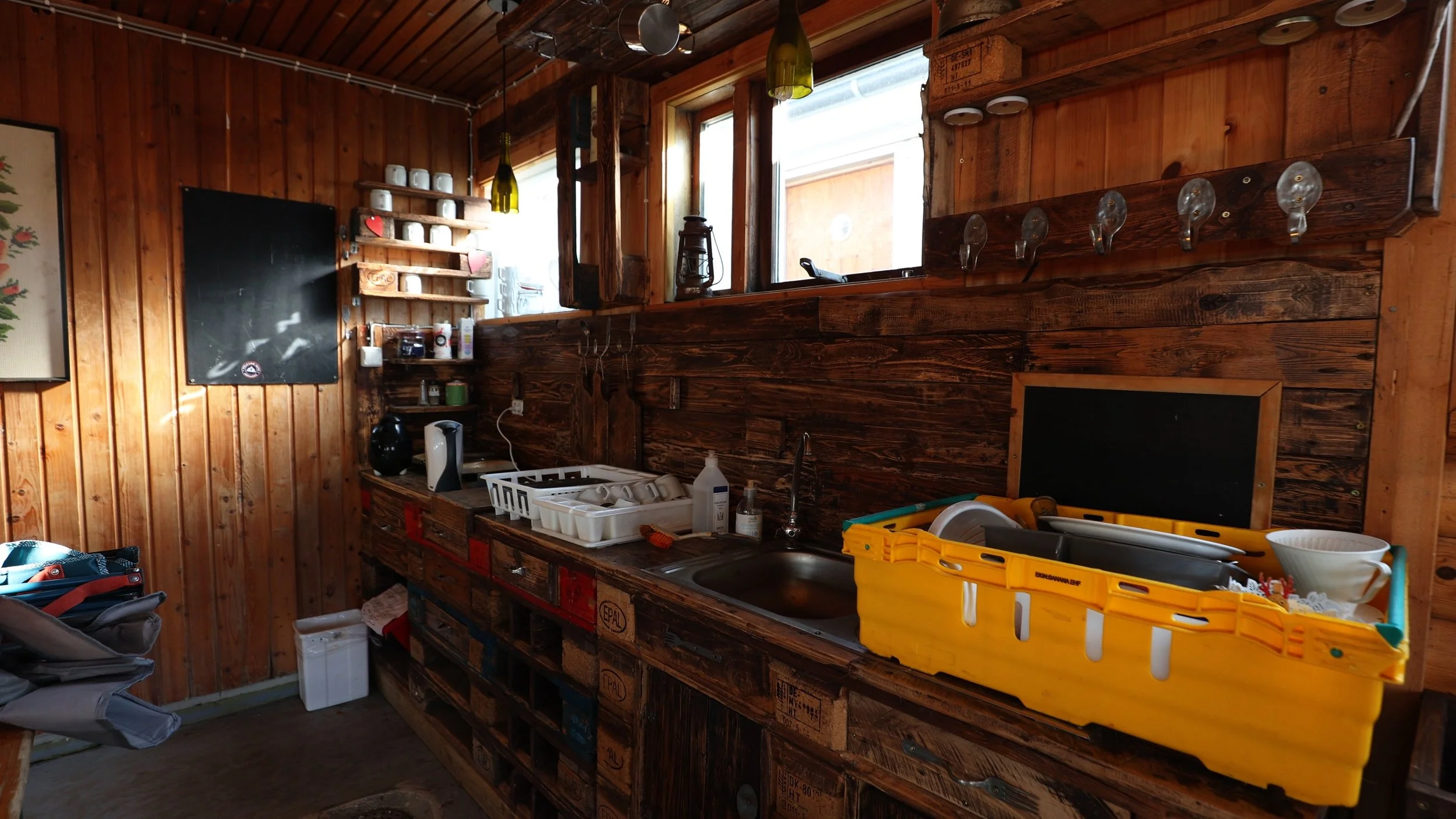
Shared kitchen facilities open to everyone on site.
Glamping
If you’re looking for a bit of private luxury and at a reasonable price I would highly recommend checking out the glamping tents! This is what we went with for our time in Thorsmork and we loved it! It was a great break from the small camper van we’d been calling home for the previous 10 days.
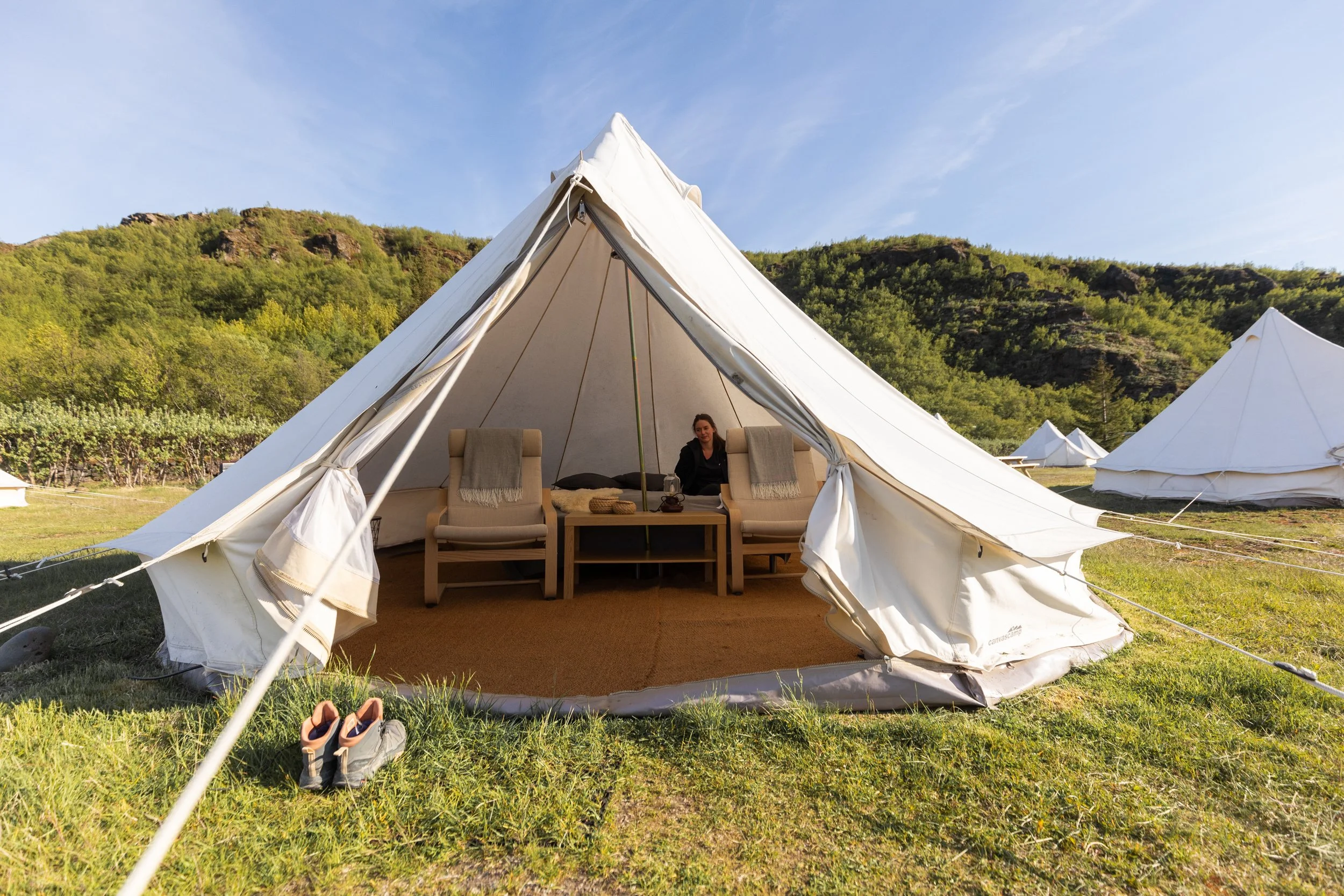
Our glamping tent for the night.
With your glamping stay you’ll get a comfy bed with all the linen, provided towels, an electric heater for if it gets chilly, access to the shared bathrooms and showers, wifi, access to the sauna as well as some amazing views of the midnight sun right from your door.
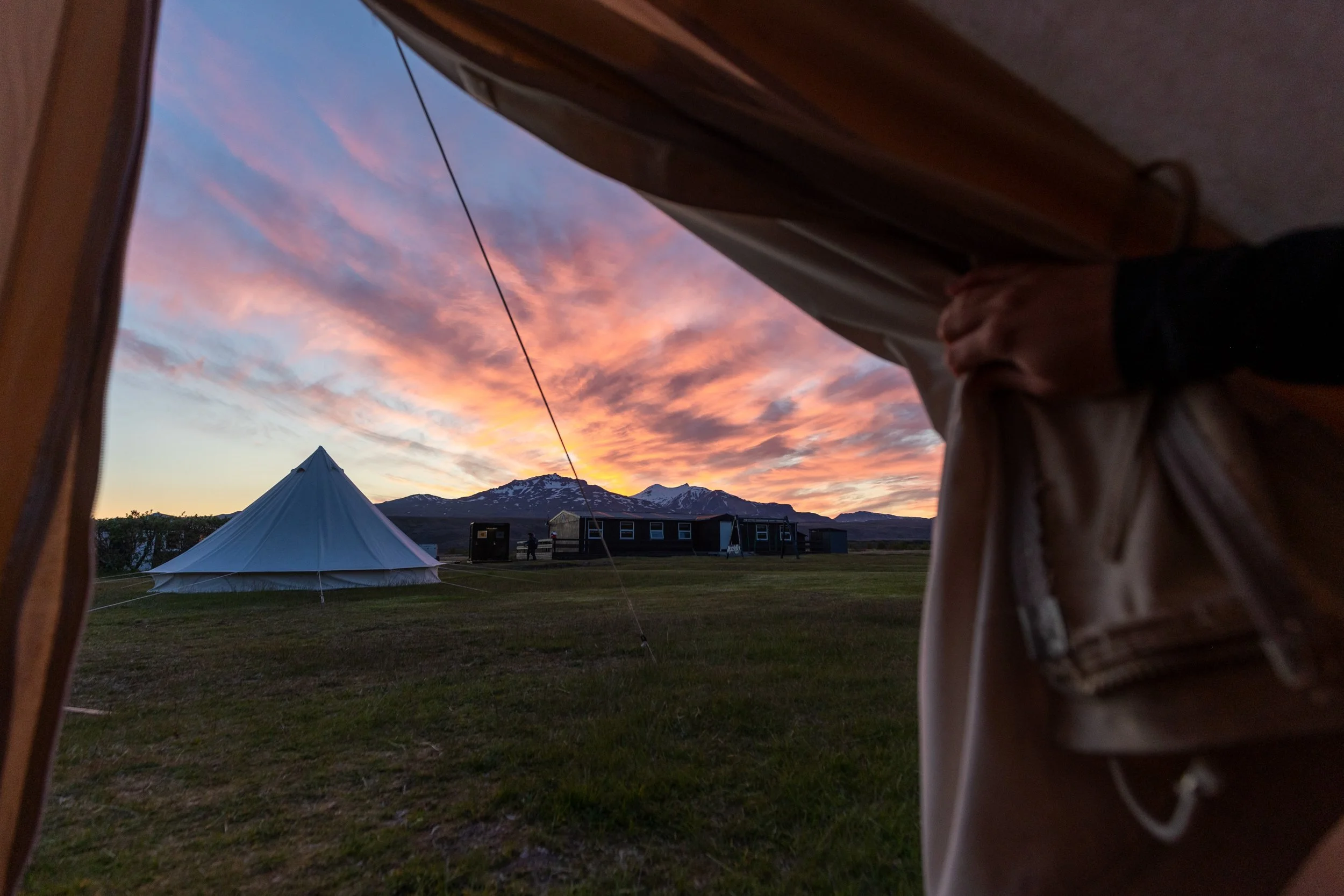
This picture was taken at around midnight during our stay!
Mountain Hut
If you’re after a more solid 4 walls and a bathroom close by the mountain hut is a great option and perfect for solo travellers.
In the Mountain huts you’ll be treated to a single bed in a shared dorm with a shared bathroom inside the same building. You get access to all the usual sauna, shower and main buildings as well as a private kitchenette with a kettle, perfect for making hot drinks.
You will however need to either bring or rent your linen for an extra fee.
One of the mountain cabins.
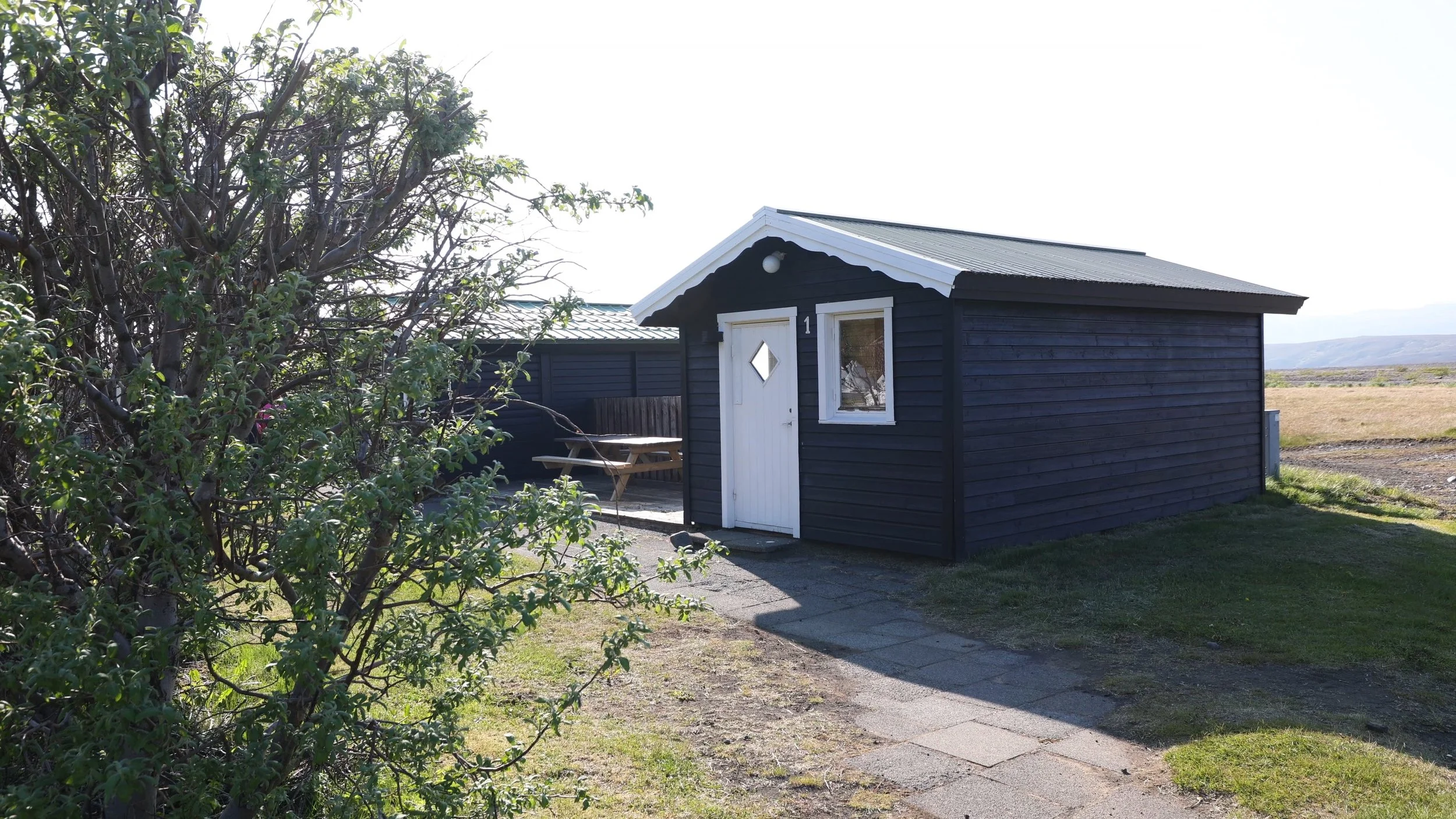
Cabin Rooms
If you don’t fancy a sharing a room with strangers but still want those 4 solid walls to protect you from the wind then take a look at a cabin room.
These cabins have 14 rooms each with a double bed and an upper bunk so can be used as two single occupants or a couple. Shared bathrooms are in the main building and made up beds and towels are included.
Shepherd’s COTTAGES
Finally we have the Shepherd’s Cottages perfect for small groups or those after a bit more privacy.
Each cottage includes 4 bunk beds / 3 singles and 1 double and a small kitchenette with enough tableware for 5 people. Again you’ll need to either rent or bring linen with you but you do also get access to shared bathrooms/showers, the sauna and Wifi in the main building.
One of the cabins set in a row.
Eating at Volcano Trails In Thorsmork
With any of these accommodation options you can either bring and prepare your own food or add on a meal plan. There’s also an onsite bar and ice creams! It really is luxury in the Icelandic backcountry
Prices for 2026:
Breakfast Buffet: ISK 3.200
LavaBurger: ISK 3.500
Soup Lunch Buffet: ISK 3.250
Dinner Buffet: ISK 5.500
Lunch Package: ISK 3.200
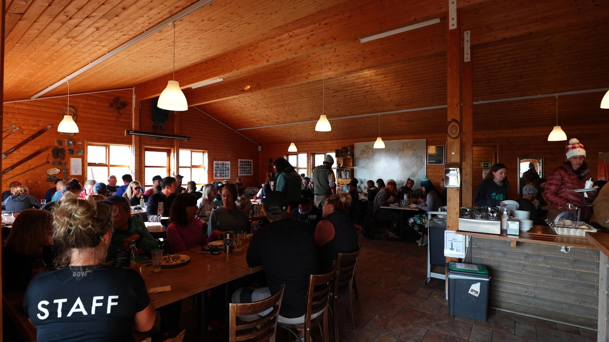
The diner buffet room, a little out of our budget so we came self prepared!
The Best Hikes in Thorsmork
Now there are lots of hiking trails in and around the Thorsmork Valley. Some of these trails are point to point trails that cover a long distance and take more planning logistically.
One of these is the Fimmvörðuháls Trail, that I mentioned before, that goes all the way back to Skógar, past Skógafoss waterfall.
Another is the 55 km hike to Landmannalaugar (the Icelandic highlands). The Laugavegur Trail is an advanced long distance trail covering 55 km and over 2000 metres of elevation gain and best split over several days.
If you have the time, and the weather permits, these are both great options. However in this blog I’ll be going in to a bit more detail about a couple of fantastic day hikes!
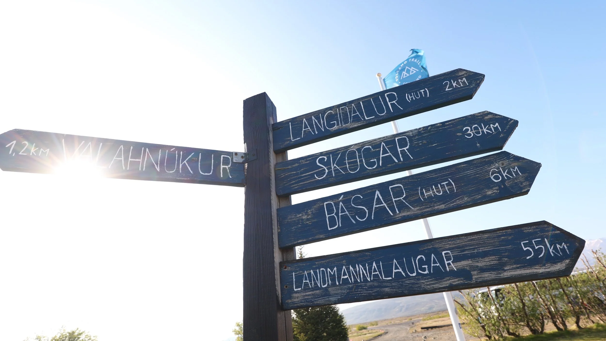
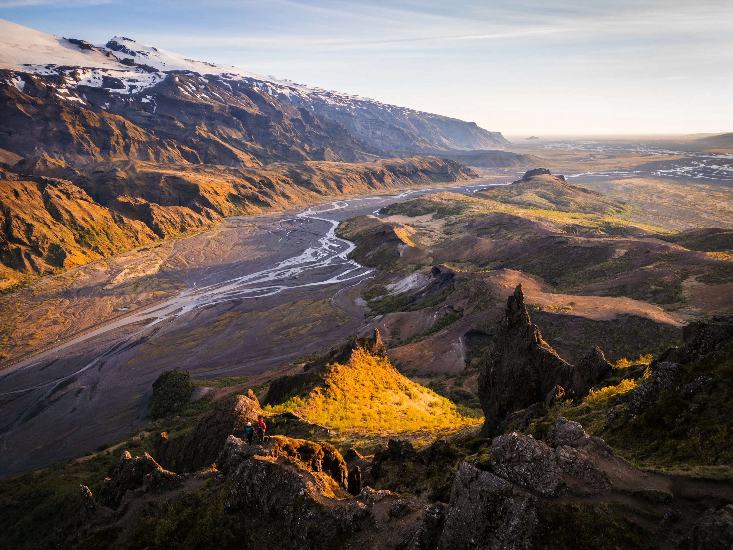
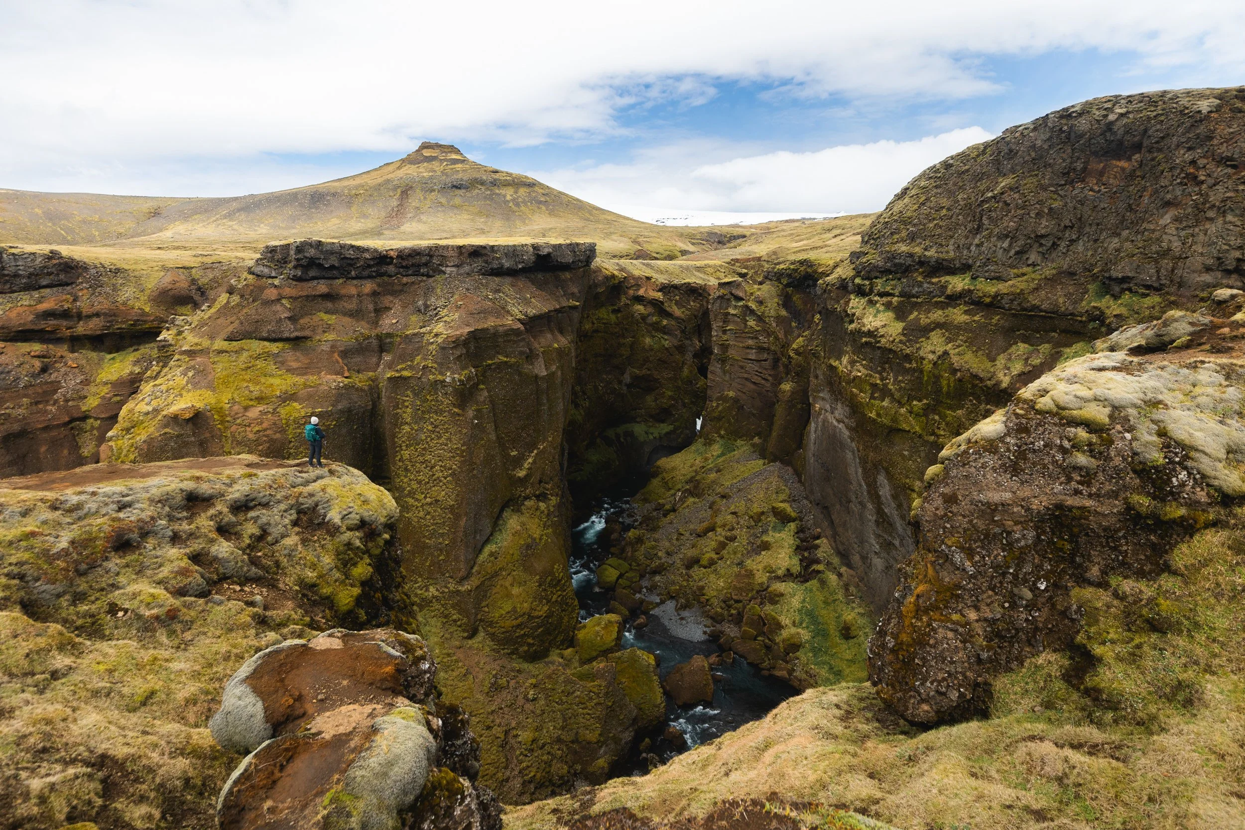
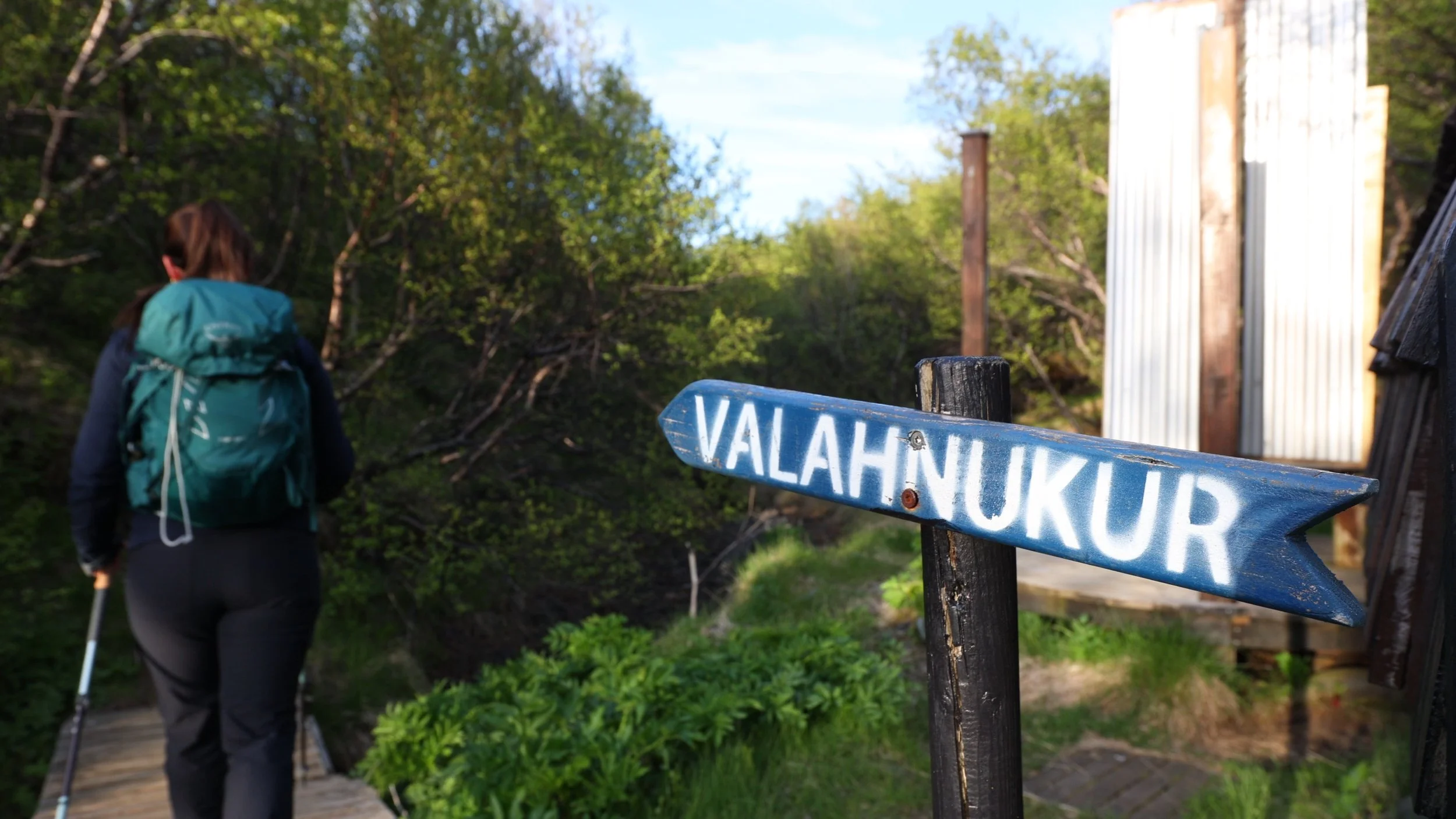
Valahnjúkur ViewPoint
This viewpoint is probably the image you know of Thorsmork. It’s probably the view that inspired you to start your research in to the area. The great news is that this hike is short, easy going and leaves directly from the Volcano Huts or is a similar distance leaving from Langidalur Hut/campsite and campground . From Básar Hut/campsite you’ll need to add on an extra few km each way.
I’ll be describing this trail starting from the Volcano Huts (Húsadalur)
Valahnjúkur Viewpoint
The Valahnjúkur Viewpoint trail is a 2.5 km out and back with 230 metres of elevation gain.
The trail itself will only take around an hour to an hour and a half to complete but you’ll want to leave plenty more time to take in the view.
The trail starts off from the Volcano huts, (this is where most buses will drop you and where the majority of accommodation is based) from here it’s well sign posted along a defined trail.
The trail initially winds through ancient woodland, something that Iceland was once covered in but in more recent years has become a much rarer sight since agriculture took over the island.
Once you’ve cleared the forest the views back down the valley become ever improving.
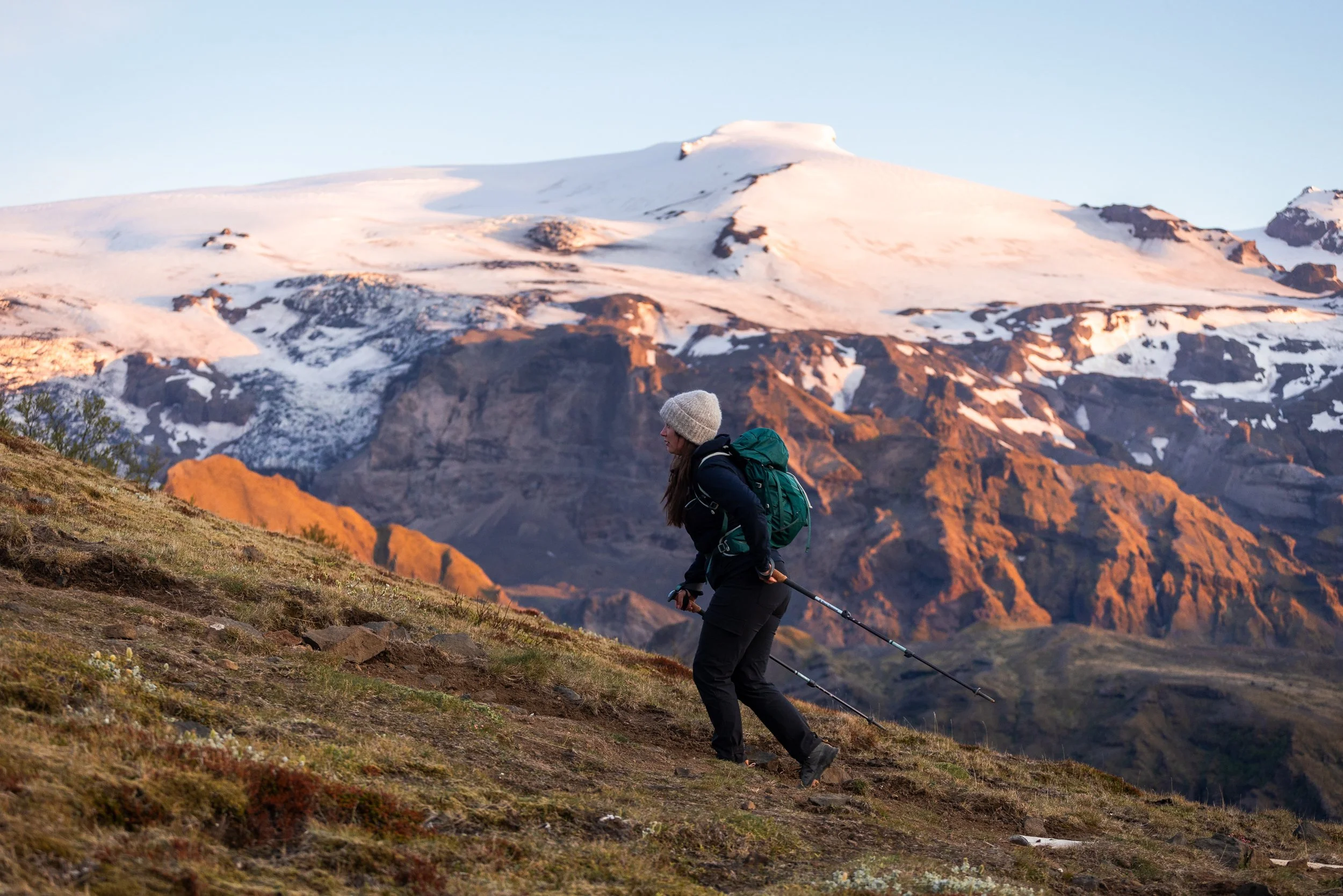
On the way up to Valahnjúkur
Once at the top you’ll get views of braided rivers, glaciers and rugged mountain peaks in all directions.
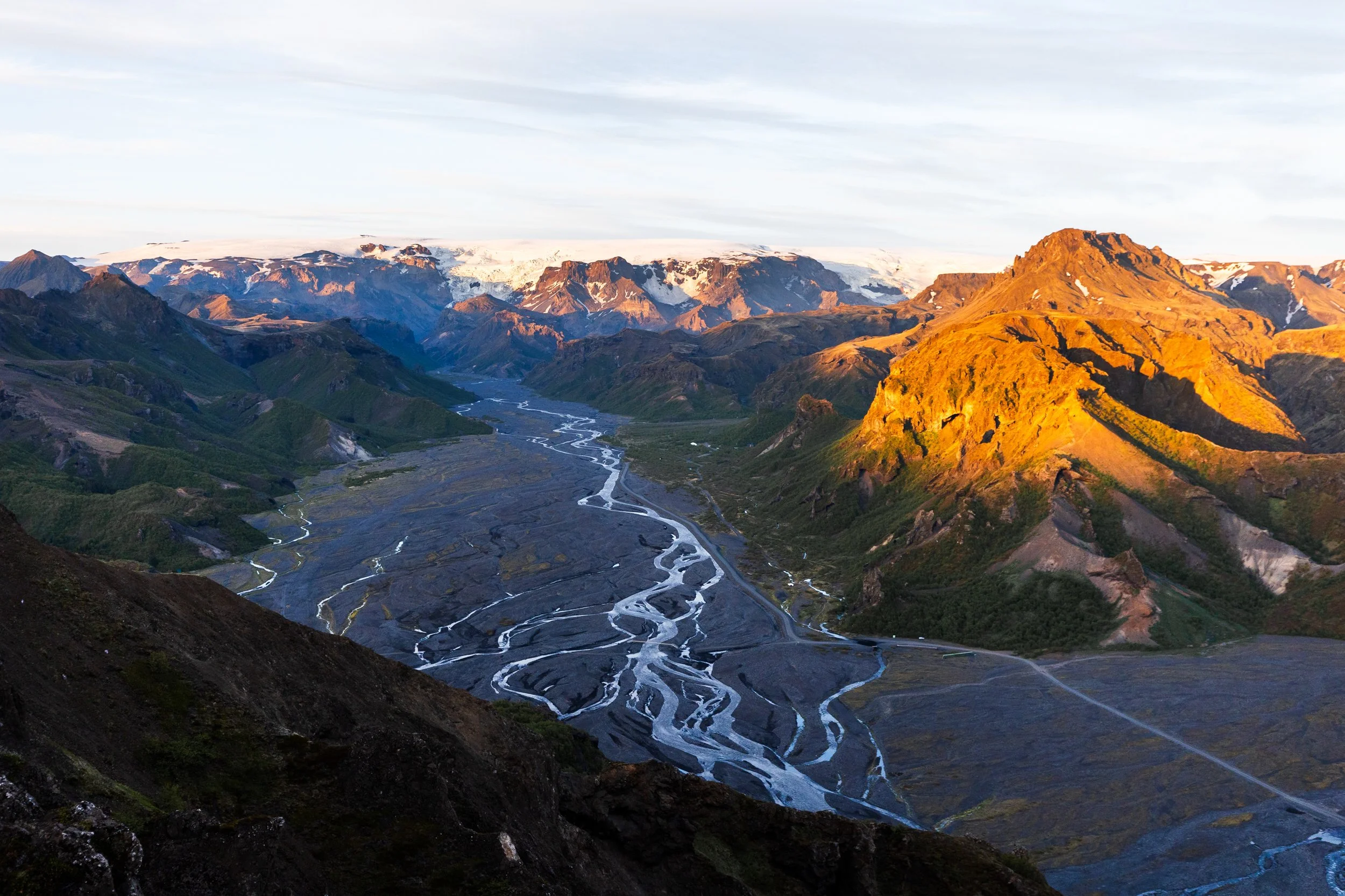
Views back down the valley
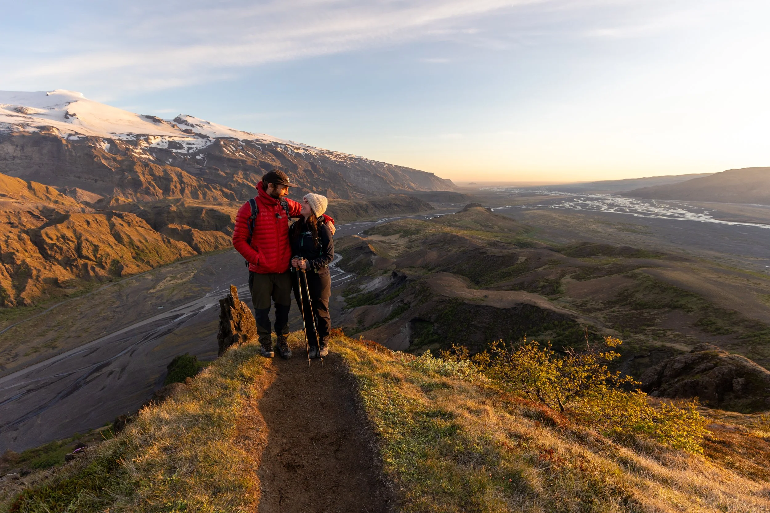
It truly is the perfect place to watch the sun skim the horizon during the summer months.
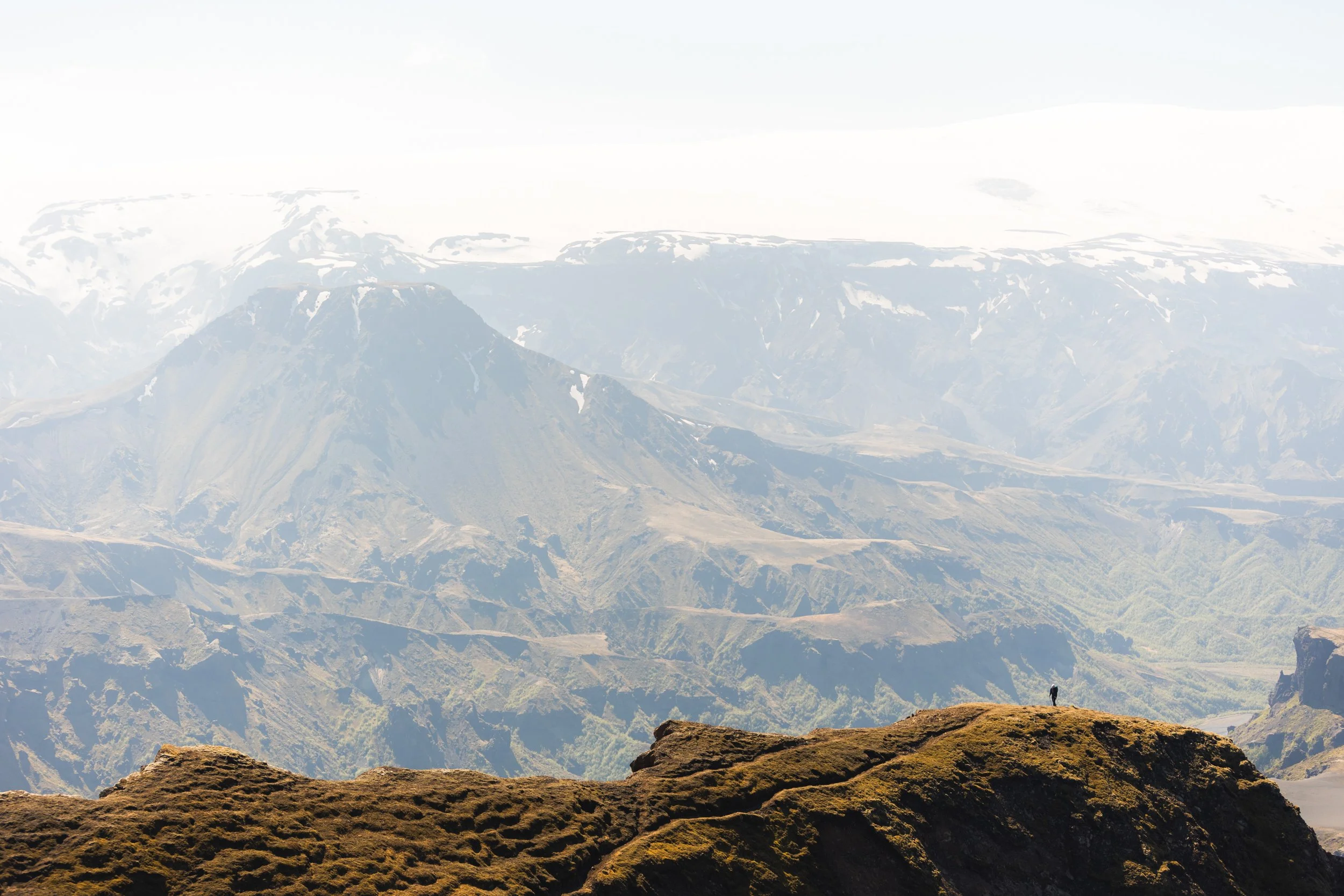
Rjúpnafell
At 823 metres in height Rjúpnafell is the tallest and steepest peak in the Thorsmork Valley.
It’s distinct double summit and prominence in the valley makes it a worthy adversary. It’s hard not to want to climb it!
The hike covers between 18 and 20 km depending on what route you take and just over 1,100 metres of elevation gain if starting from the Volcano huts (Húsadalur) and is around 4 km shorter if starting and ending at Langidalur Hut. It can be a long day but very manageable for experienced hikers.
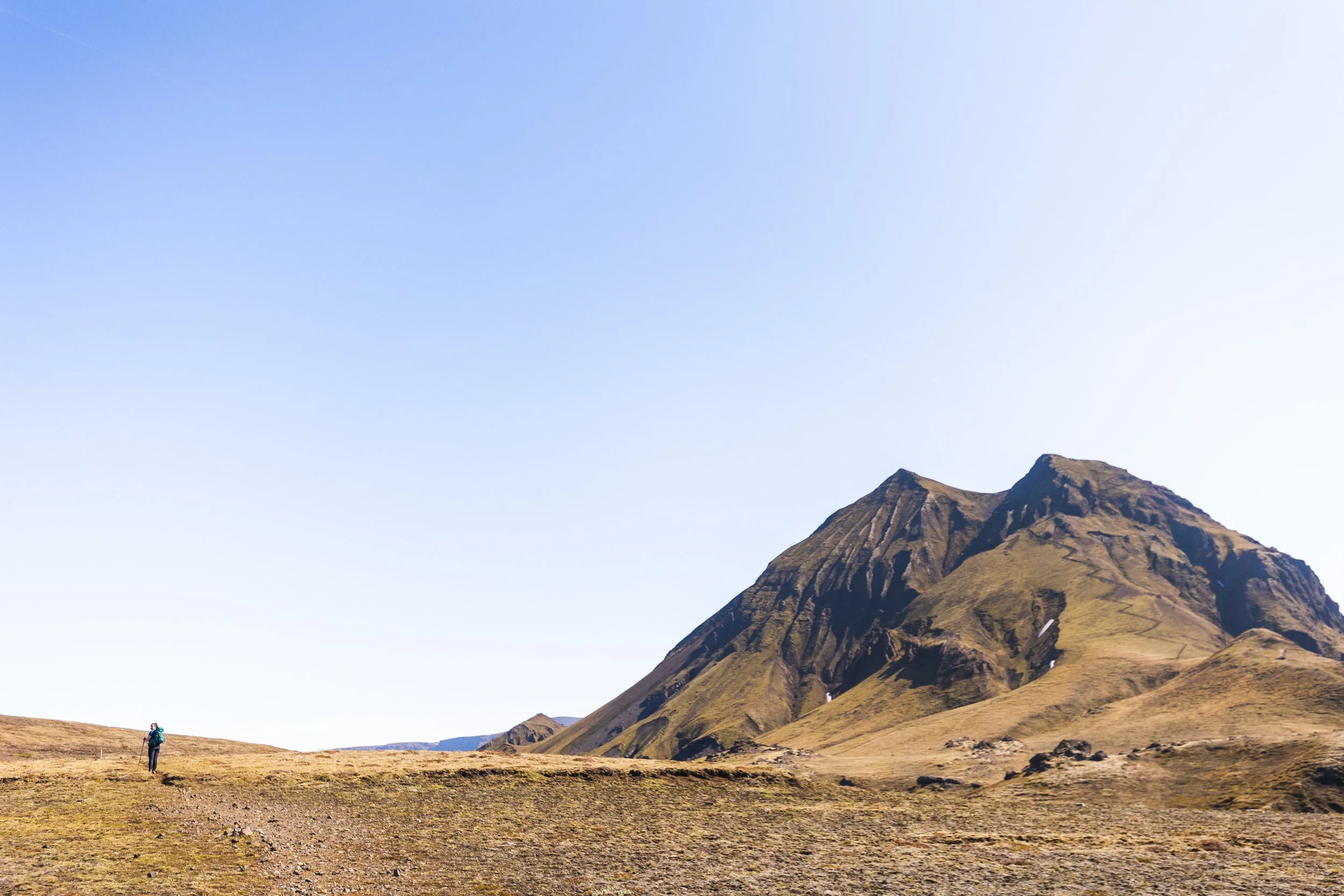
Rjúpnafell looms in the background.
There are a few different trails that lead towards Rjúpnafell, including an option that will also take in Valahnjúkur Viewpoint on the way back.
As we’d already been up to this view point during golden hour we opted to skip it on our second day.
We started this trail from Húsadalur (the Volcano huts) and it in fact follows their well sign posted orange trail for the majority of the hike until you have to deviate off a little to make the summit.
Langidalur Hut
The first 2 km section of trail crosses from Húsadalur (the Volcano huts) to Langidalur.
From here you take a left and follow the trail up through the valley. The trail is well sign posted with orange markers and makes a loop from this point. If you choose to go straight on or left to follow the orange trail you’ll end up back at this junction.
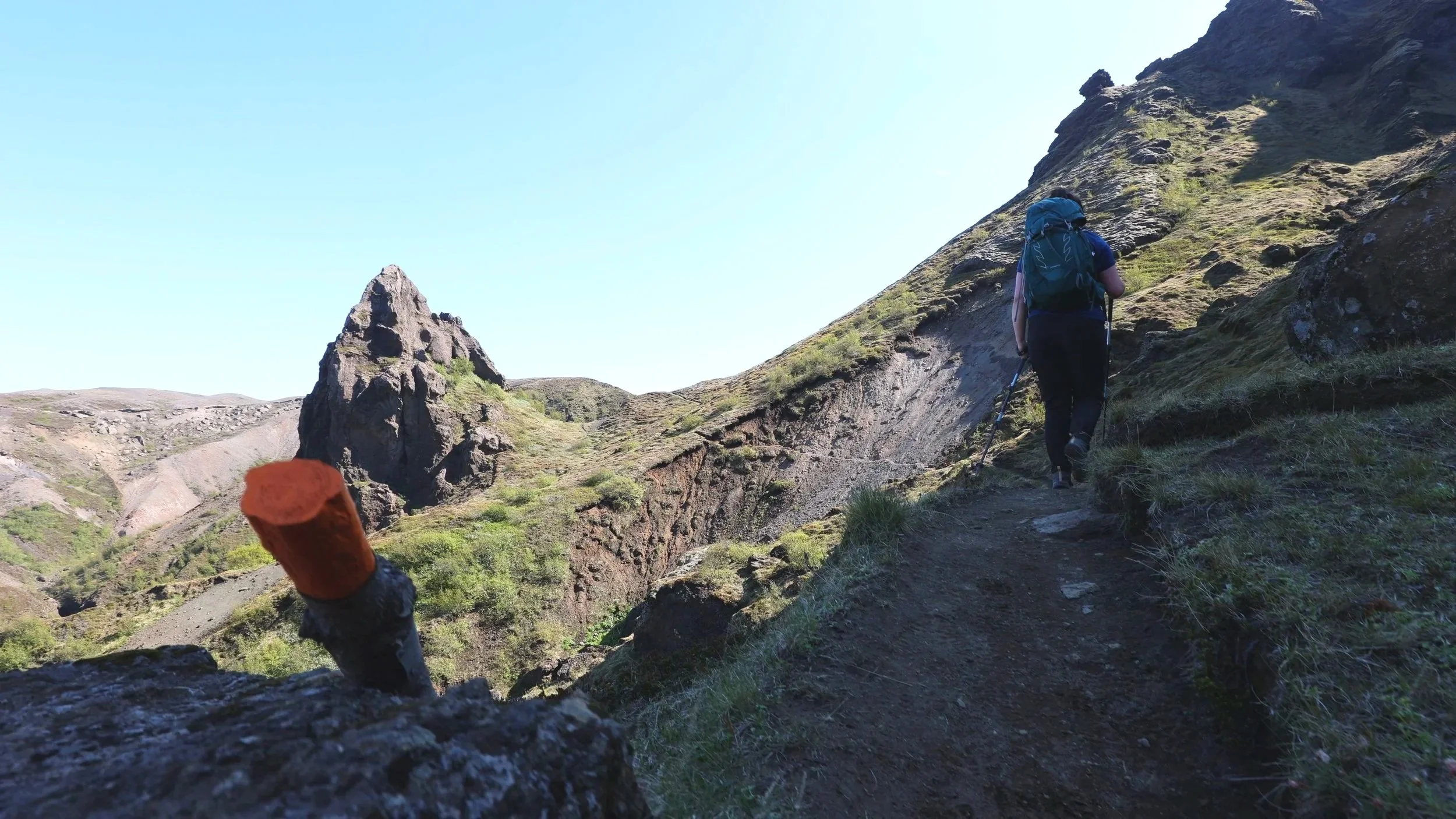
An orange marker leads the way.
When it comes to deviating a little from the orange trail you’ll be able to see Rjúpnafell in the distance as well as the trail that leads you there. It’s a struggle to get lost but I always recommend taking an offline mapping option. A free trial at AllTrails will give you what you need for your trip!
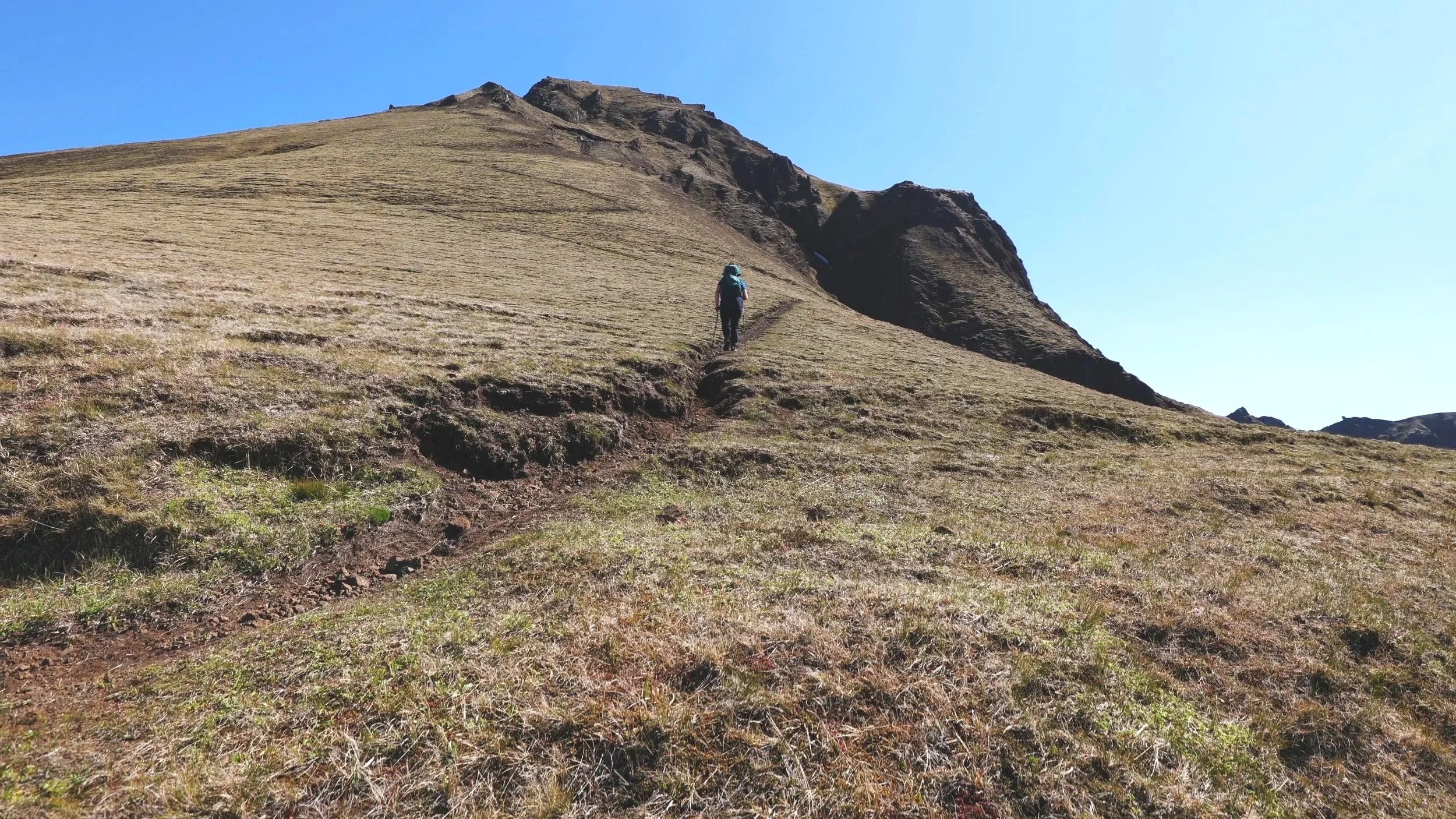
Heading up Rjúpnafell
The ascent up to Rjúpnafell is steep covering about 260 metres of elevation gain in around a km and has a little exposure. Taking this deviation adds about 5 km of distance on to the marked orange trail.
When we hiked this trail we saw a couple of other hikers below us turn back as they didn’t feel comfortable on the gradient or the exposure.
If I’m honest we didn’t think much of it but we do spend the majority of our time hiking in the Canadian Rockies so hikes like this are a pretty regular ocurence. I would say this trail is something that most hikers at a good fitness level could complete but it’s something to keep in mind if exposure or heights are an issue.
Just before the summit of Rjúpnafell
Once of the summit you’ll be surrounded by glacial views and mossy mountains on every side! It’s hard not to feel a little insignificant in such a vast landscape.
After you’ve taken in all the views head back down the way you came to rejoin the orange trail and follow it back to the start.