Yates Mountain - Prairie View Trail
Yates mountain trail is known by several different names including the Barrier Lake lookout, McConnell Ridge and Prairie View Trail! In all honesty it’s kind of all of those places all at once!
This beginner friendly hike at the front end of Kananaskis is close to Calgary and a great season opener. It gives you views over the prairies and acts as the Barrier Lake fire lookout with Yates Mountain being the unofficial name of the high point of the McConnell ridge!
The Stats
Time: 4 - 5 hours with a couple of good breaks!
Distance: 12 km out and back
Elevation Gain: 700 m up to the fire look out.
Difficulty: Easy to moderate
What Time of Year is Best to go?
Yates Mountain is a great option for a winter hike! In fact it’s a pretty decent option year round and one of the first summits once you turn in to Kananaskis. It’s closer proximity to the Prairies, Calgary and the highway means it doesn’t tend to get as much snow as the hikes deeper in to Kananaskis.
Even when it’s covered in snow the trail doesn’t pose an avalanche risk and all you’ll need to get those summit views are some micro spikes, poles and some good warm layers!
Then during summer the trail gets even easier to navigate and it’s a great spot to watch the sunset!
How to Get to The Yates Mountain Trailhead
The trailhead to Yates Mountain, or Prairie View trail if you like, starts at the Barrier Lake carpark. Barrier Lake is almost spot on an hours drive from Calgary. Once you turn off in to Kananaskis you have a 10 minute drive before turning right in to the car park. Look out for signs for ‘Barrier Dam’ - the turning comes up a little suddenly!
The car park has plenty of room but on summer weekends can still fill up as visitors come to recreate and relax on the lake.
The Hike
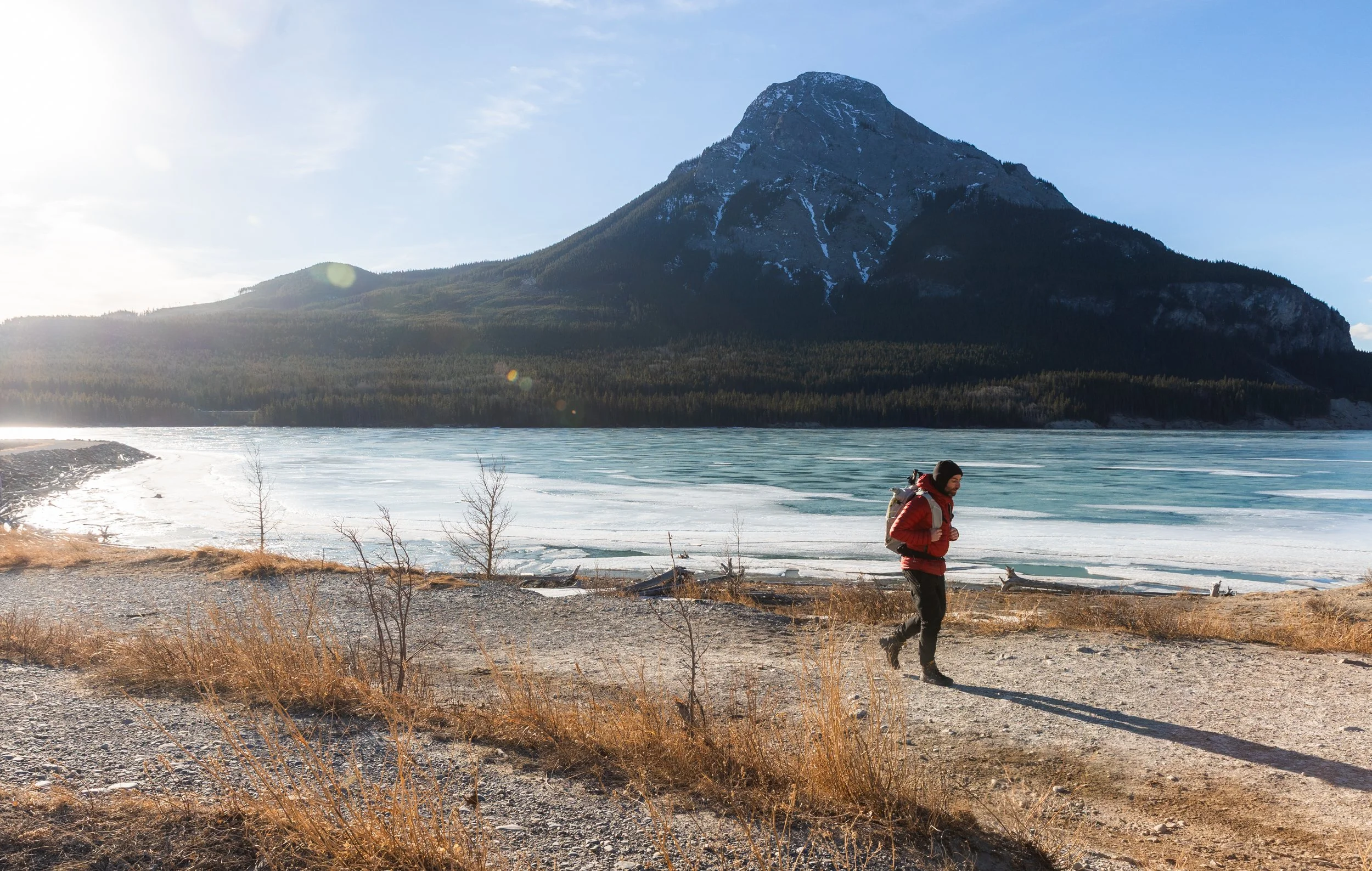
The first section of this trail is a great opportunity to warm up the legs! For the first km the trail is nice and wide and, most importantly, flat as you follow the trail around the edge of the lake. To your left you’ll get some fantastic views of Mount Baldy.
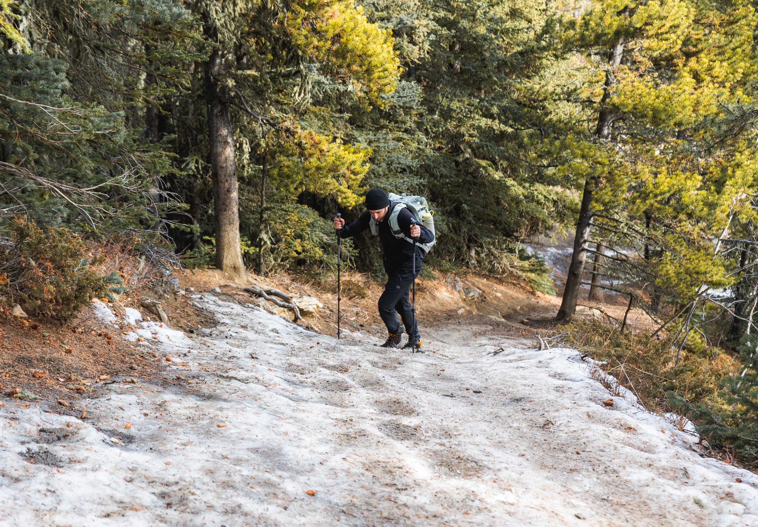
Believe it or not the first few images in this post are from a recent hike in February! Normally there would be a lot more snow around than there is in these pictures!
From here the trail makes it’s way in to the trees, from early on you’ll be able to see the cliff band above that holds your reward in the way of some brilliant views. The elevation gain is steady, manageable and consistent throughout the majority of the trail.
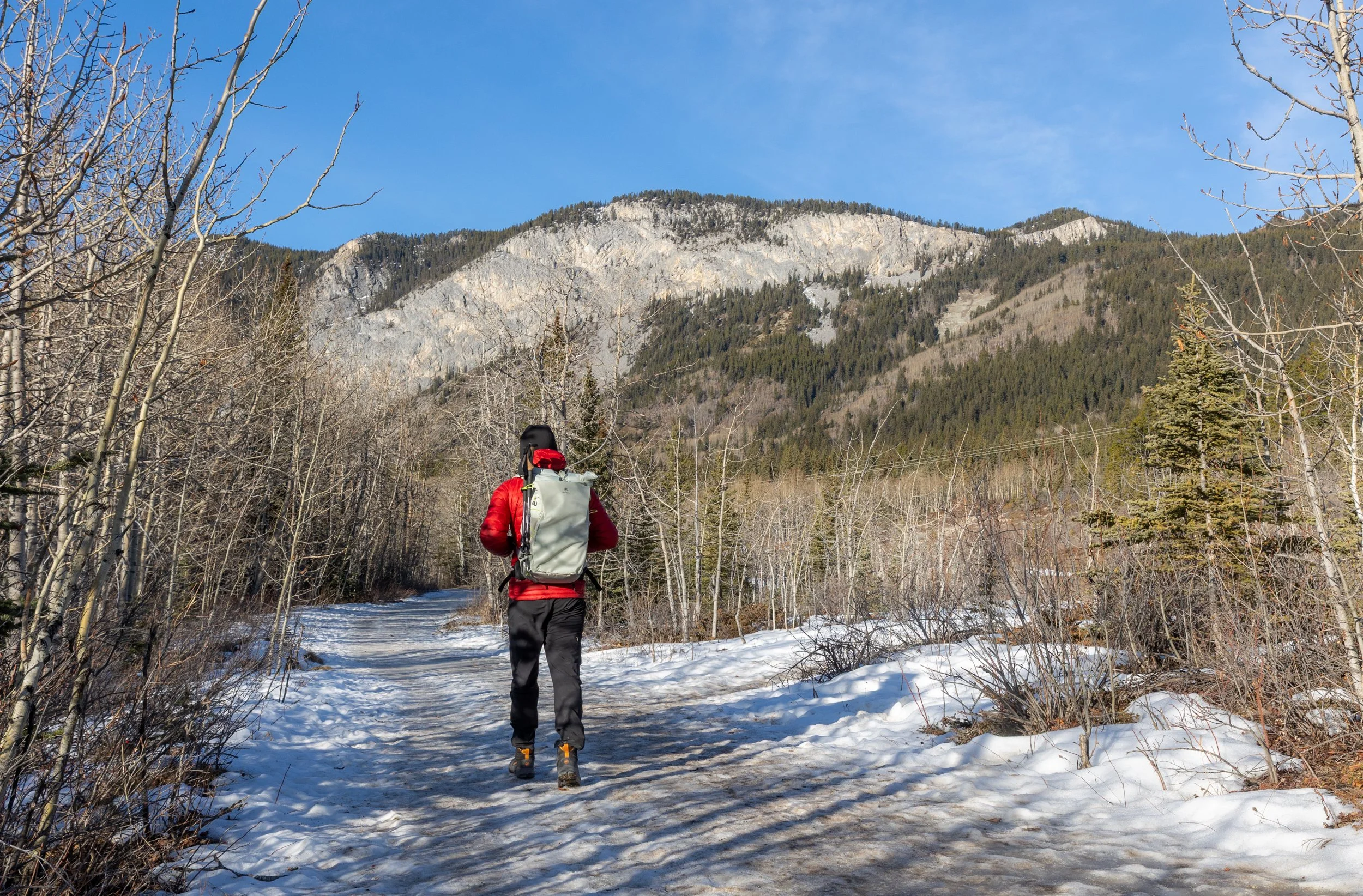
In the above image you can see the small cliff band sticking out of the trees towards the right hand side just below the summit. That’s where you’re heading first!
Even though there hadn’t been a lot of snow on the lead up to this hike and the weather was spring like the trail was still pretty icy in places so, again, micro spikes are very much worthwhile!
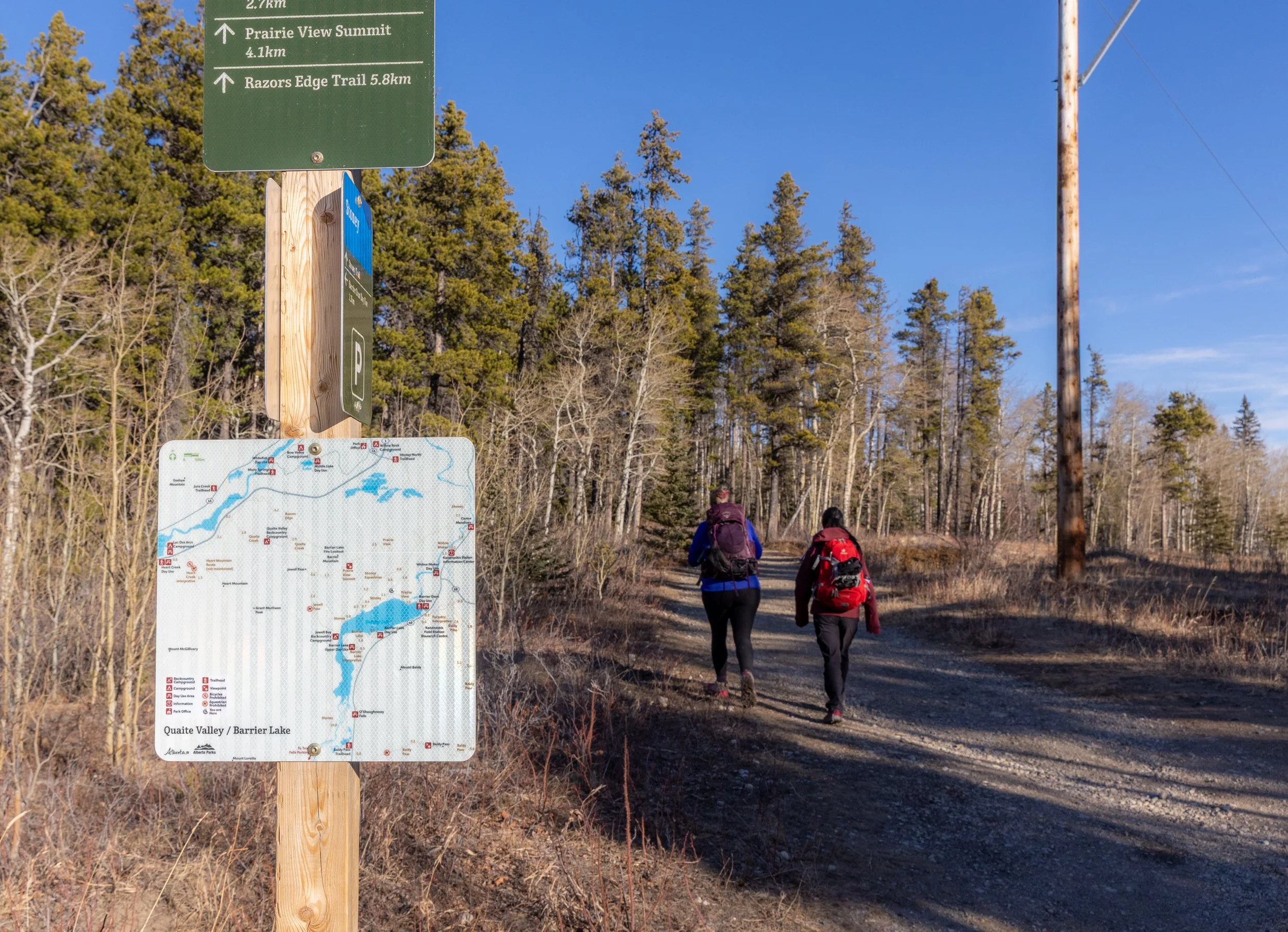
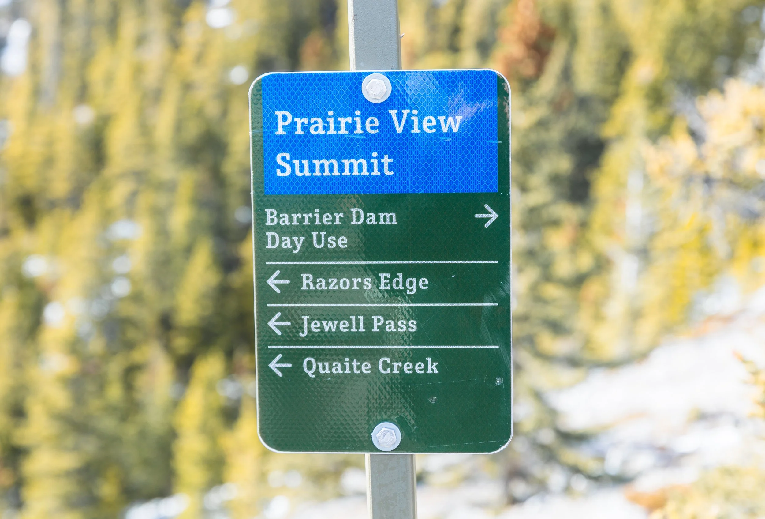
Navigating this trail is pretty straight forward and you’d be hard pressed to get lost! Placed on some of the few junctions there is good signage guiding you along and as long as you follow signs to ‘Prairie View Summit’ you won’t go too far wrong!
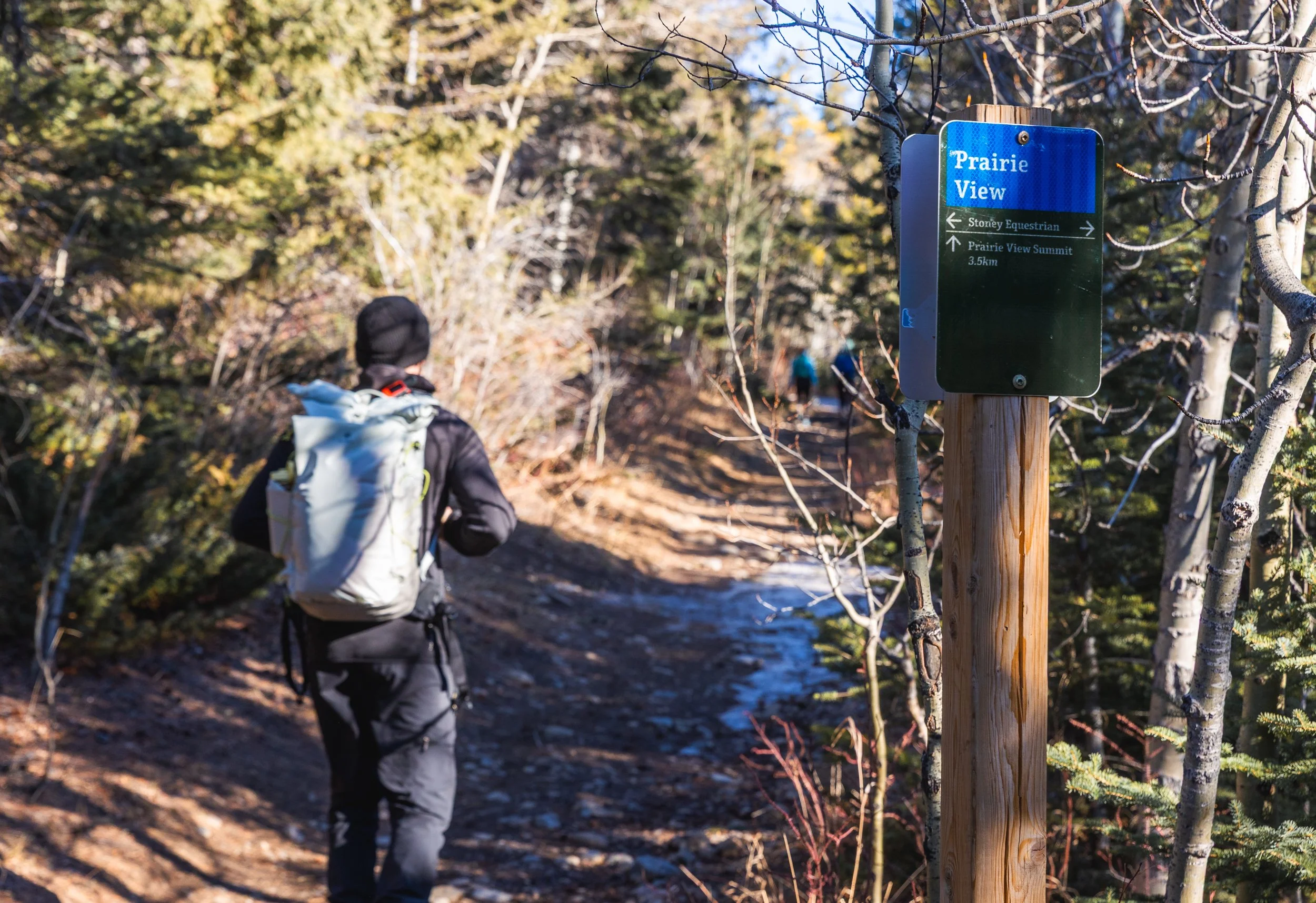
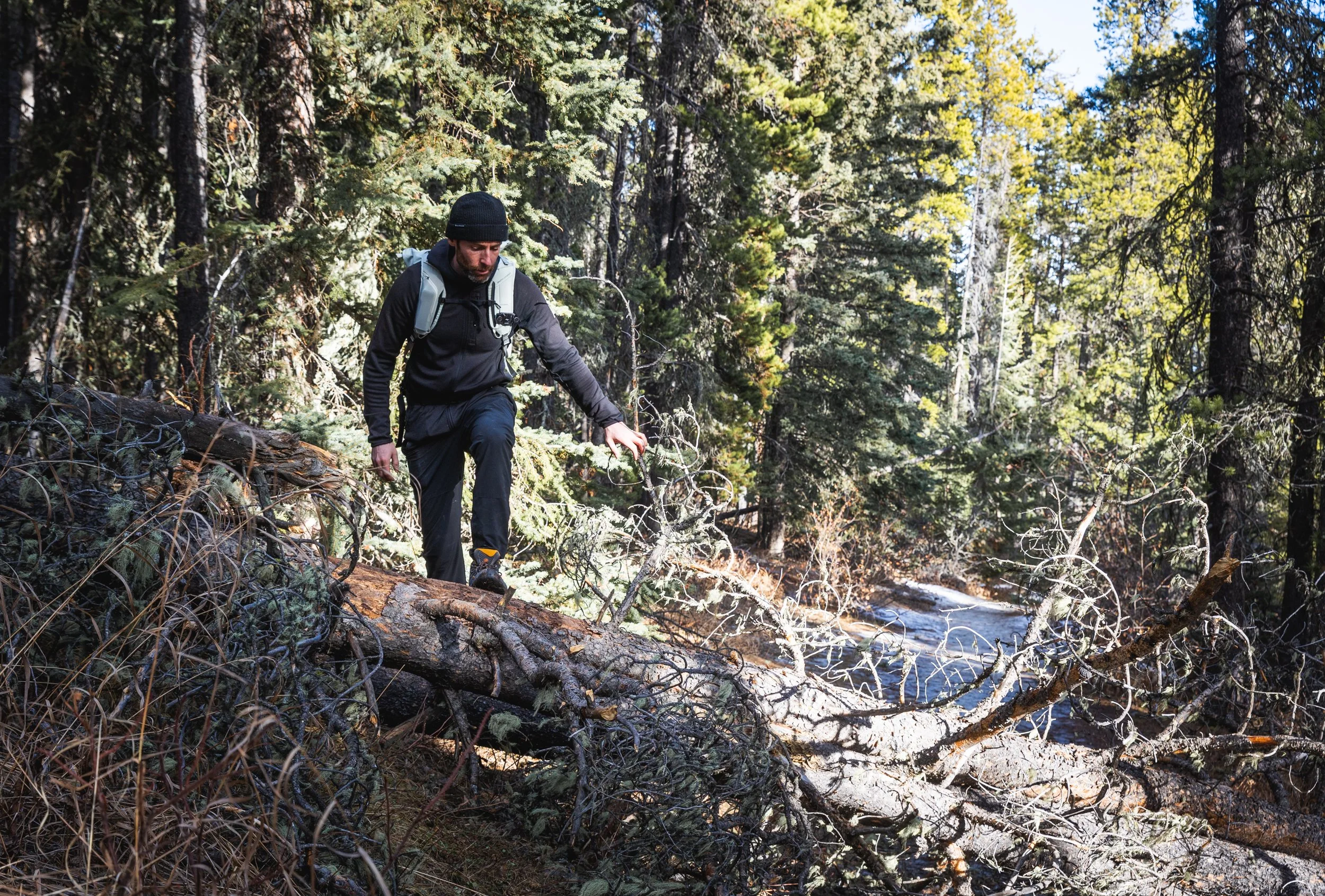
Throughout the trail on this February day there were several fallen trees to negotiate. On a popular trail like this these trees are often cleared relatively quickly - but more so in the summer.
Tree fall is always a risk to be aware of on any trail that makes it’s way through the woods. Something to keep in mind, especially if you’re hiking on a particularly windy day or towards the start of summer before any trail maintenance has taken place.
After about 5 km you’ll come across the first view point. A huge clearing in the trees giving you sweeping views of the front end of Kananaskis. Directly opposite you have Barrier Lake and the peaks of Mount Baldy, at the right time of year you can see some great reflections of the mountains in the lake below.
This is a great spot to enjoy the view, the sun, rest and have a bite to eat. The last little section of trail coming up is the steepest and most challenging section so it’s worth catching your breath!
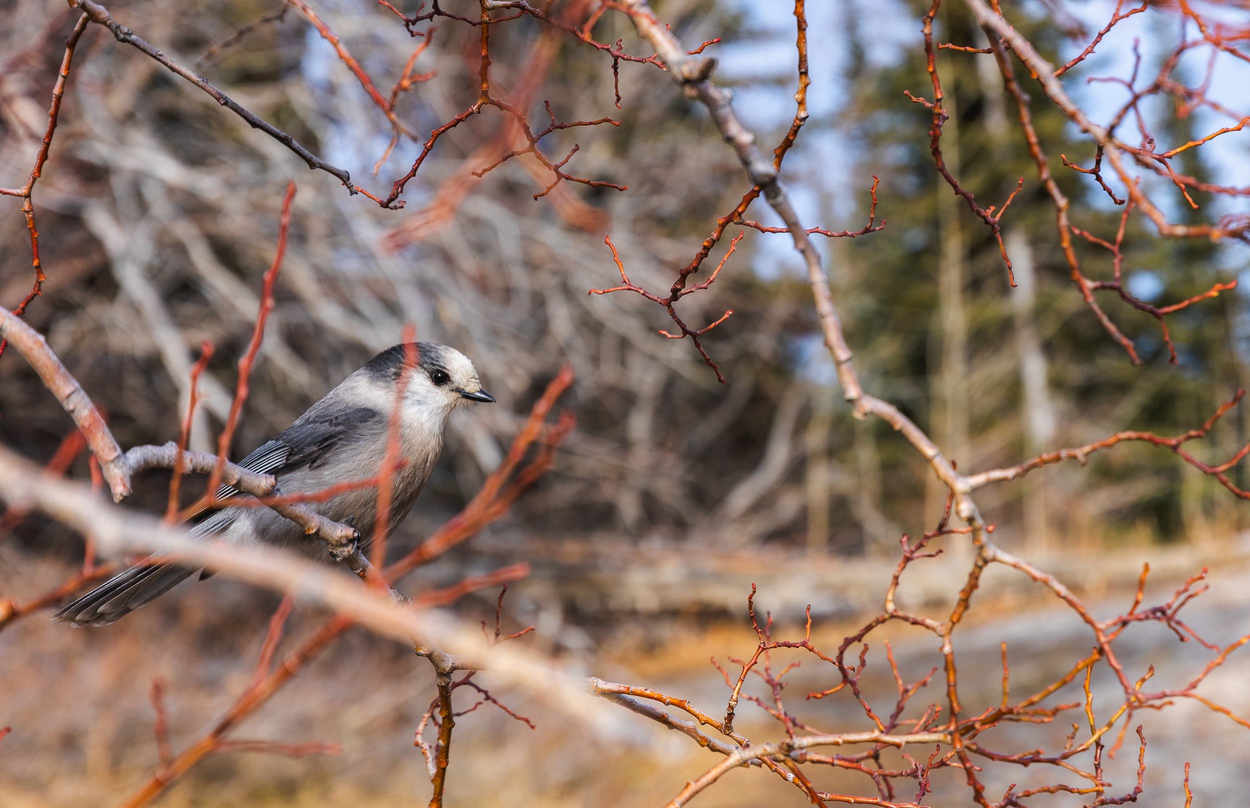
The canopies around the trail are home to plenty of curious Canada Jays or Grey Jays or Whiskey Jacks - a bird that has as many names as the trail it lives on! As with all wildlife be mindful of leaving any good scraps around. The Jays are always on the look out for an easy meal but it isn’t great to encourage them to become reliant on human left overs. So enjoy them from a distance as they jump between branches but please don’t give in to temptation and attempt to feed them!
The next 600 m or so is relatively steep and if you’re hiking on a winters day and haven’t put on your micro spikes quite yet I highly recommend you do before making your way up to the next view point!
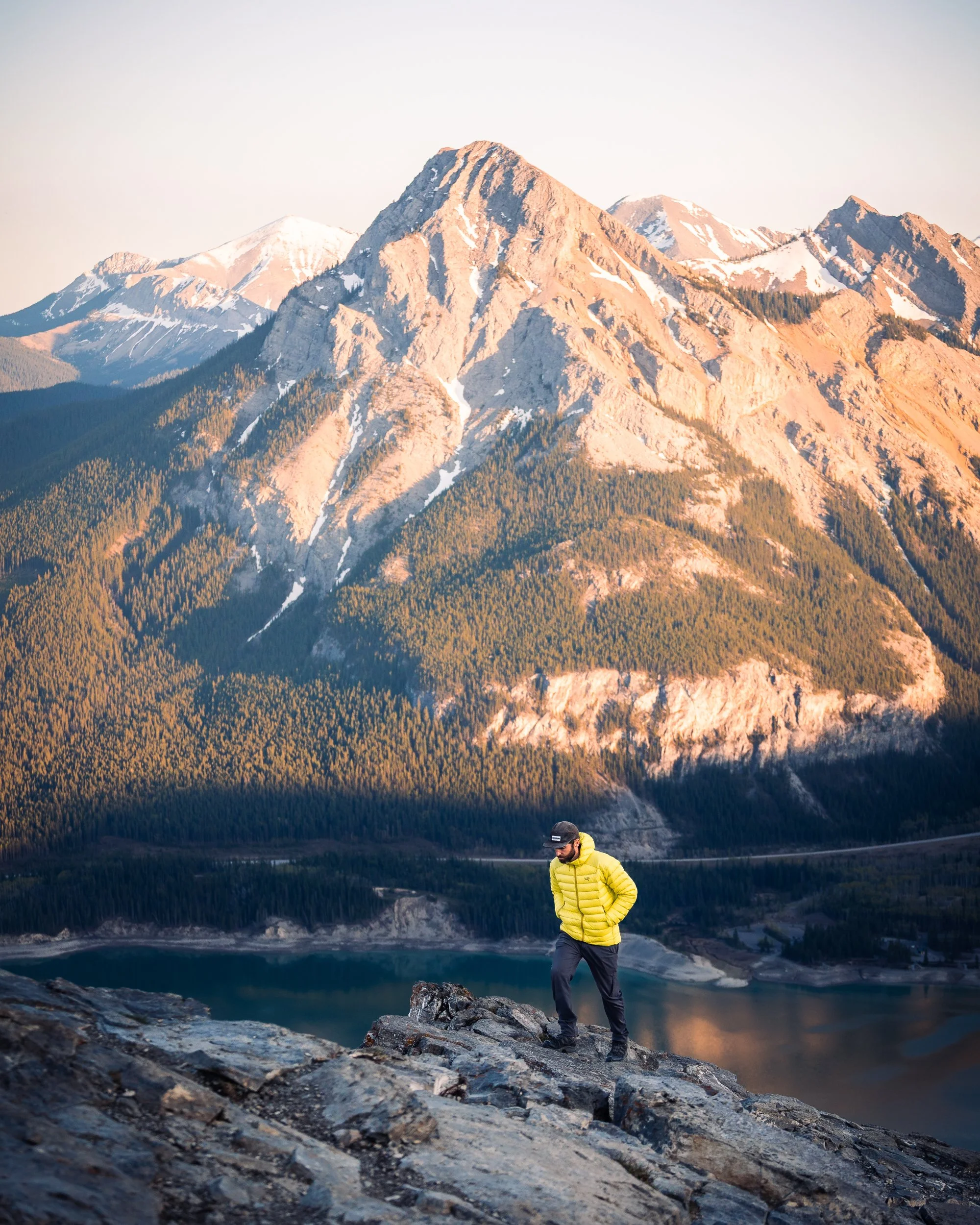
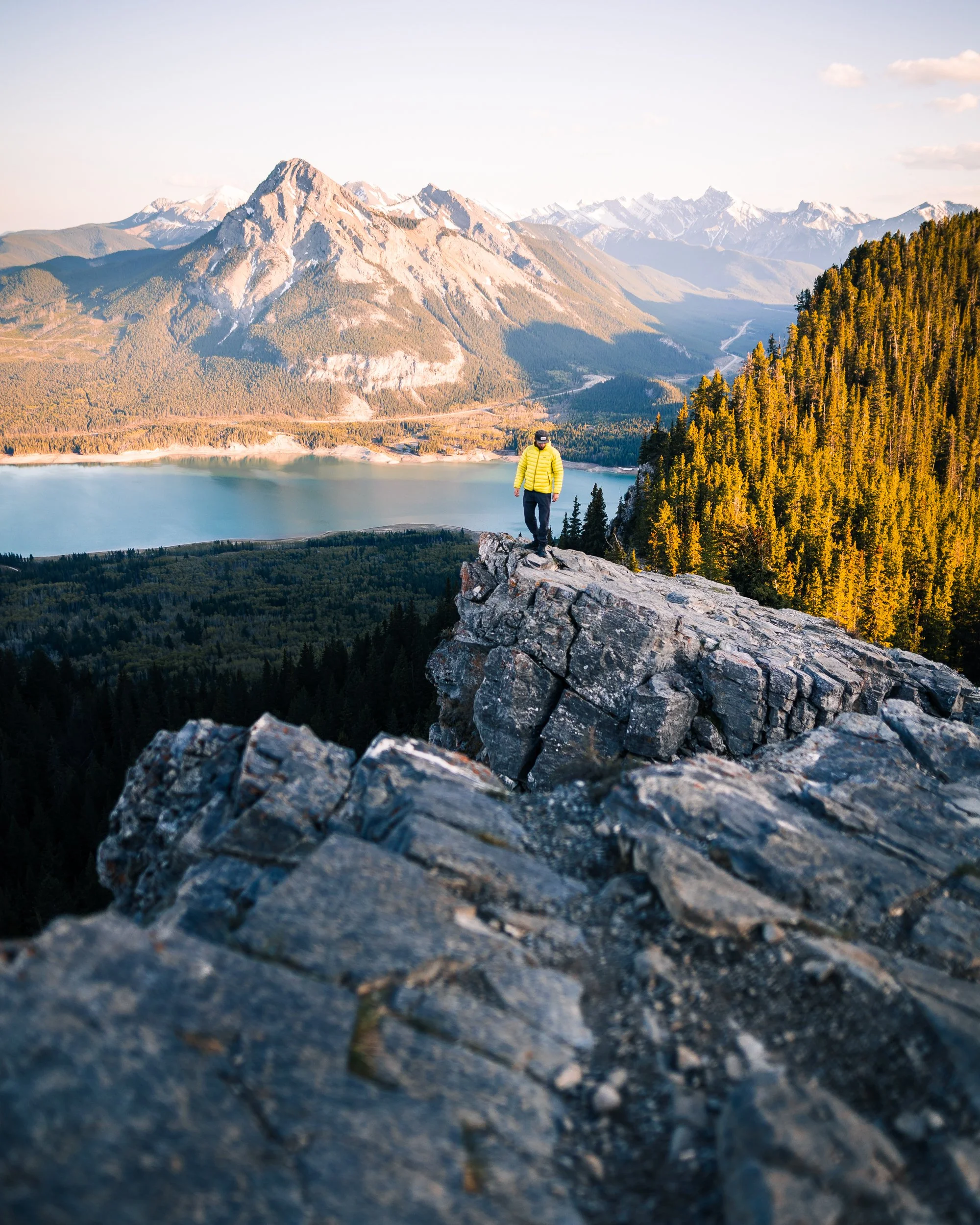
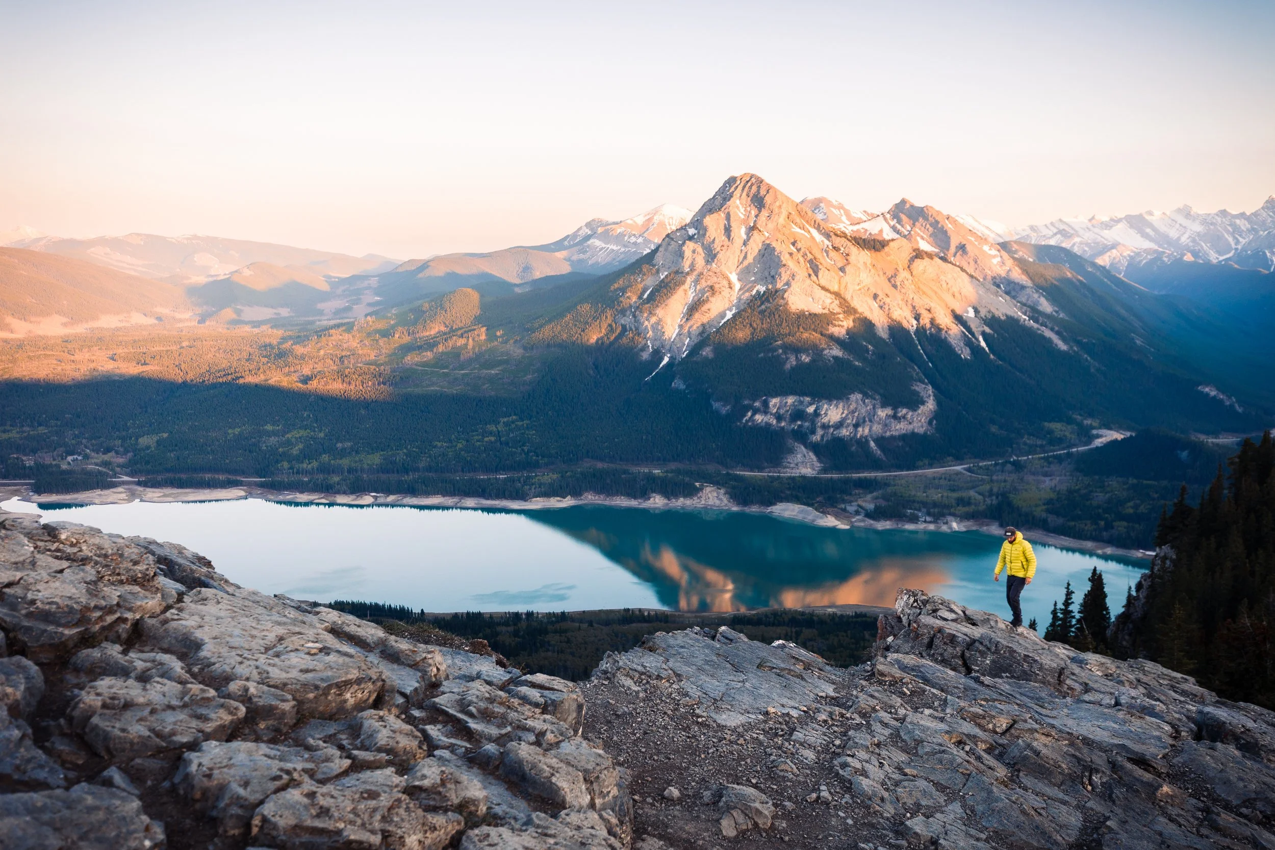
After a little bit of an uphill slog you’re rewarded with more fantastic views. This view point is often referred to as the “Rocky Outcrop Viewpoint’ and is where a lot of hikers end their trail. It’s a great place to watch the sun come down as the golden light illuminates Mount Baldy over the valley.
Depending on how much energy you have left at this point you have a couple of different options! There are some great return options that extend your hike a little. For example taking Jewell Pass back down will extend your hike by about 3 km and bring you back down at the other end of Barrier Lake. Alternatively you can follow the signs back down to ‘Barrier Dam Day Use’ to get back to your start point the same way you came.
On any trail I always feel like I need to get to the high point to say I’ve truly ticked it off! This trail is no different! It’s only about 600 - 700 m further up hill to get to the Barrier Lake Fire look out from this point.
This section of trail can be a little harder to find and isn’t as well sign posted. However if you’re looking at the sign pictured above you really just need to head straight on and up! Once in the woods keep an eye out for the best worn trail that trends up hill. It takes a little route finding skill if it isn’t recently trodden but you’ll get there in the end!
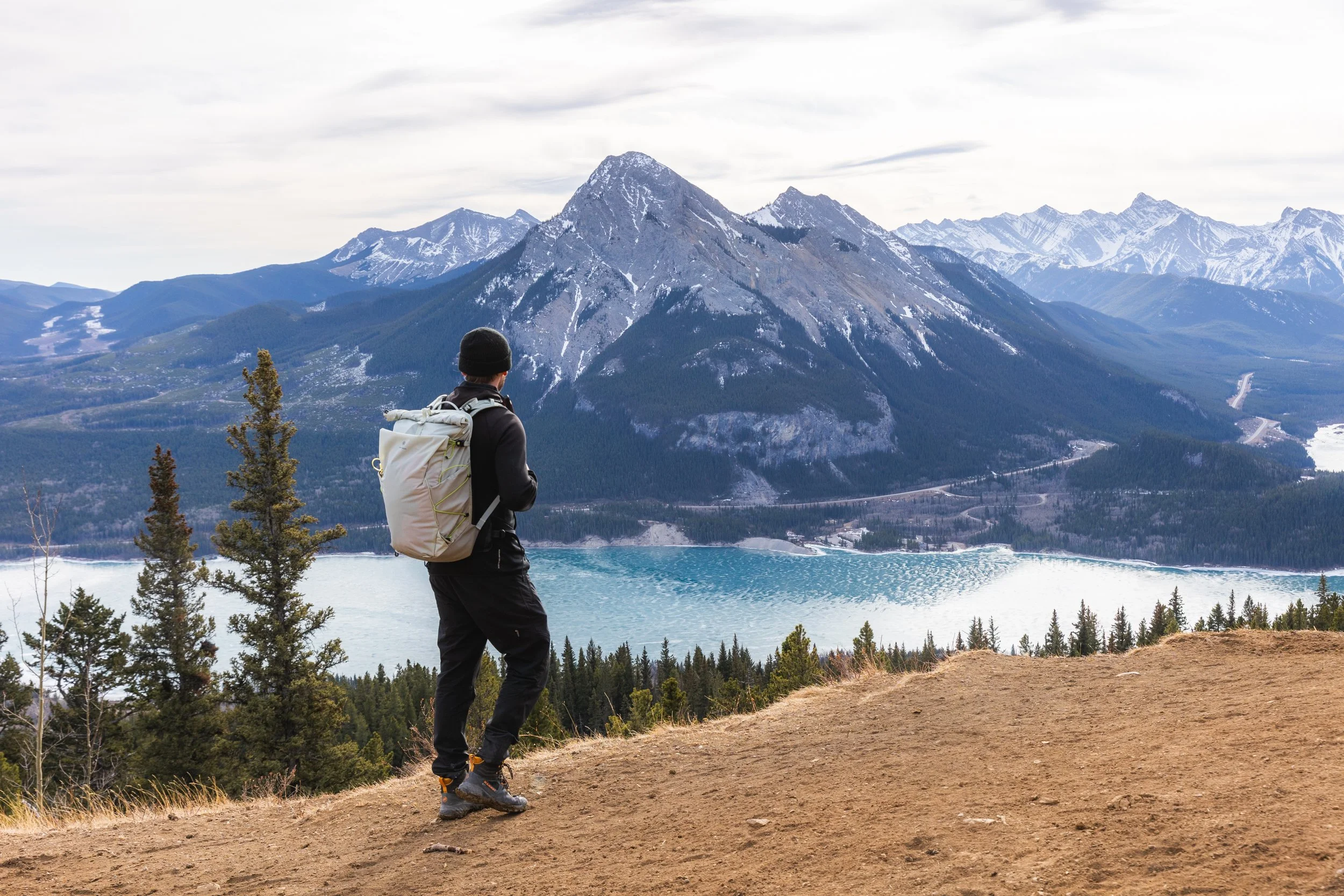
Once close to the top the view opens up once more allowing for views back towards the distinctive flat face of Yamnuska the other side of the valley.
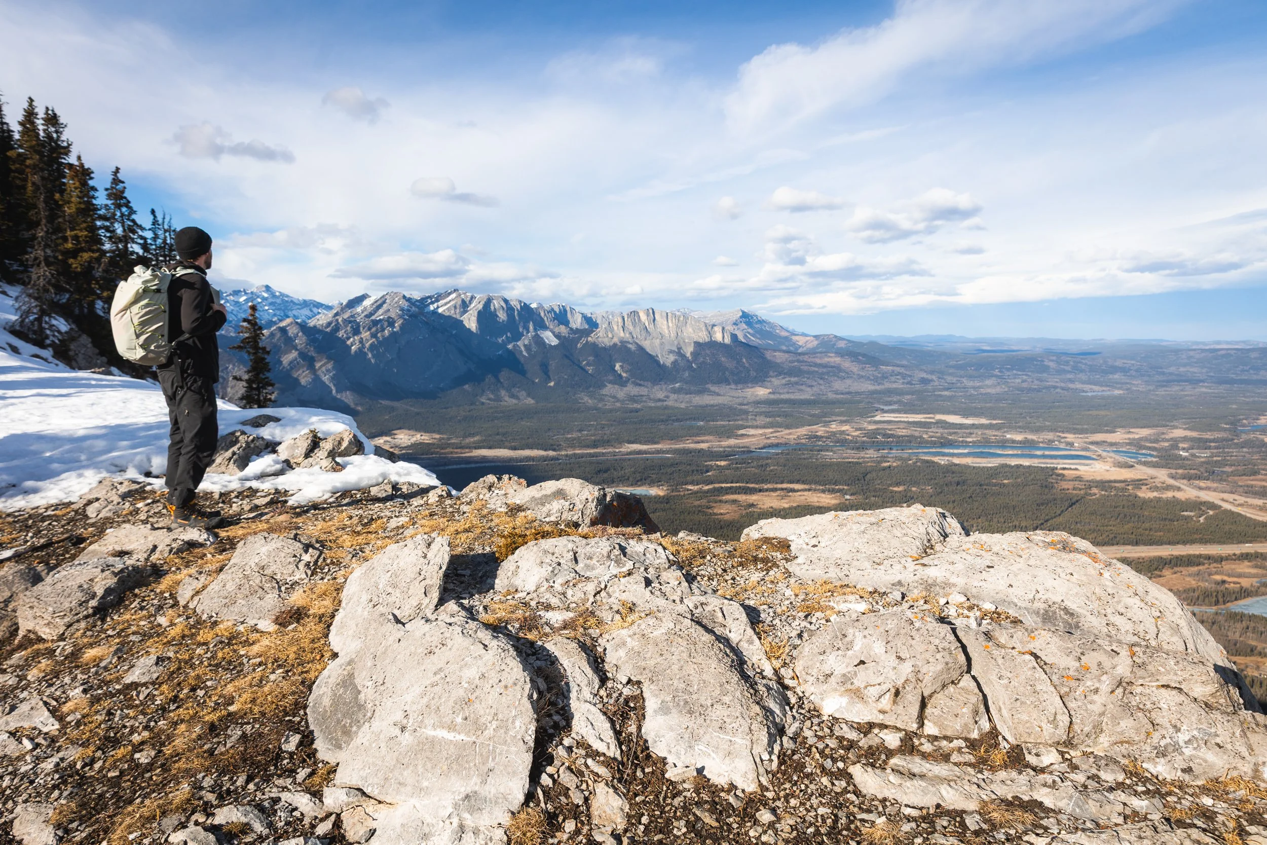
From this image you can definitely tell how this trail got it’s name of ‘Prairie View’.
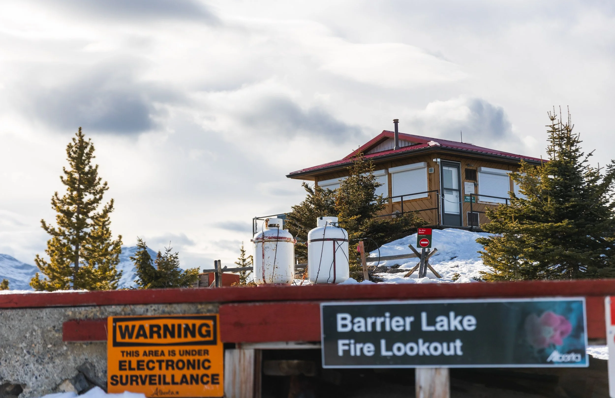
Once at the top you’ll come across the fire look out. The summit of this mountain has been used as a look out for centuries, originally by the indigenous Stoney Nakoda who used the summit to look out for approaching enemies and now by the province to watch for wild fires on the valley floor.
The hut and helipad here are private property and not to be accessed or used by hikers. So as tempting as it is to get comfy on the helipad and get the lunch kit out do you’re best to resist! There are also several picnic benches in the area which in all honesty make a better spot for that summit sandwich!
Things to know Before You Go
Leave No Trace: When hiking anywhere in the world it’s important that you practice a leave no trace philosophy. This means whatever you hike in to a trail or campground you have to be able to hike out too. There won’t be trash cans or waste disposal in the backcountry and you should never throw trash in any out houses or pit toilets. In recent years, as trails and parks become busier, litter is becoming more of a problem. Don’t add to that problem!
Bears and Wildlife! Wild life is everywhere in the Canadian Rockies, even on trails that are close to town. People and animals have been attacked by bears and other wild life on popular trails in the past so don’t take it for granted.
Most wildlife is looking to avoid human contact so no matter what type of wildlife you see be sure to keep your distance. 30 metres is the minimum recommendation for most species but under any circumstance don’t approach wildlife. Even the cuddliest of critters can be dangerous!
So as always be bear aware, make noise, hike in groups, carry bear spray and, if they’re allowed on trail, keep your dog on a leash!
Offline maps knowing where you’re going is super important as to not get lost. I recommend All Trails Plus for finding routes and offline mapping allowing you to safely find your way home.
Interested in other multi-day hikes in the Canadian Rockies or maybe day hikes?
Gear Recommendations
After 10 years living in the Canadian Rockies, years working in retail and years reviewing outdoor gear I’ve dialled in my backcountry kit! And on all day hikes there are definitely a few things I always take with me to make my trip safer, easier and more enjoyable.

Merino Socks
Merino socks are a must for any hike. They keep you dryer, warmer and smelling better!
Once you go merino you never go back!
My socks are now 100% Smartwool!
Get them at Smartwool.com
Hiking Poles
Poles are often overlooked by new hikers and seen as unnecessary. However once you use them you’ll never go back! They make you more efficient and take the weight of your knees!
Get it on Backcountry.com
Down Jacket
No matter what the weather I carry a lightweight down jacket. The Arcteryx Cerium is light and very warm! Perfect for keeping you toasty when you take a break or if you were injured and awaiting help.
Get it on REI.com
Comfortable Day Pack
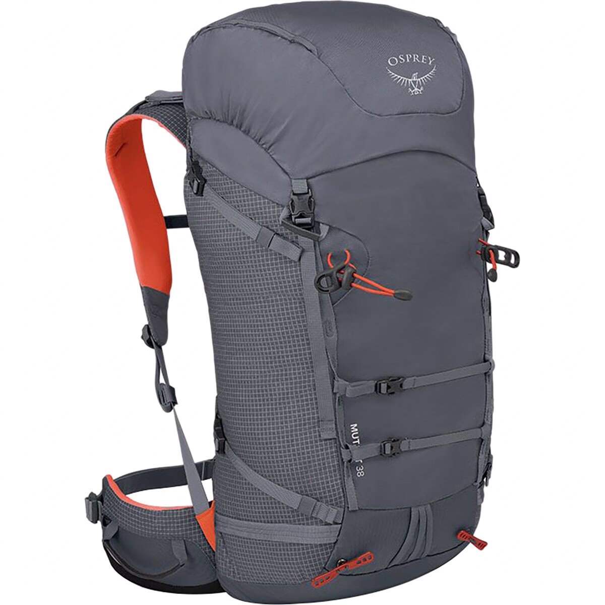
The Osprey Mutant is my favourite day bag. Even though it’s designed more for scrambling or mountaineering this bag is one of the most comfortable bags I own and has enough space for everything I need.
Get it on Backcountry.com

Water Filter
A Katadyn BeFree has to be the easiest filtration system to use. When out on the backcountry you want to be able to filter and refill your water along the way.
This filter packs down small and filters fast. It’s in my bag on every hike!
Get it on Backcountry.com

Capture Clip
Another item that comes on every hike with me and a must own for every photographer.
Keeps your camera close at hand making capturing moments much faster!
Get it on Peakdesign.com