A Hike and Scramble up Heart Mountain Horseshoe
The Heart Mountain Horseshoe trail in Kananaskis, Alberta is another trail I first completed many years ago and in all honesty had forgotten how good it actually is! It goes up there with some of my favourites on the front end of Kananaskis.
Although it starts close to the main highway you are quickly whisked in to a world of alpine meadows, steep climbs and mountain peaks.
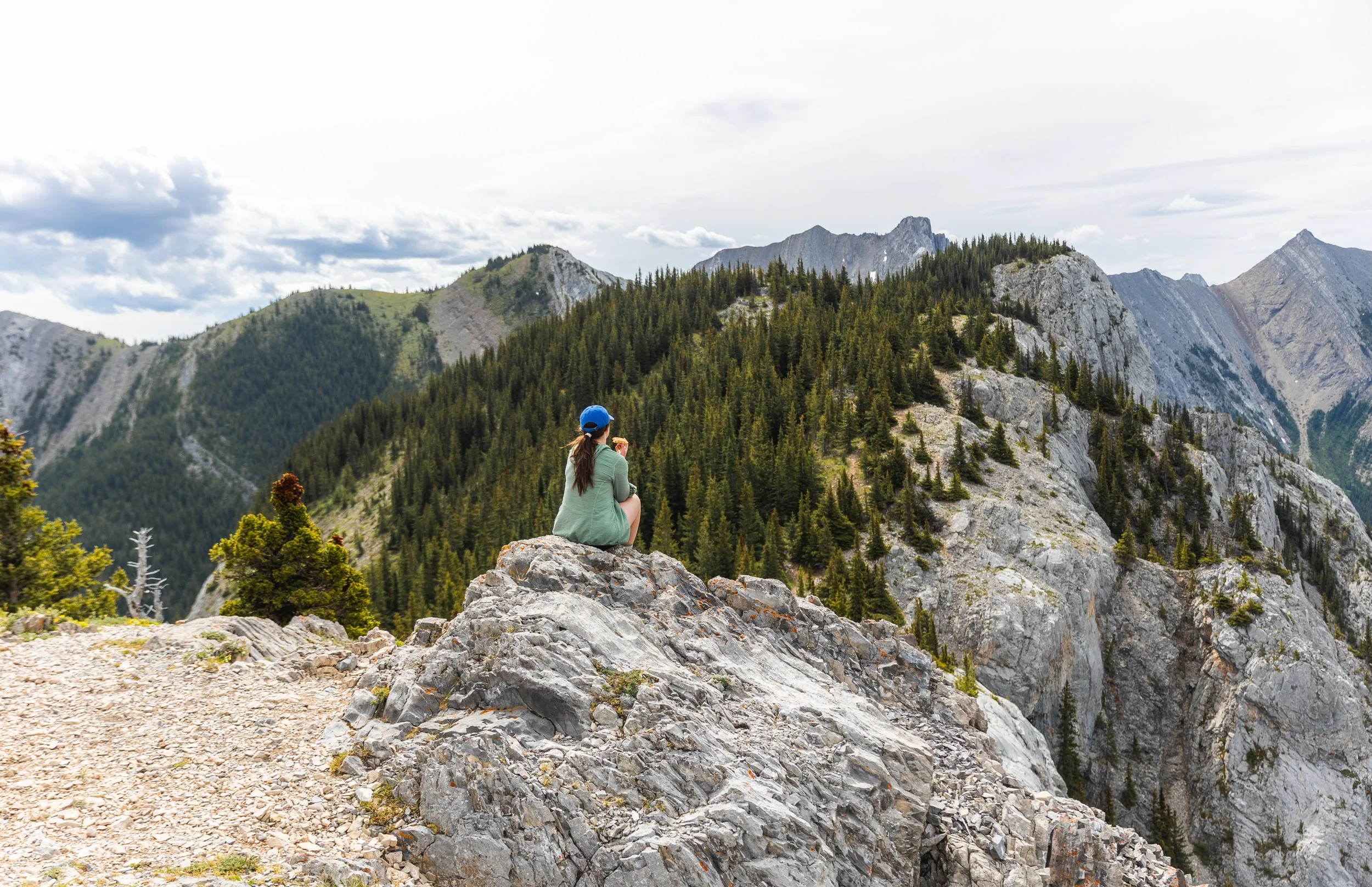
Lunch on top of Heart Mountain looking towards Grant McEwan peak.
The Stats
Time: 4 - 6 hours for the horseshoe loop.
Distance: 10.8 km
Elevation Gain: 1000 m
Difficulty: Moderate to Hard depending on your scrambling skills!
How To Get To The Heart Mountain Trailhead
Access to Heart Mountain is now super straight forward! When driving on Highway 1 take exit 105, signed for Lac des Arcs, the generous car park is the other side of the freeway to the hamlet. The trail starts along side several others at the Heart Creek Day Use area.
In the past it has been common place for people to park on the side of the free way and cut on to the trail from there. Please refrain from doing so! The amount of time you’ll save from not hiking the extra distance to and from your car does not out way the risk you put yourself and others in when making an awkward pull out on to a high speed road from a grassy bank!
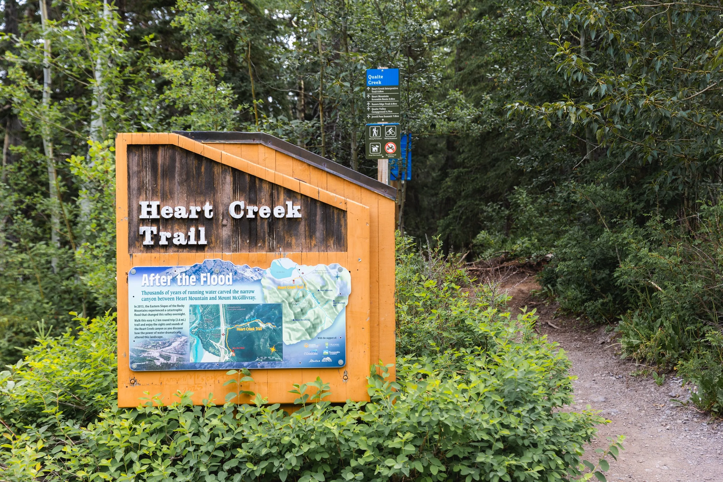
The well signed heart creek trailhead where several trails start from.
The Hike
Heart Mountain horseshoe is a fantastic day hike and scramble that covers it all! From alpine meadows to technical scrambling and stunning views across both sides of Kananaskis.
As with any hike in the Rockies bear activity is a real consideration. Although this trail is close to the road the highway noise doesn’t put the bears off so be sure to be bear aware, make noise, travel in groups and carry bear spray!
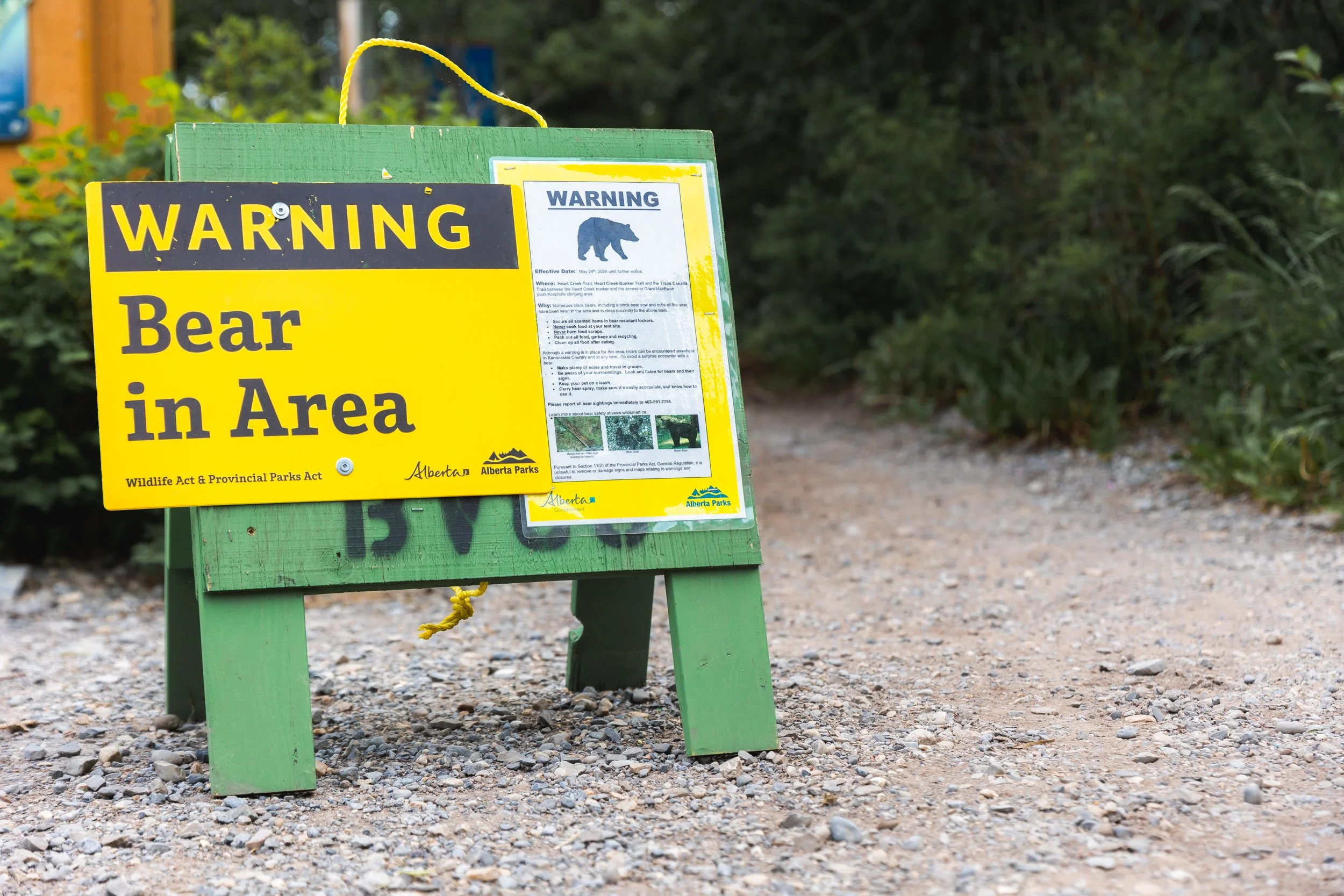
Bear warnings at heart creek.
In 2013 there was large scale flooding throughout the bow valley and several trails were washed away. The Heart Creek trail was one of those and since then work has taken place to mitigate future flood events as well as improve the trail in regards to signage and walkability.
The first section of the trail, and last couple of kms on the way out has been widened and flattened in recent years making for a nice and soft initial walk in and final walk out, terrain that’s great for the knees!
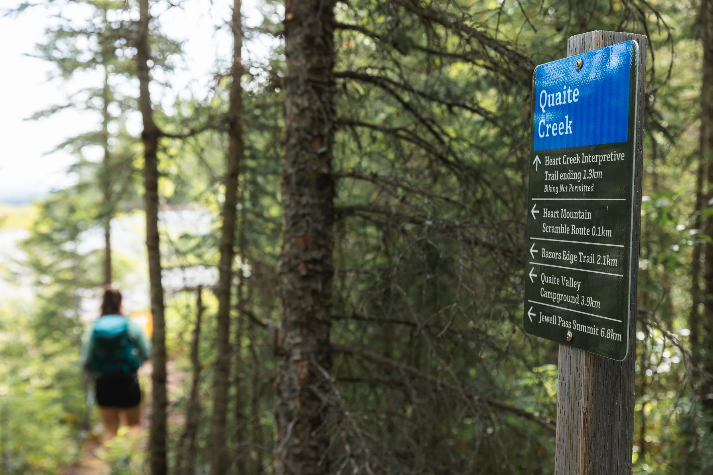
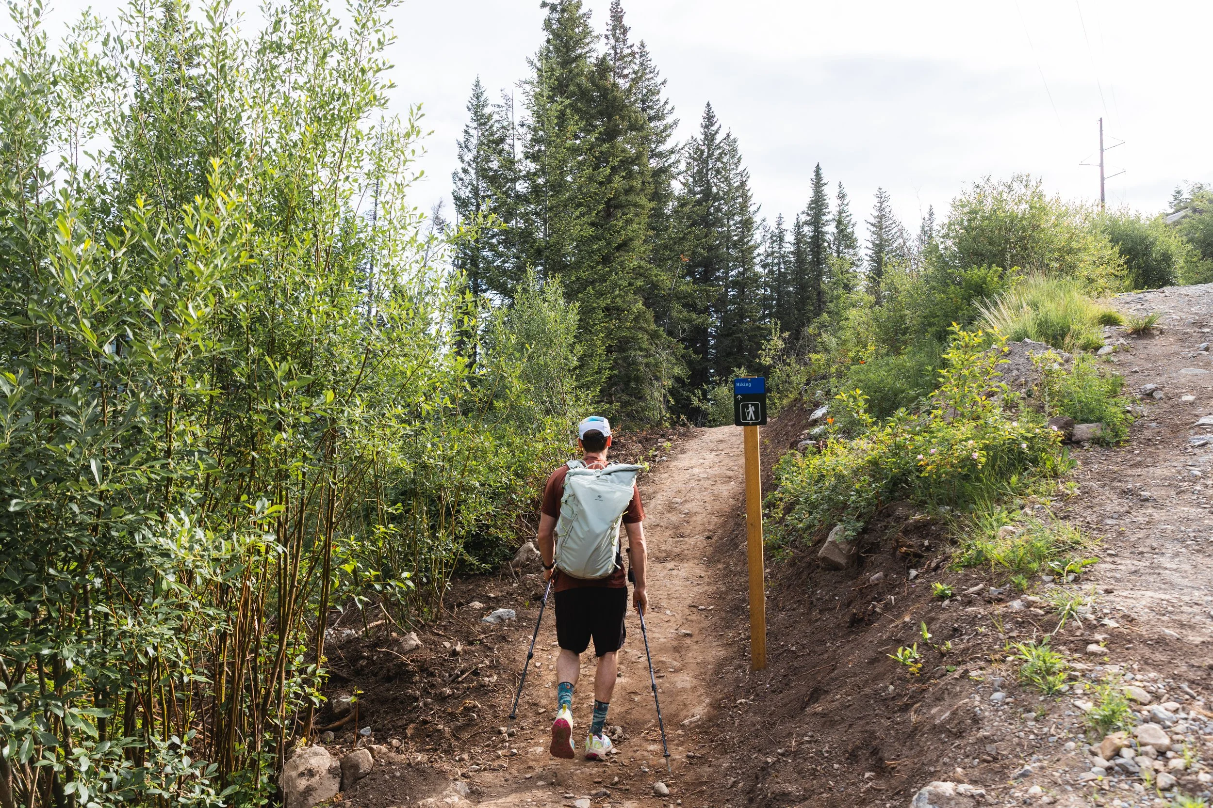
After around 800 m of easy trail you’ll come across a new sign giving direction to several route options. The Heart Creek interpretive trail is a great option for families or more novice hikers however on this occasion we’re heading for the ‘Heart Mountain Scramble Route’.
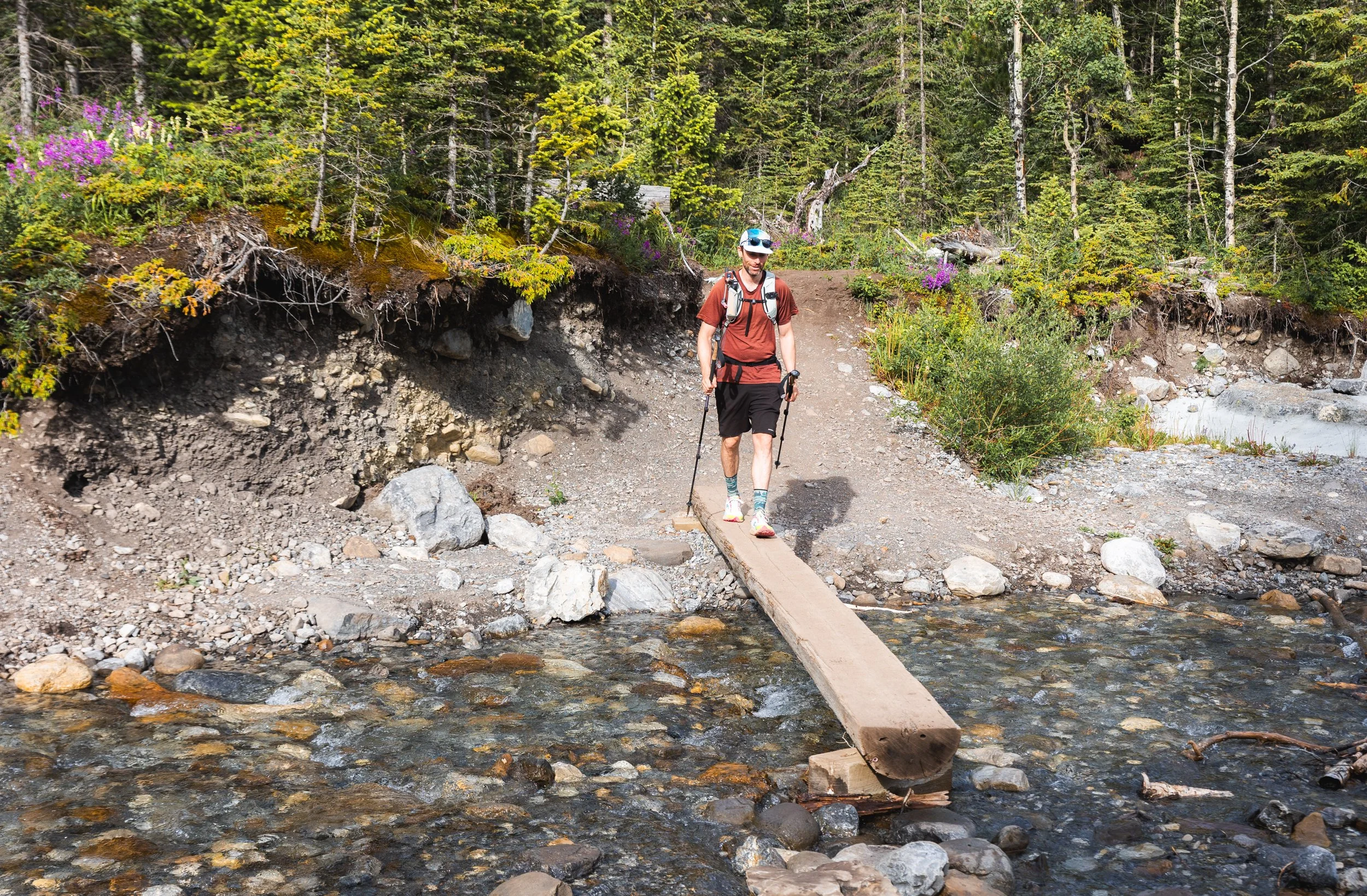
Once you’ve crossed the creek you’ll come across another sign directing you towards your trail and warnings about what it means to scramble.
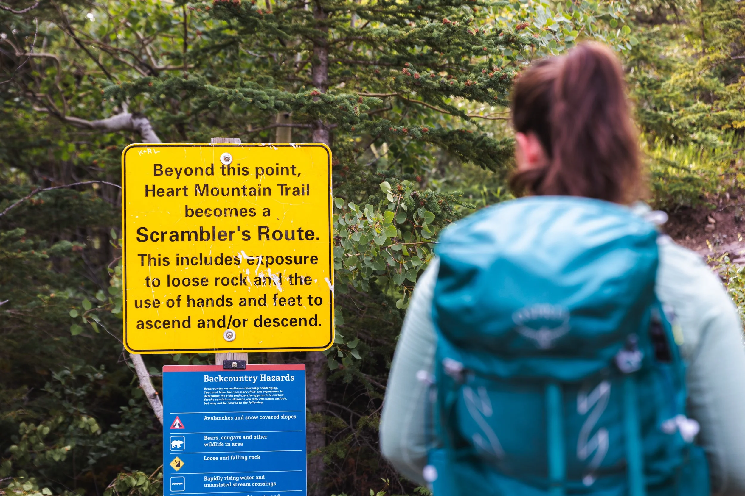
Warning signs before the Heart Mountain trail
Now to some these warning signs might feel a little like over kill but over the years there have been several accidents on Heart Mountain and I think it’s important to distinguish between a hike and a scramble.
Scrambling can be seen as low level climbing routes on steep, but not vertical terrain without the use of a rope. There are several sections on this route where you do have to climb a little and use your hands on steep terrain, a slip could be very problematic!
I’ve done my best to document these trickier sections throughout this blog to help you get a better idea of whether or not it’s something you’d be comfortable tackling.
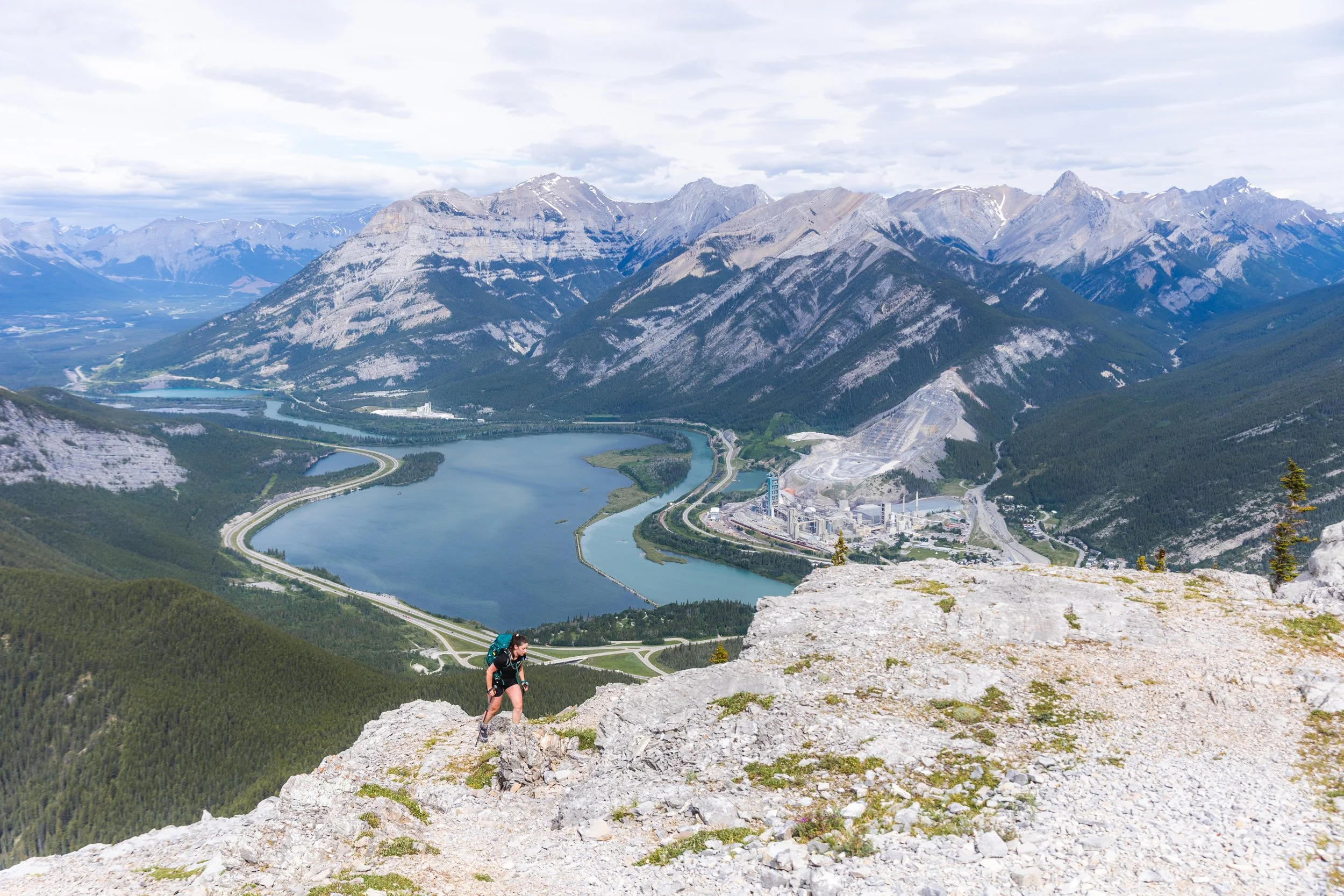
On the initial ascent up Heart Mountain
After just shy of a km the trail hits it’s true grade! The majority of elevation gain in this hike comes in one short burst covering around 700 m of elevation gain in just 2 short kms. The going is a little tough and relentless but the scenery and varied terrain make the time pass quicker than it does with a lot of steeper hikes.
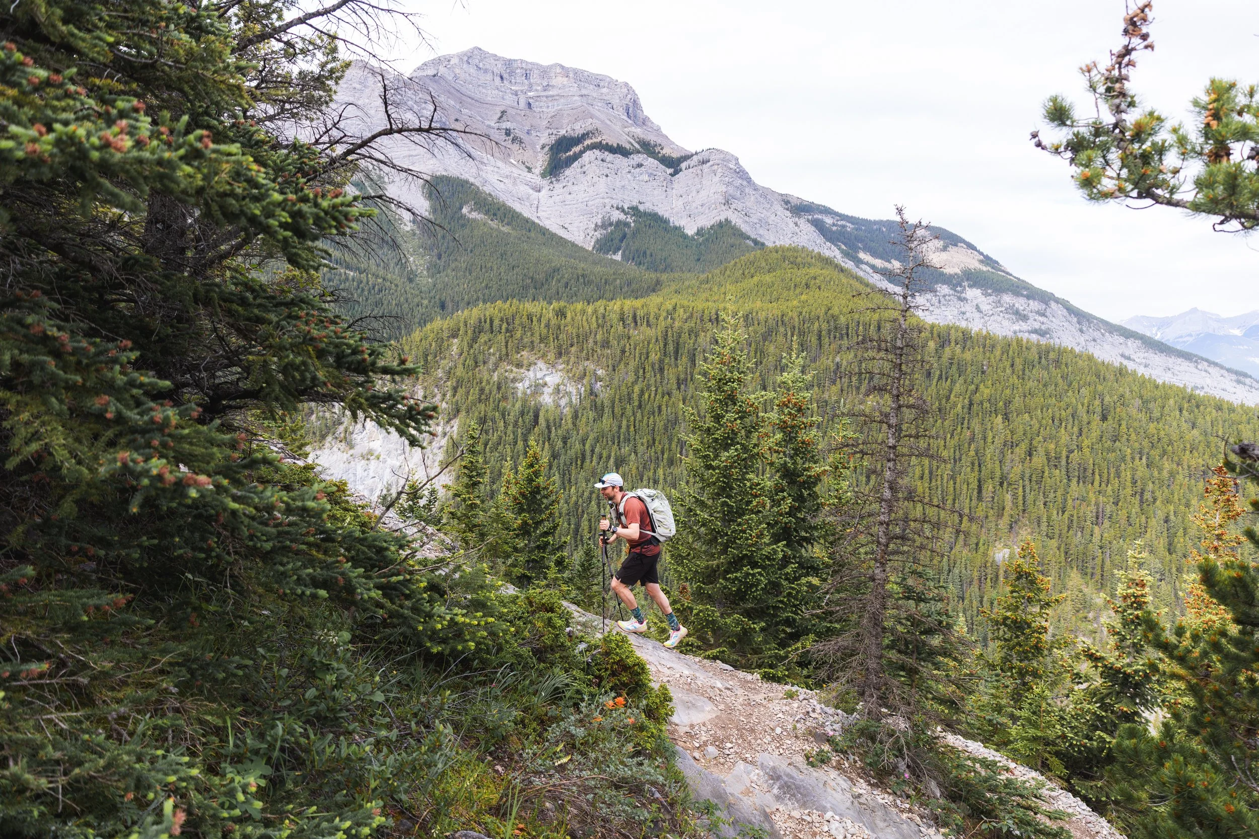
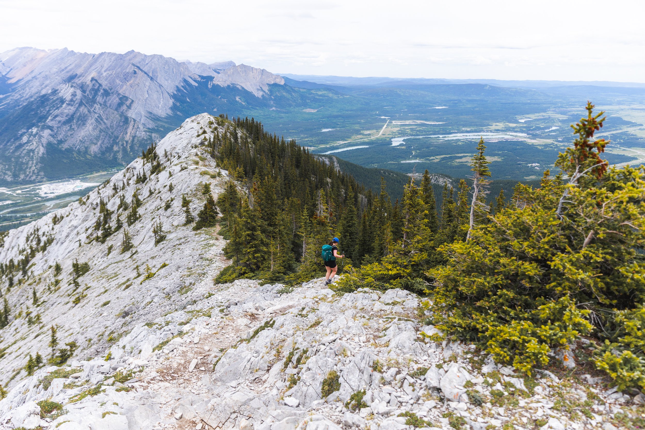
The route throughout is a little of a ‘choose your own adventure’ style with trails following the ridge more directly and others temporarily ducking in to the woods to by pass more technical terrain.
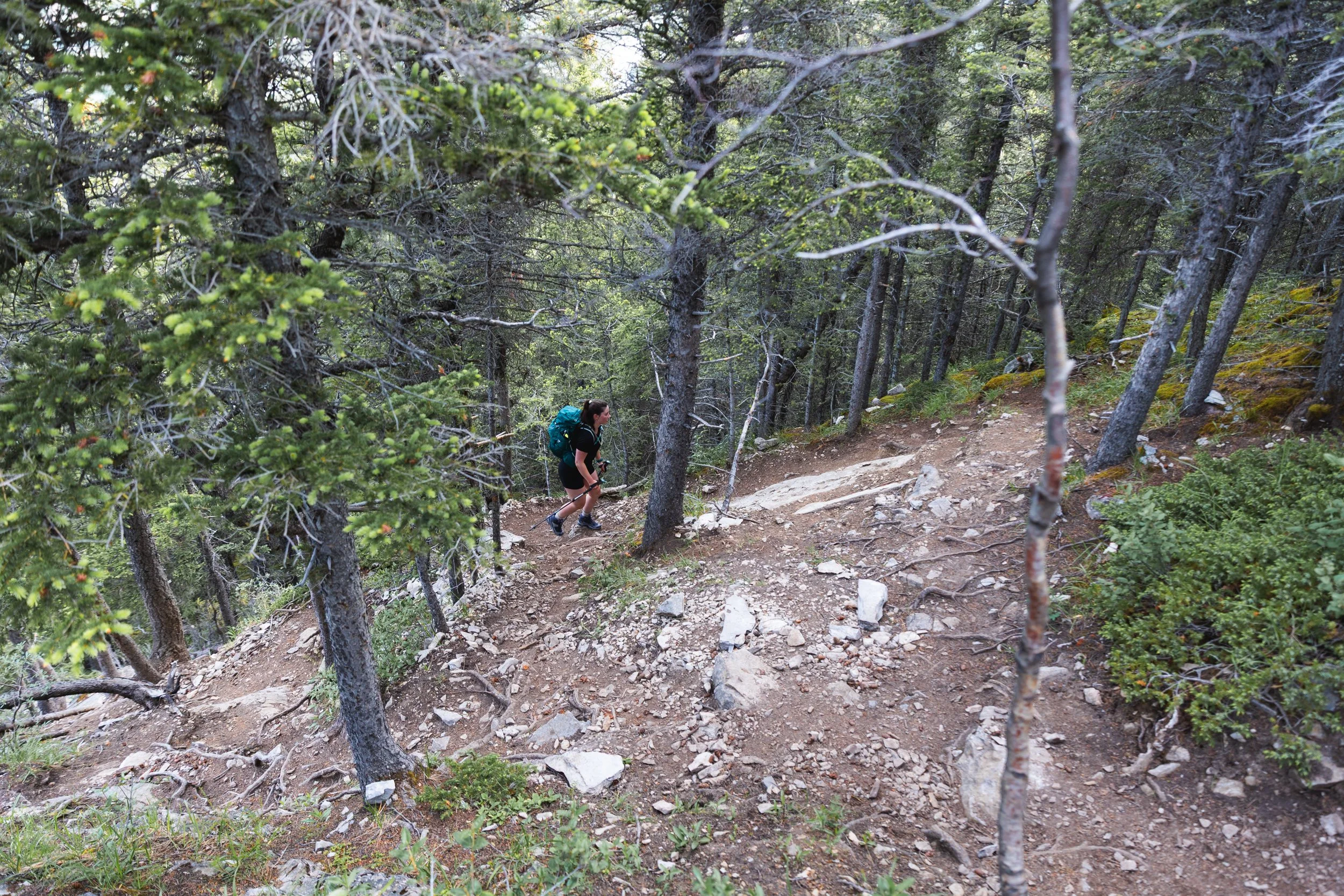
Braided trails in the woods.
Brook makes her way up Heart mountain, notice the non-distinct trails - choose your own path!
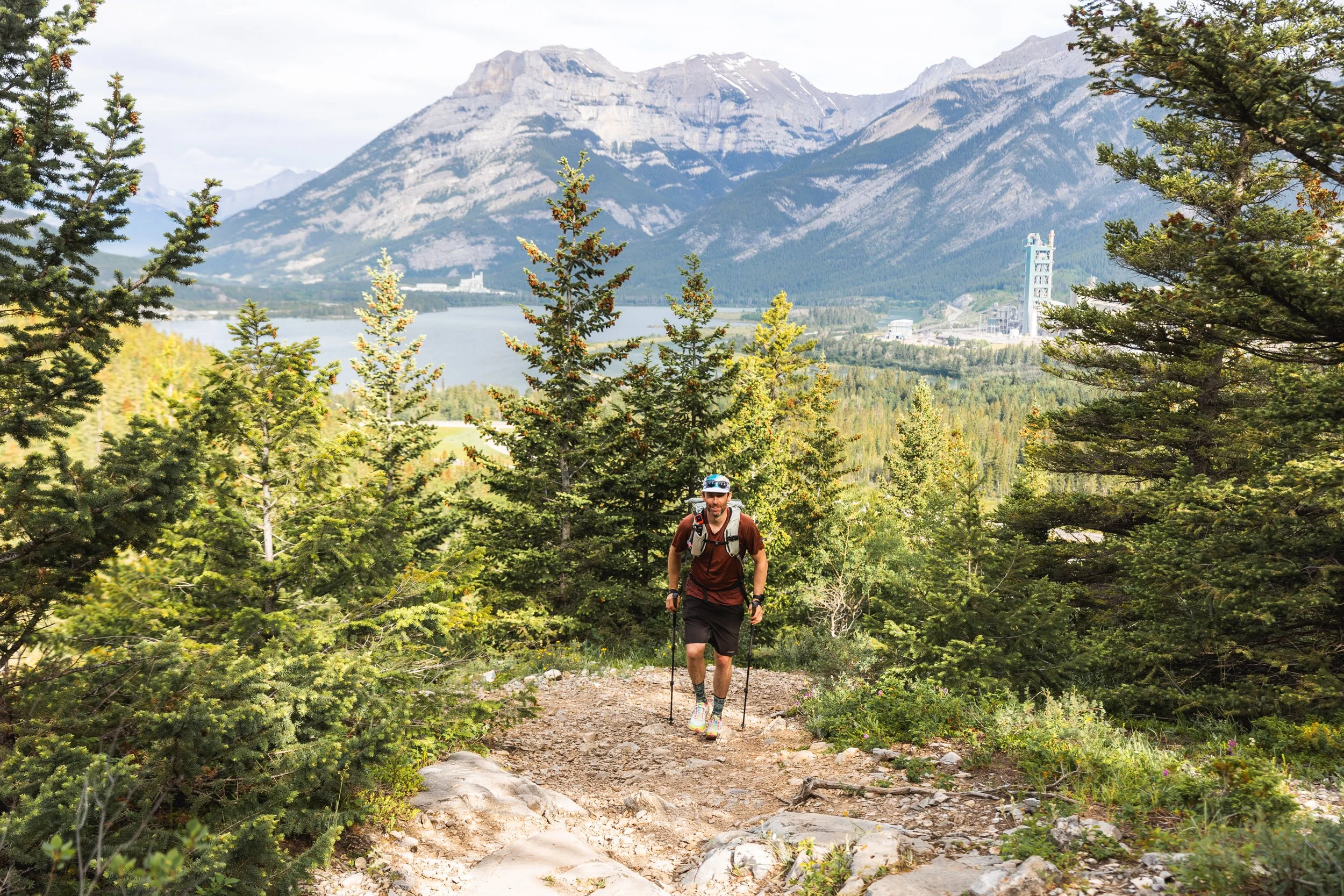
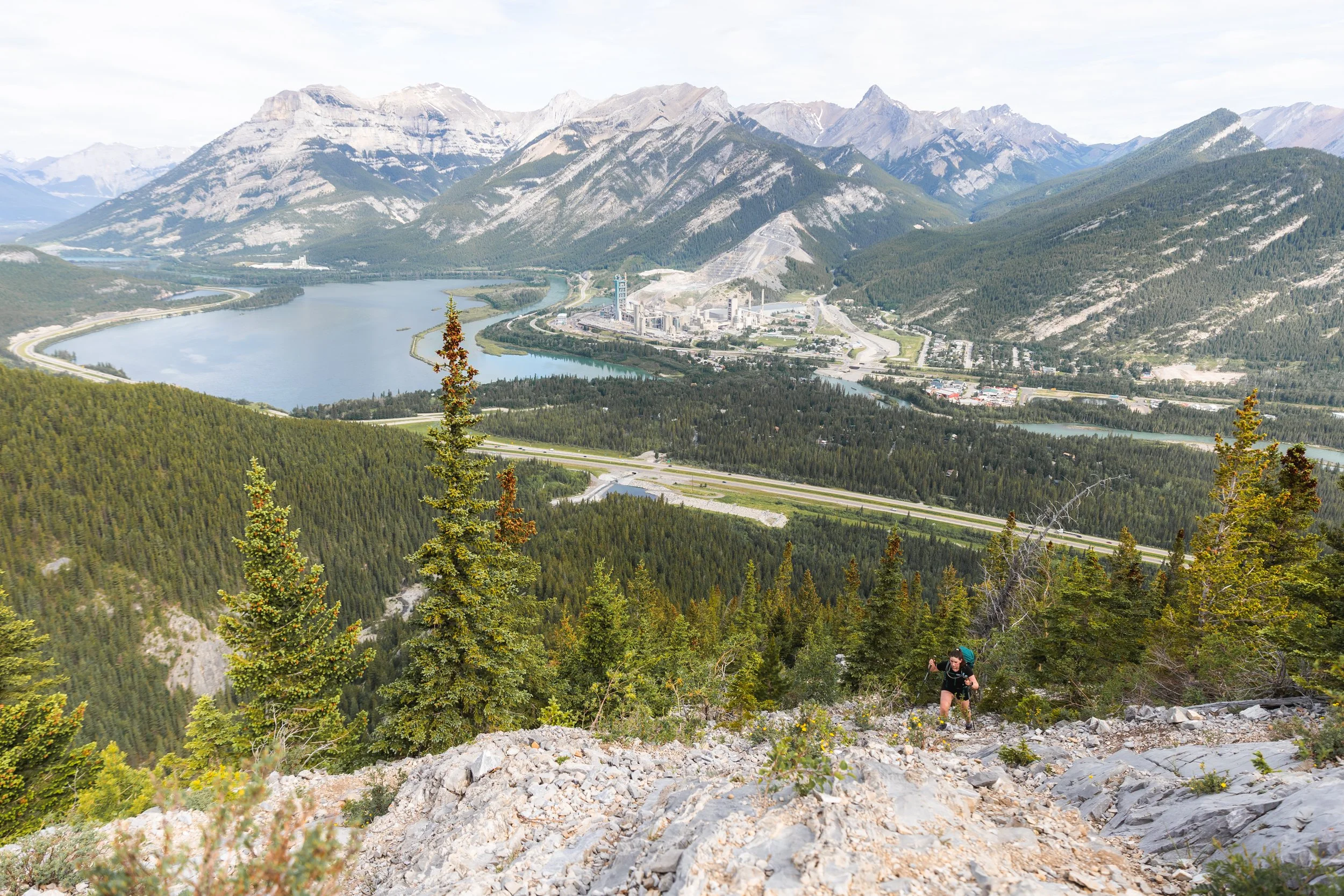
One advantage of such a steep initial climb is you are quickly high up in the mountains with 360 degree views. At first the sound of the highway distracts a little from the nature around but it isn’t long before that fades in to the distance and you’re just left with bird song.
Now there is one section on Heart Mountain where it is possible to get a little lost when the scrambling begins.
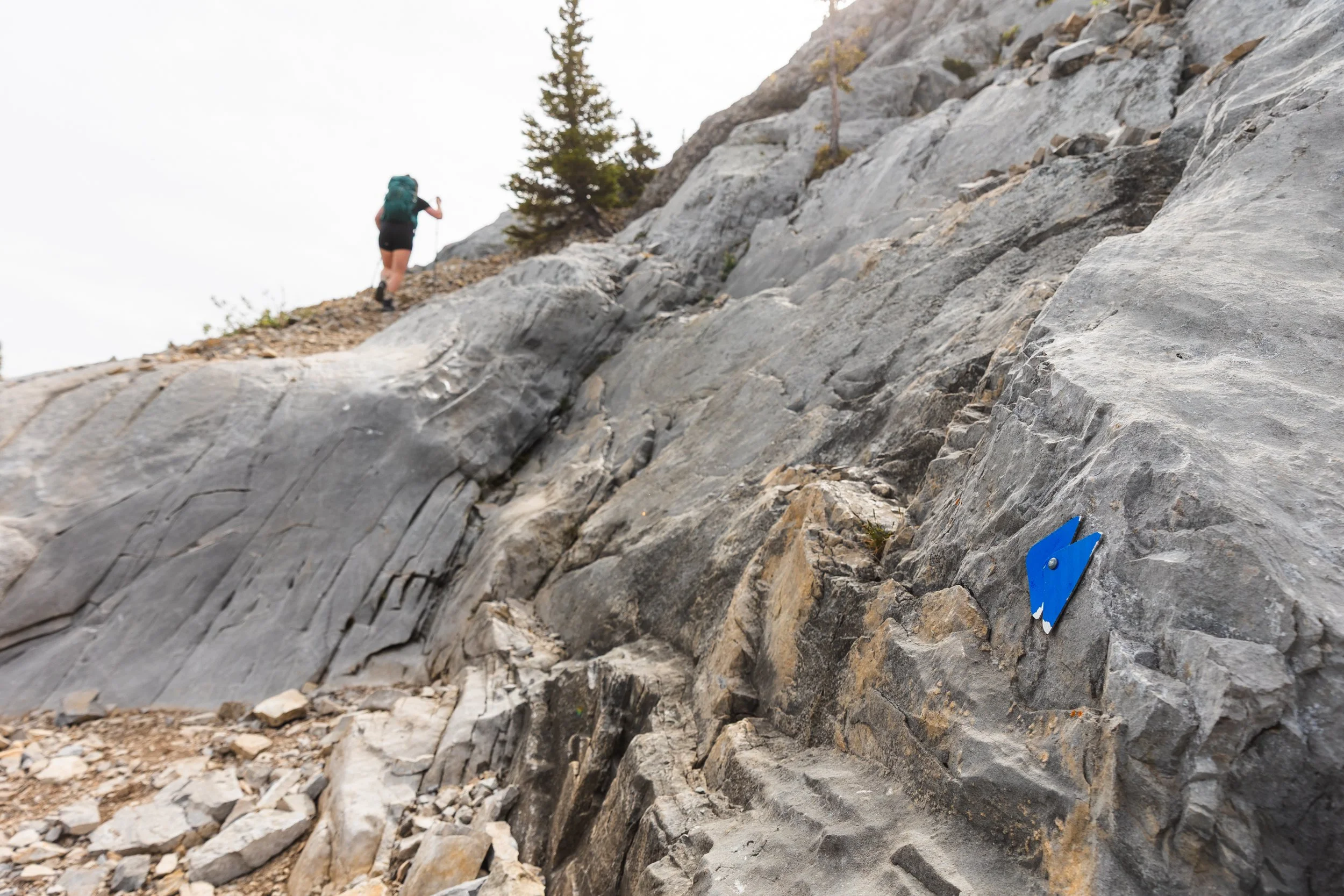
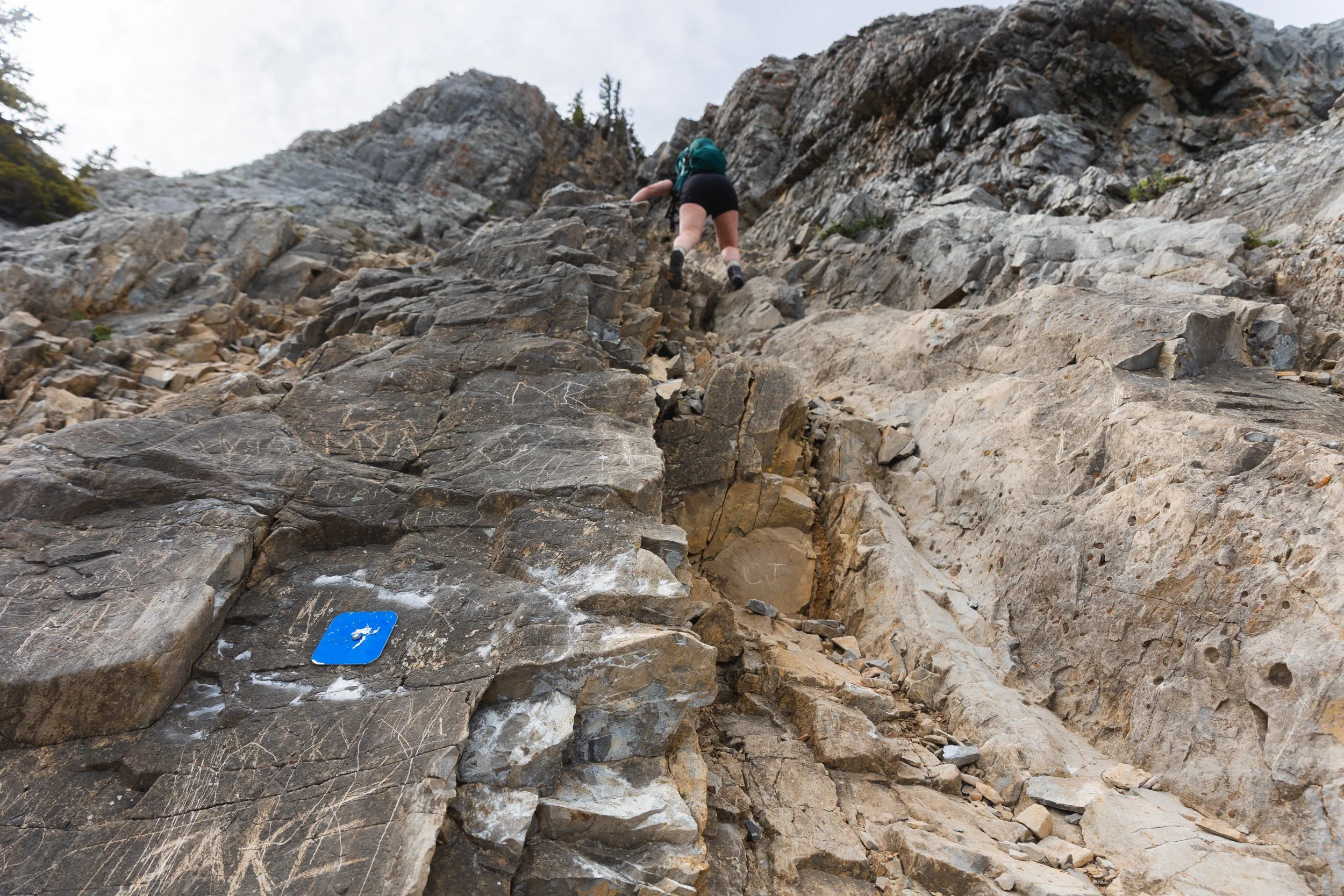
Somewhere just over 2 km in to the trail there are two blue triangles attached to a boulder (I think these used to be red markings years ago) pointing in the direction you need to go and towards a section of rock with a blue square on it about 5 metres above.
If you miss this and walk past you’ll end up following a trail to the right of the ridge until you end up almost cliffed out with sheer rock faces covered in bolts and hangers for sport climbers. If you get to this point you’ve gone too fat!
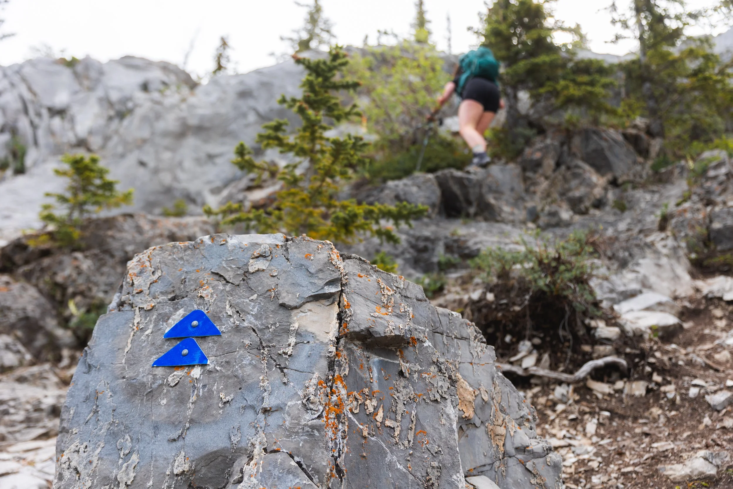
Blue markers lead the way!
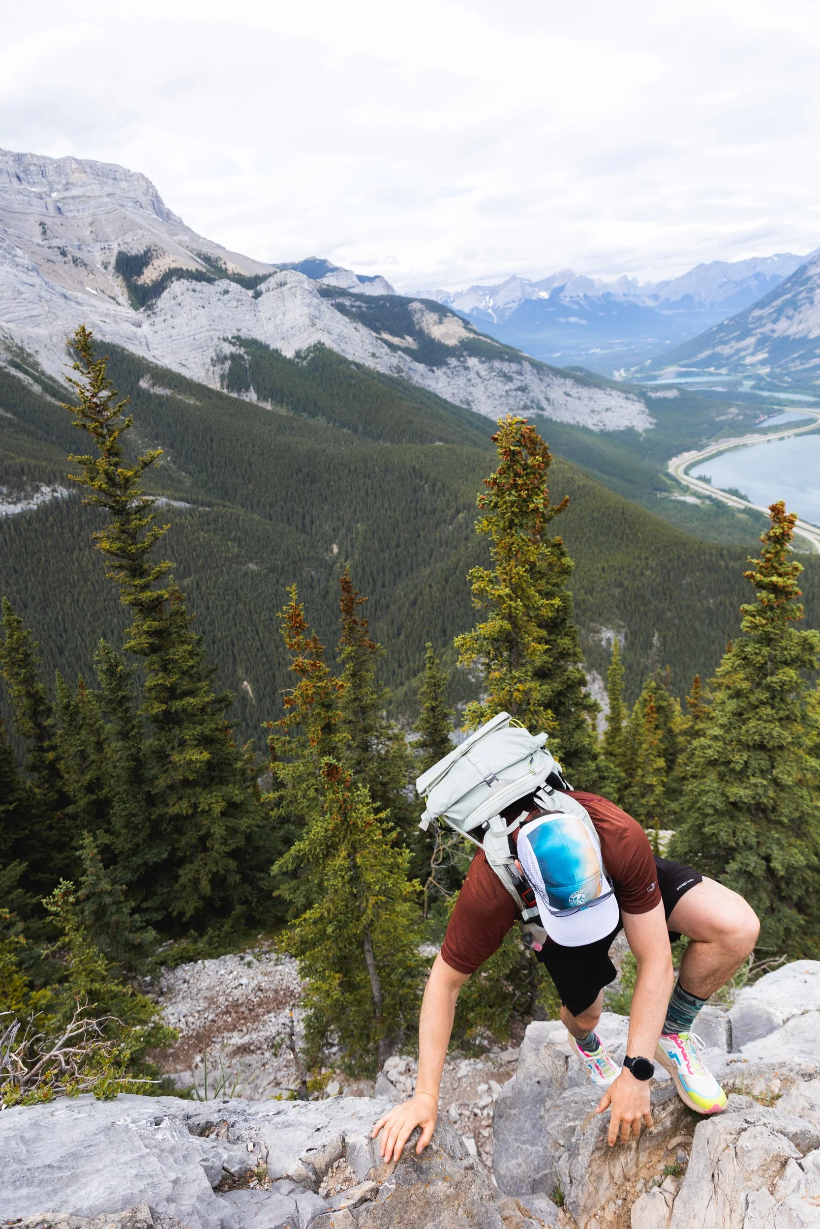
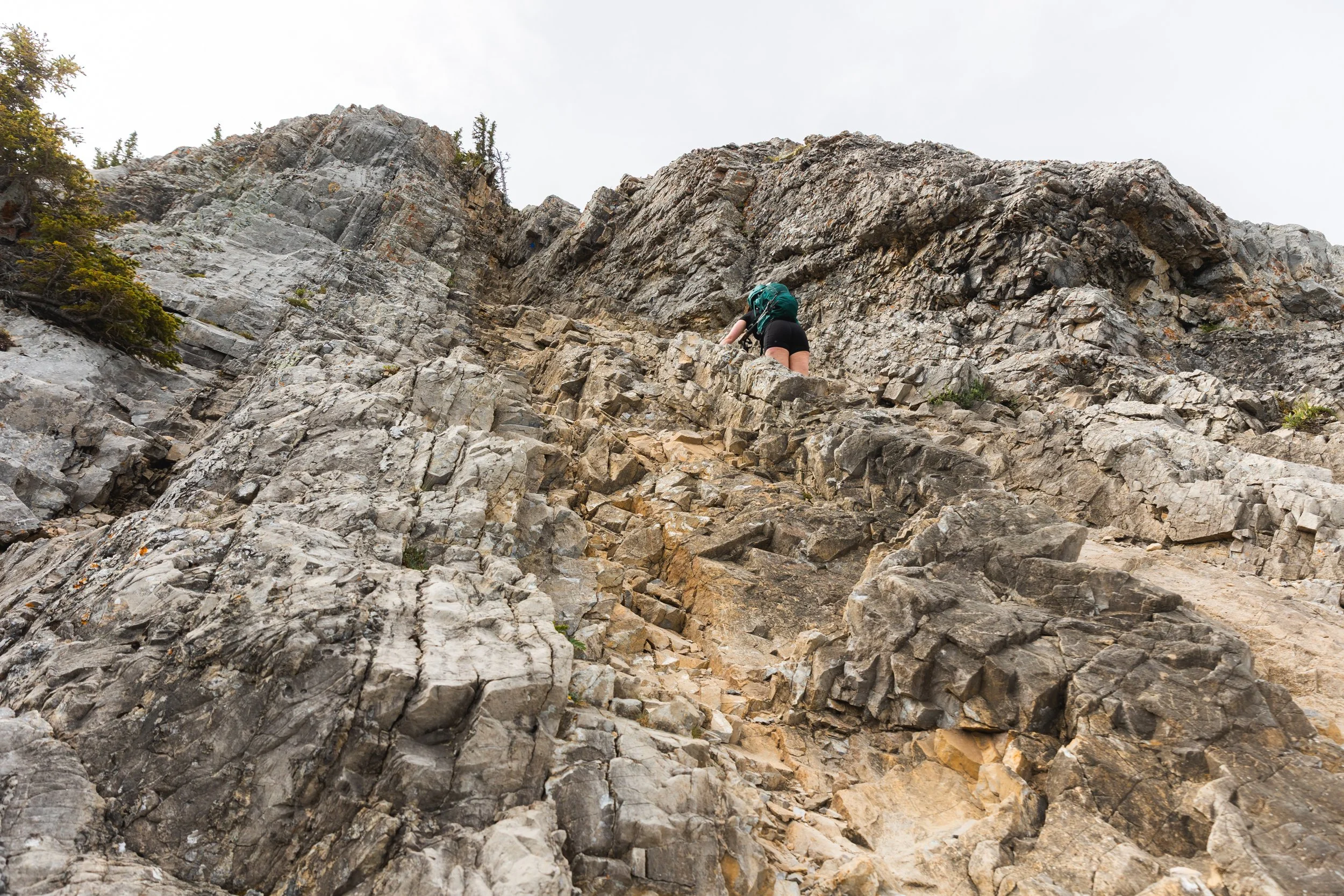
The blue square on the small rock face indicates a small 2 metre high climb to gain access to the rest of the route and scramble. This section, although small and short, does require a little climbing skill, you’ll be using your hands and the foot placements are well worn and a little slippery. It can be a little tough if you’re on the shorter side - this is probably the crux of the trail, the single hardest move.
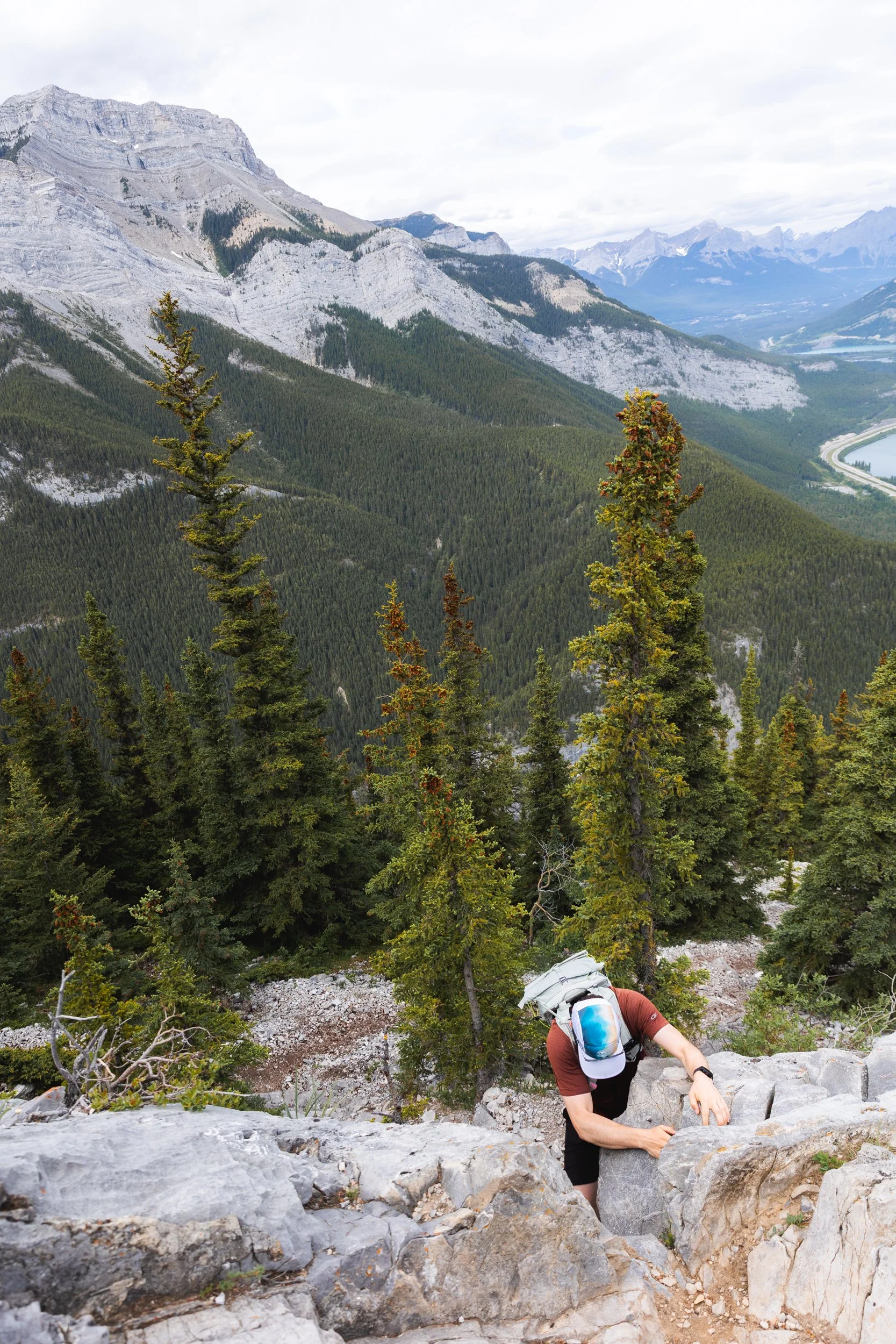
Negotiating the climb to rejoin the ridge.
The trail carries on marked by yet more blue triangles and squares each indicating an unavoidable scramble. They are steep but not overly exposed however a dislodged rock or a slip and fall would not end well so go careful!
The main scramble gulley, longer but easier than the first initial scramble.
Another view of the gully scramble.
Climbing out of the gulley.
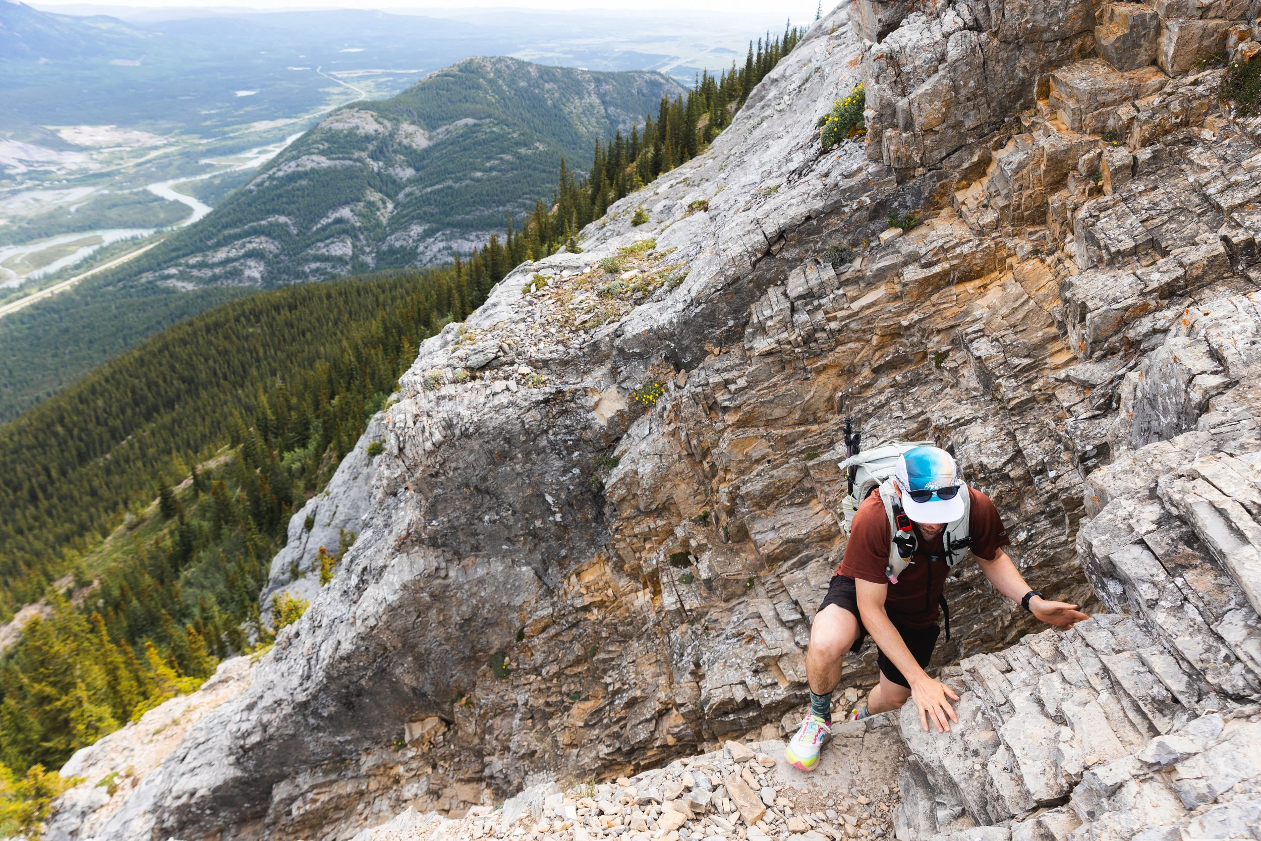
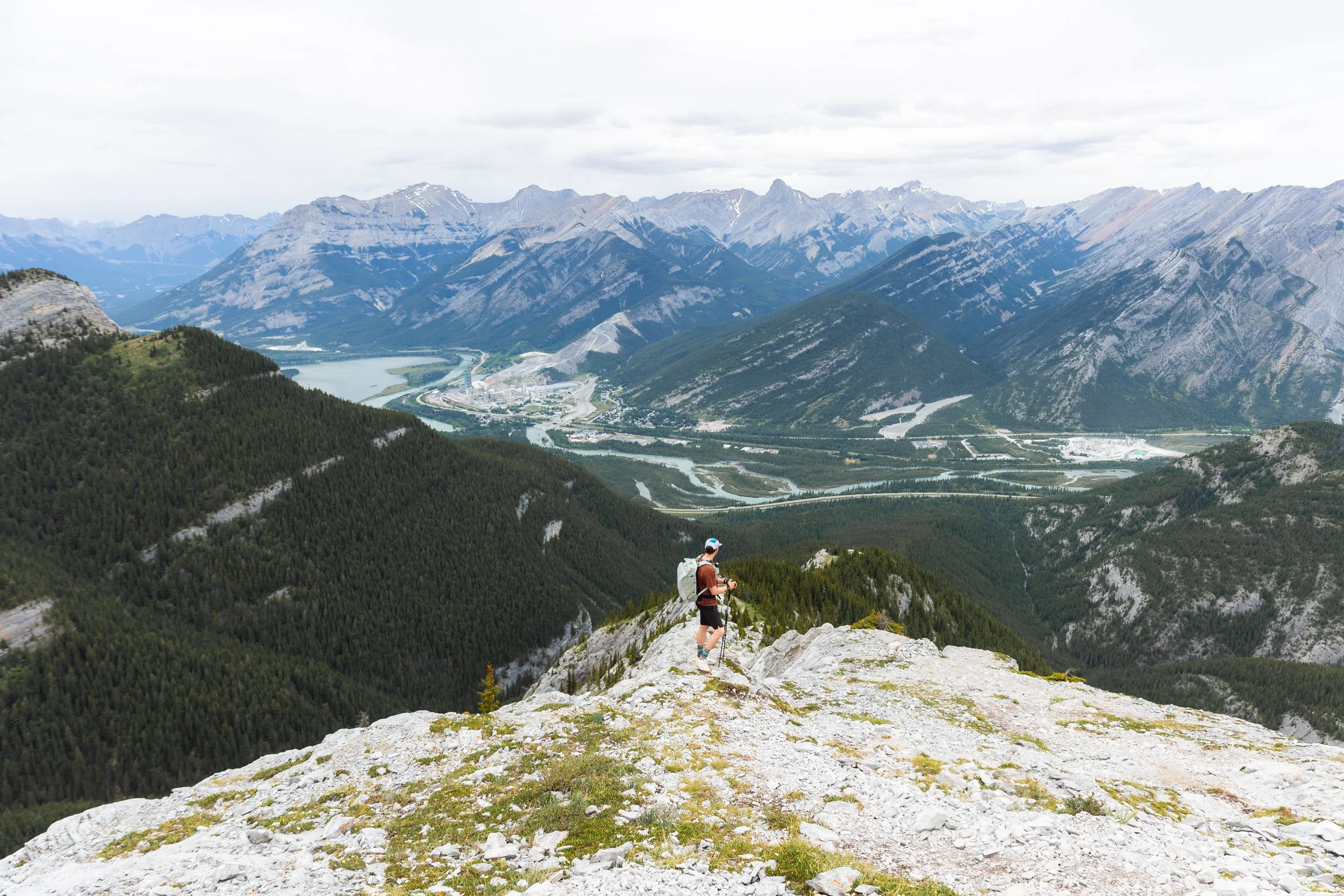
After this point the harder scrambles are over and done with but there’s still some steeper terrain, as you approach the summit you may need to use your hands for.
The final ascent towards the summit.
Views back towards Lac des Arcs from the summit of Heart Mountain.

All smiles from the top of Heart Mountain!
A lot of hikers like to treat Heart Mountain as an out and back trail and simply re-trace their footsteps back down the way the came.
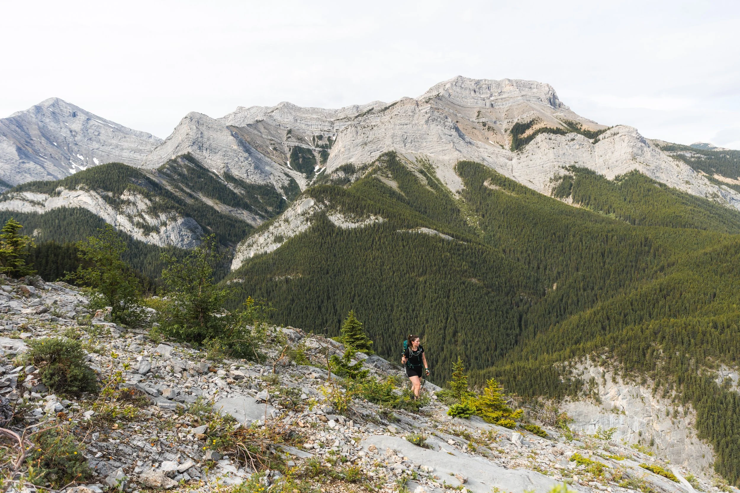
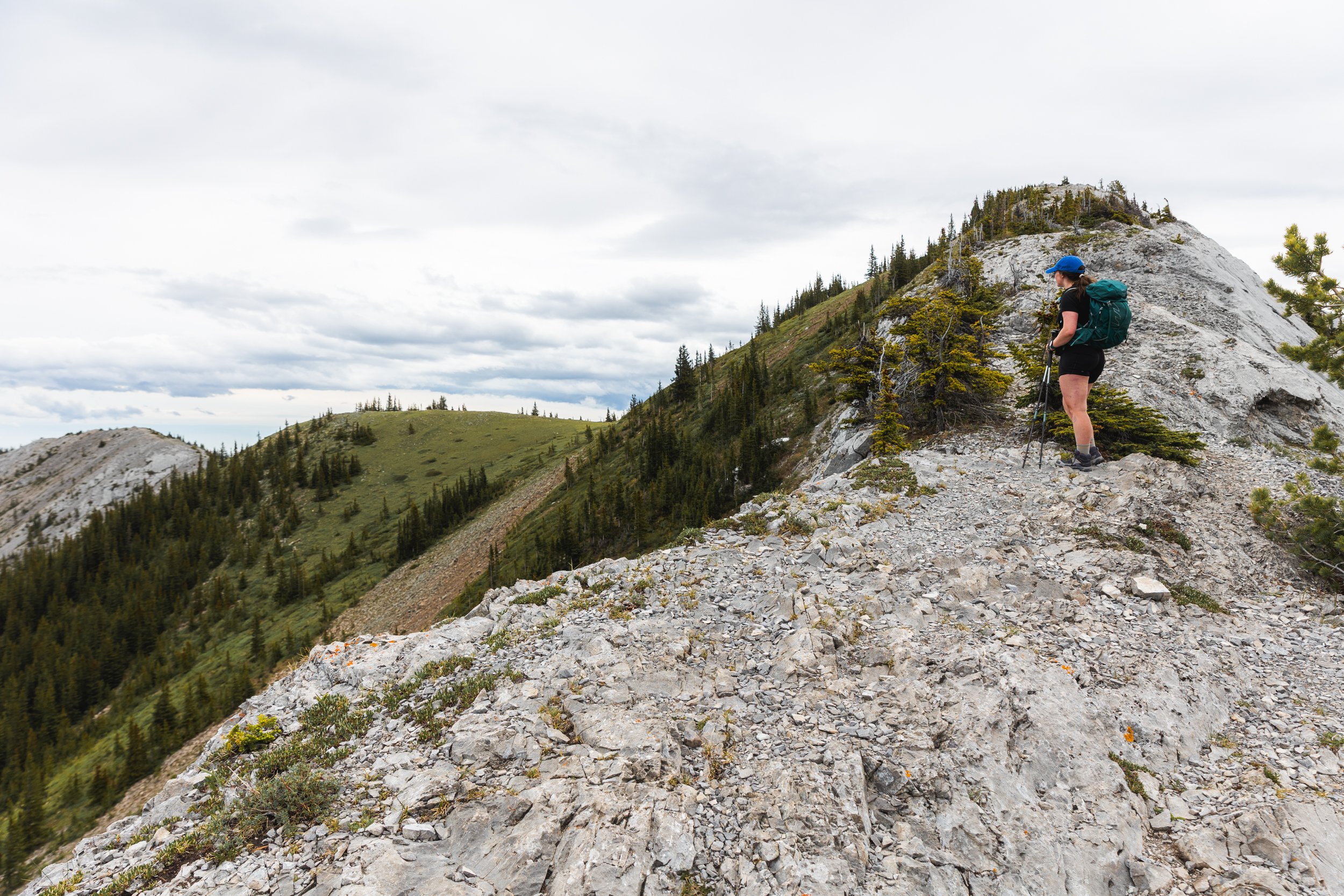
If you have time though I would highly recommend completing the full horseshoe. I mean by this point you’ve already done the hard elevation gain so why not treat yourself to a nice ridge walk!
In the image above you can see the next summit along, Grant McEwan peak, just above Brook’s head, then following on to the left is the first section of ridge line.
Approaching Grant McEwan peak with the ridge line trail trending left.
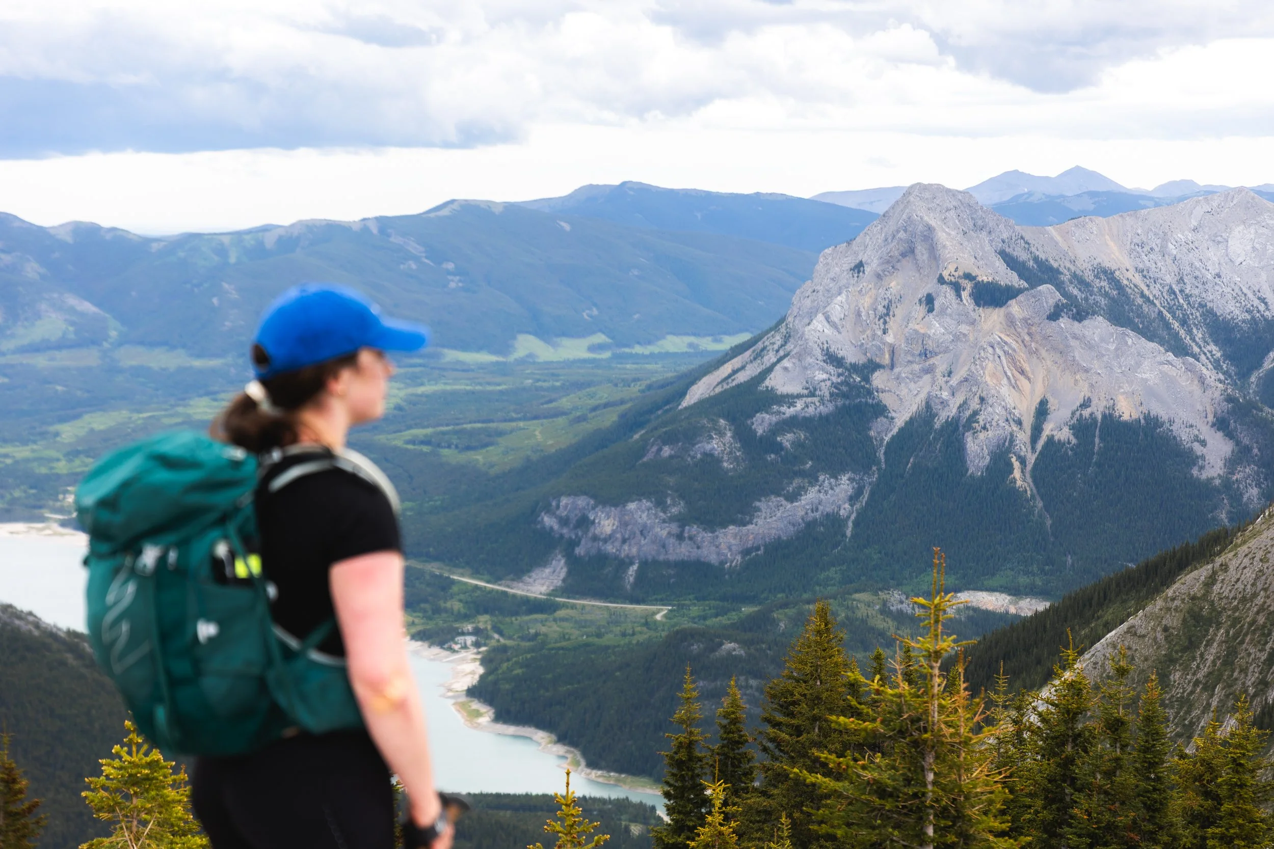
Views of Mount Baldy and Barrier lake from your second summit of the day.
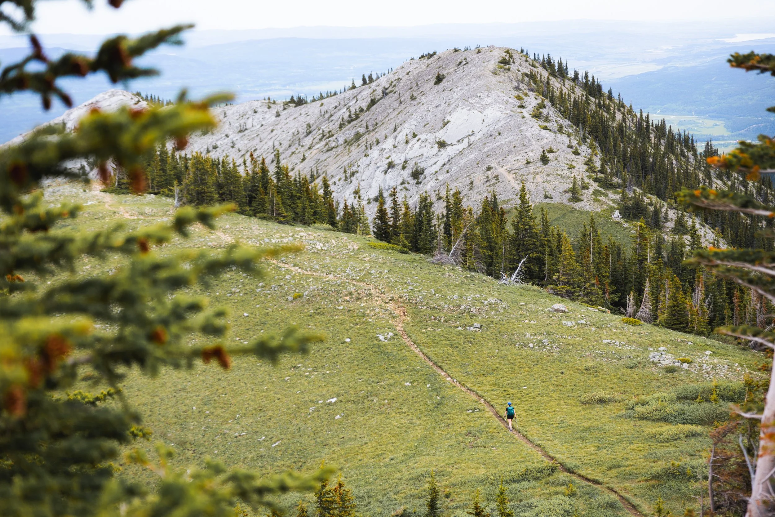
After the second summit the trail ungulates up and down and through grassy, alpine meadows. Even in late June these meadows were speckled with colourful splashes of wild flowers so by the end of July and in to August I could see these fields being absolutely stunning!
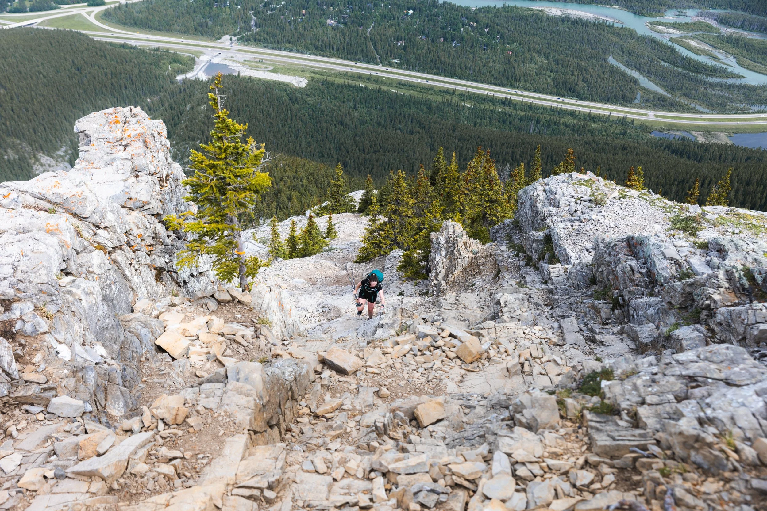
From the meadows the ridge line returns to rockier trails. The ridge line is one of the most enjoyable sections of the trail but is short lived. By this point you’re only about half way through the trail with 5 km taken up with the decent down and trail back to the car park.
Standing at the start of the decent as the ridge snakes it’s way back towards the highway.
The initial decent is still made of varied terrain with loose rock, slippery scree and the odd hand placement needed until around the 6.5 km mark where the trail heads back into the forest.
From here the trail becomes more obvious and defined as it mellows out to the valley floor. Once down off the steepest sections you head left, following parallel to the highway, until you rejoin the trail you came in on at the scramble warning sign.
The last two kms of this trail have been newly done and offer a wide and flat pathway around lakes and along the main road. This last little section is relatively uneventful but it’s fast and the soft, flat trail is a welcome break for the legs and a great way to warm down!
Looking for More Hikes in Kananaskis?
Tent Ridge offers stunning views, ridge line hiking and incredible fall colour.
East End of Rundle has to be one of my favourite for sunset photography.
Sarrail Ridge has to be one of the best views in Kananaskis Country!
Yates Mountain offers a great early season warm up to the hiking season!
Pipers Pass is a lesser known unofficial trail.
Things to know Before You Go
Parks and Conservation Passes: Whether you’re hiking in a national park in Canada or certain provincial parks you’ll most likely need some kind of conservation pass. A Discovery Passwill cover you for the year for all national parks in Canada whilst the Kananaskis Conservation Passcovers the provincial and wildland parks in the Kananaskis region.
Check Trail Conditions Before You Go: Trail conditions in the Rockies can change month to month and year to year. Trails close for wildlife, weather and avalanche hazards. Be sure to double check trail conditions before heading out to avoid any disappointment. You can do so here!
Leave No Trace: When hiking anywhere in the world it’s important that you practice a leave no trace philosophy. This means whatever you hike in to a trail or campground you have to be able to hike out too. There won’t be trash cans or waste disposal in the backcountry and you should never throw trash in any out houses or pit toilets. In recent years, as trails and parks become busier, litter is becoming more of a problem. Don’t add to that problem!
Bears and Wildlife! Wild life is everywhere in the Canadian Rockies, even on trails that are close to town. People and animals have been attacked by bears and other wild life on popular trails in the past so don’t take it for granted.
Most wildlife is looking to avoid human contact so no matter what type of wildlife you see be sure to keep your distance. 30 metres is the minimum recommendation for most species but under any circumstance don’t approach wildlife. Even the cuddliest of critters can be dangerous!
So as always be bear aware, make noise, hike in groups, carry bear spray and, if they’re allowed on trail, keep your dog on a leash!
Offline maps knowing where you’re going is super important as to not get lost. I recommend All Trails Plusfor finding routes and offline mapping allowing you to safely find your way home.
Interested in other multi-day hikes in the Canadian Rockies or maybe day hikes?
Gear Recommendations
After 10 years living in the Canadian Rockies, years working in retail and years reviewing outdoor gear I’ve dialled in my backcountry kit! And on all day hikes there are definitely a few things I always take with me to make my trip safer, easier and more enjoyable.

Merino Socks
Merino socks are a must for any hike. They keep you dryer, warmer and smelling better!
Once you go merino you never go back!
My socks are now 100% Smartwool!
Get them at Smartwool.com

Hiking Poles
Poles are often overlooked by new hikers and seen as unnecessary. However once you use them you’ll never go back! They make you more efficient and take the weight of your knees!
Get it on Backcountry.com
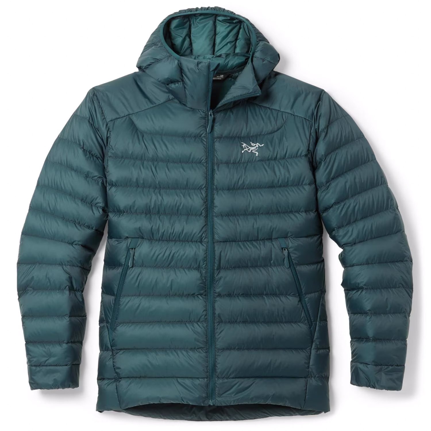
Down Jacket
No matter what the weather I carry a lightweight down jacket. The Arcteryx Cerium is light and very warm! Perfect for keeping you toasty when you take a break or if you were injured and awaiting help.
Get it on REI.com
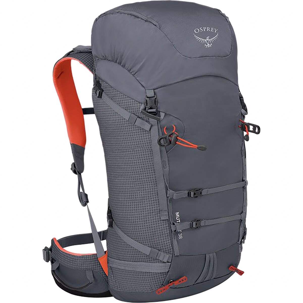
Comfortable Day Pack
The Osprey Mutant is my favourite day bag. Even though it’s designed more for scrambling or mountaineering this bag is one of the most comfortable bags I own and has enough space for everything I need.
Get it on Backcountry.com

Water Filter
A Katadyn BeFree has to be the easiest filtration system to use. When out on the backcountry you want to be able to filter and refill your water along the way.
This filter packs down small and filters fast. It’s in my bag on every hike!
Get it on Backcountry.com

Capture Clip
Another item that comes on every hike with me and a must own for every photographer.
Keeps your camera close at hand making capturing moments much faster!
Get it on Peakdesign.com