East End of Rundle (EEOR) - The Best Sunset in Canmore!
I have revisited the East End of Rundle, or EEOR, many a time over the years and it has quickly become my favourite place to watch the sunset in the whole of Canmore. Once on the summit you’ll be rewarded with endless 360 degree views of layered peaks and plummeting valleys. Even though it’s a steep hike to get to the top the photography on offer is well worth the effort.
However this trail is a step up from it’s cousin, Ha Ling, just over the road. You won’t find stairways and wide paths here but steep scree, braided trails and hands on scrambling towards the summit. It’s easy to get lost on the way back down if you aren’t paying attention so I always recommend hiking with a group and having some form of navigation. I’d also highly recommend some decent hiking boots as well as some hiking poles.
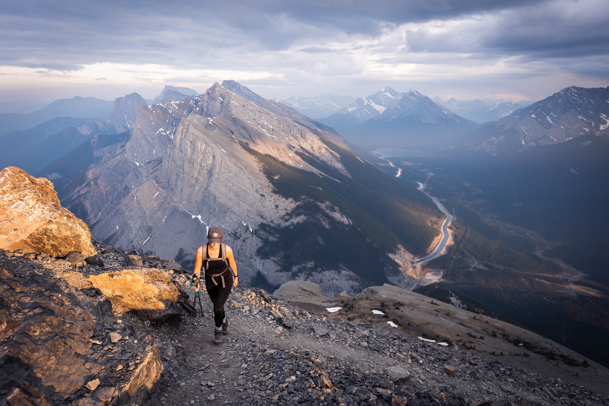
Approaching the summit of EEOR with Ha Ling in the background.
The Stats
Time: 4 to 6 hours out and back (Can be done quicker if experienced)
Distance: 6 Km return
Elevation Gain: 870 metres
How to Get to the East End of Rundle Trailhead
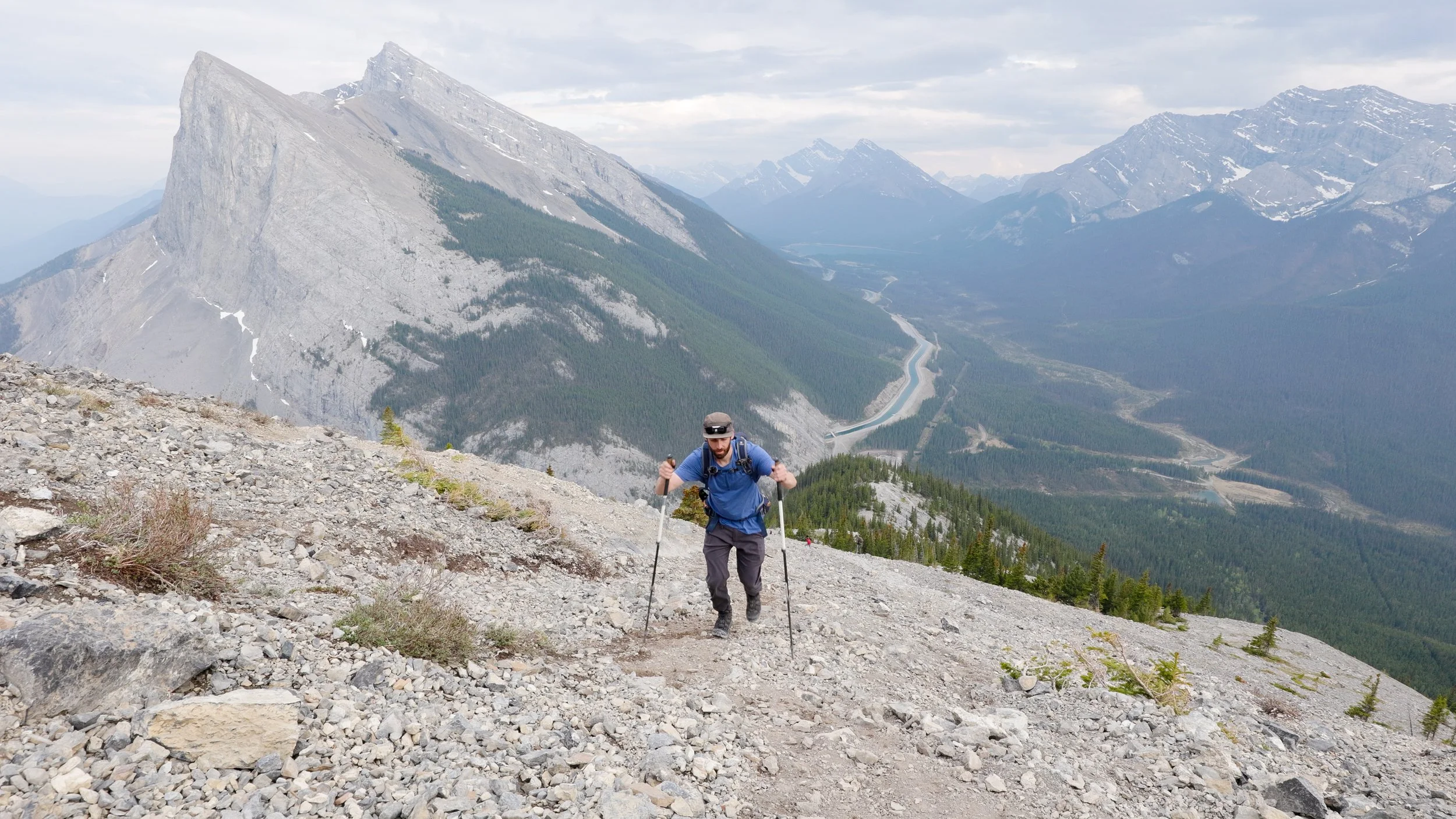
A short 20 minute drive from the town of Canmore, head towards the Nordic Centre and follow the 742 (Smith Dorrien Trail) towards Spray Lakes until you get to Whitemans Pond. As the Pond ends and narrows to a river you'll see a lay-by for parking, the trail starts just opposite here. Alternatively if this lay-by is full there is a new, large parking lot just down the hill called the Goat Creek parking lot.
The Hike
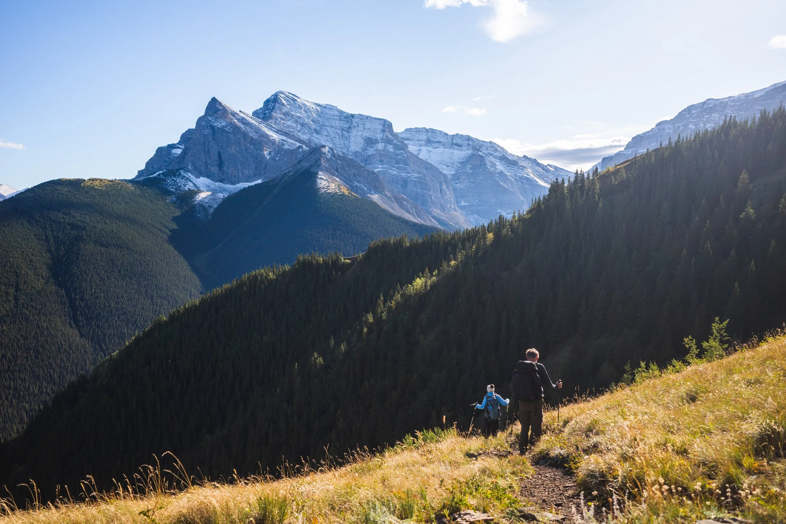
The East End of Rundle, commonly referred to as EEOR, is one of my favourite short hikes in the immediate Banff/Canmore area. It offers some challenging terrain as well as stunning views over the town below and endless peaks behind.
The start of the trail isn't overly obvious but if you follow the road up the hill from the larger parking lot and keep a look out for the telegraph poles you should come across a little orange flagging and then notice the trail start to weave into the woods. Very early on you'll see a sign warning of unexploded avalanche bombs, if you see this sign you're on the right track!
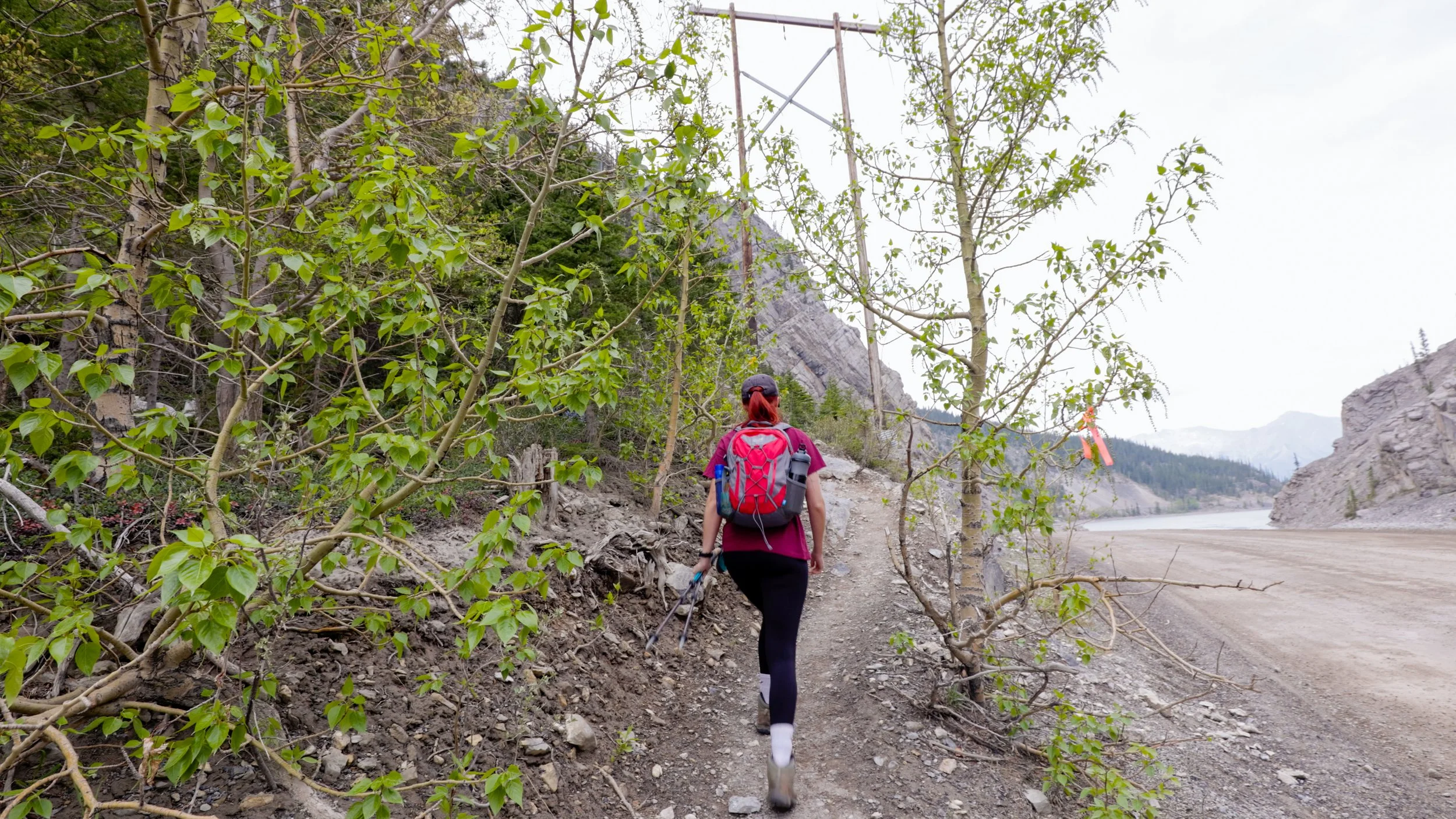
Note the orange flagging on the right hand side, the trail switches back into the woods just after the pylon.
The first section of the trail is obvious and well trodden as it switches back and forth uphill. The EEOR trail is pretty much uphill from the get go so go steady and take your time!
A word of warning: Even though this trail is popular and well used bears very much call this woodland home. In fact this is where a viral video was filmed of a huge grizzly walking towards a group of hikers on the trail. So as always be bear aware, hike in groups, carry bear spray and make plenty of noise!
Once out of the woods the trail will become less obvious, erosion over time has led to a braided trails as hikers criss cross across the mountain side trying to find the most efficient route. The general direction is up however it’s easy to get lost so some route finding skills are essential.
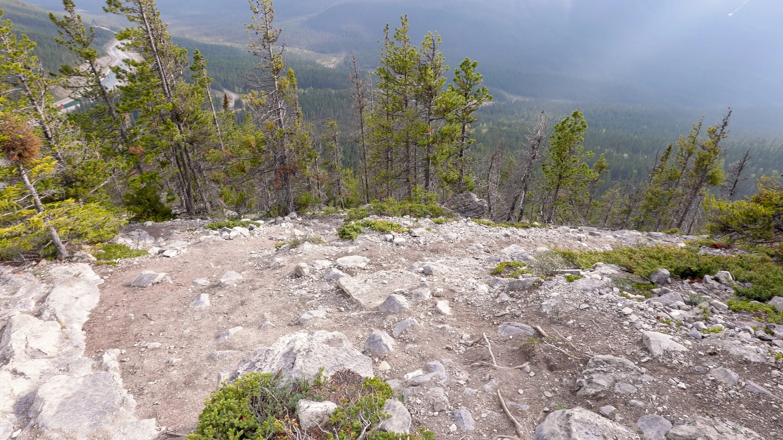
Braided trails as you exit the wood, as you can see there appear to be several.
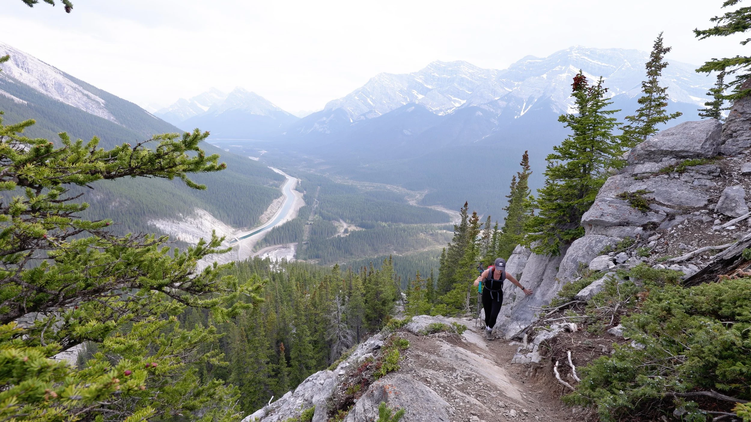
Some of that braided path leads you on to a ledge type feature with some exposure
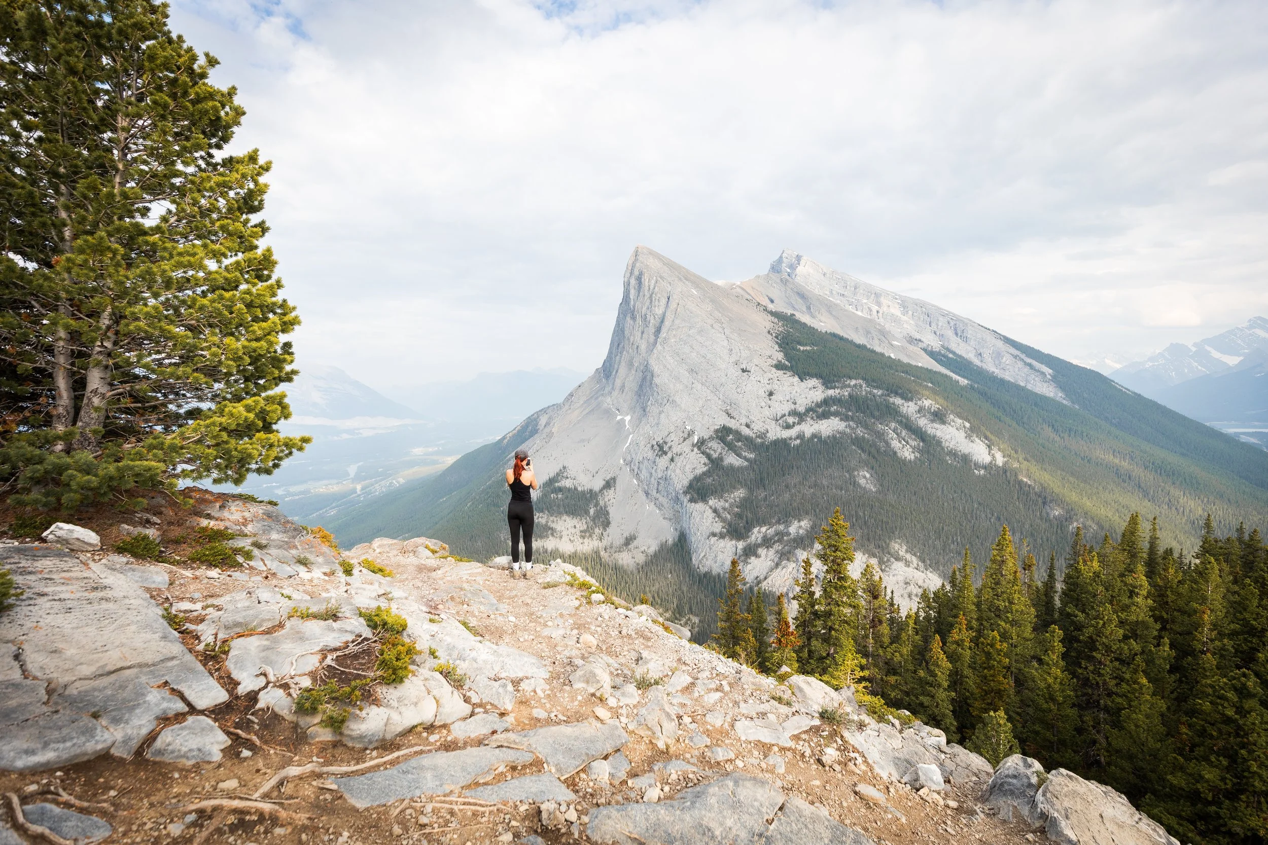
Around half way through your ascent you'll be rewarded with incredibly views of Ha-Ling Peak, a distinctively pointy mountain peak. This peak itself is also hike-able but personally I prefer the views and challenge of EEOR. This view point should only take around 45 minutes to an hour to get to depending on your fitness level.
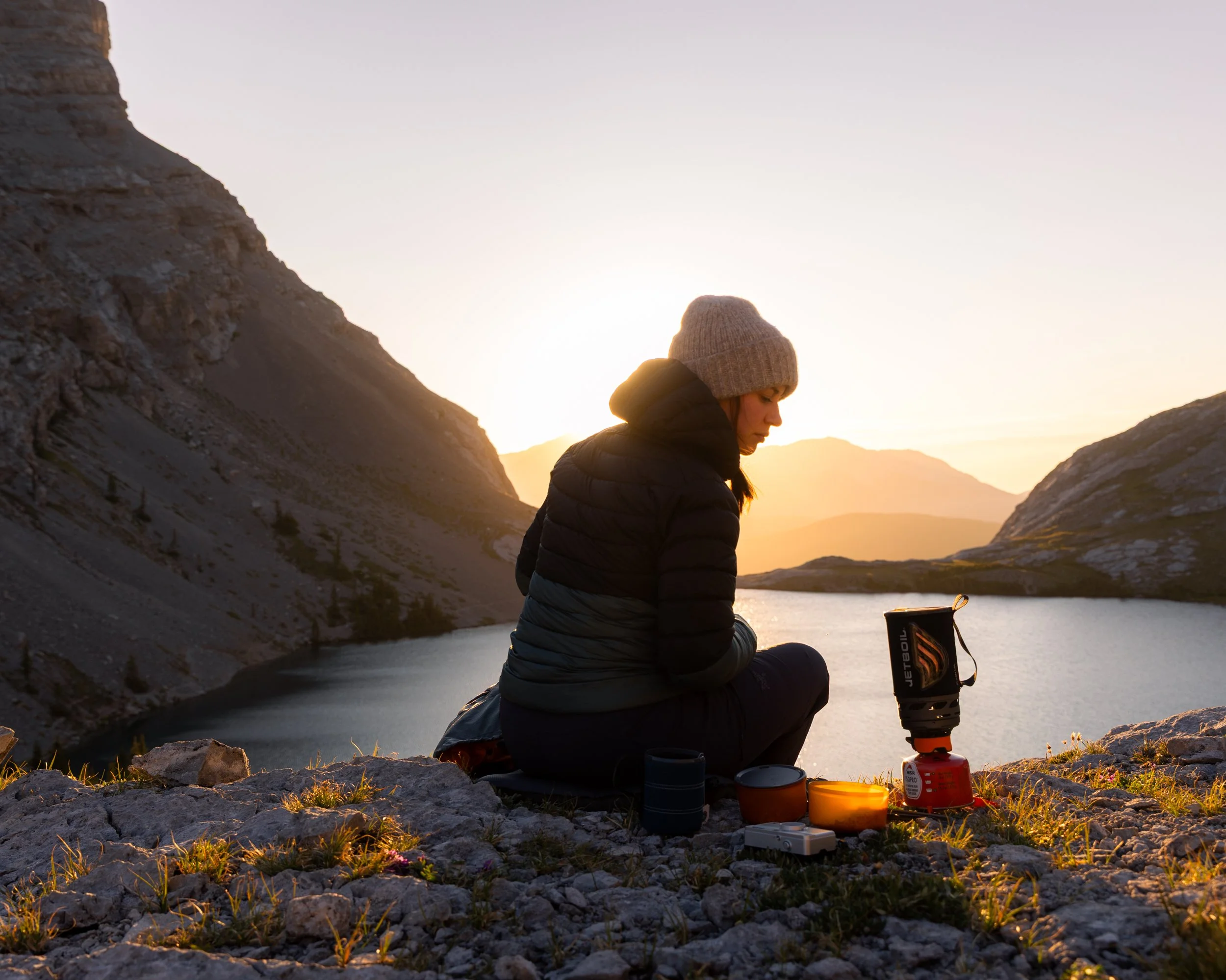
This is one of the best spots to get some fantastic sunset photography without having to hike all the way to the summit. I’ve spent the evening shooting astrophotography here as well as multiple sunsets.
The final section of this peak is a mixture of hiking up steep scree and some hands on scrambling. There are a couple of ways to the summit, however I recommend taking the more direct path up the scree as this minimises your exposure and scrambling. I have in previous years summited by following more along the cliff edge to the right and doing a more exposed scramble but this isn’t the usual route and I don’t think I’d recommend it to most.
The more direct scree path.
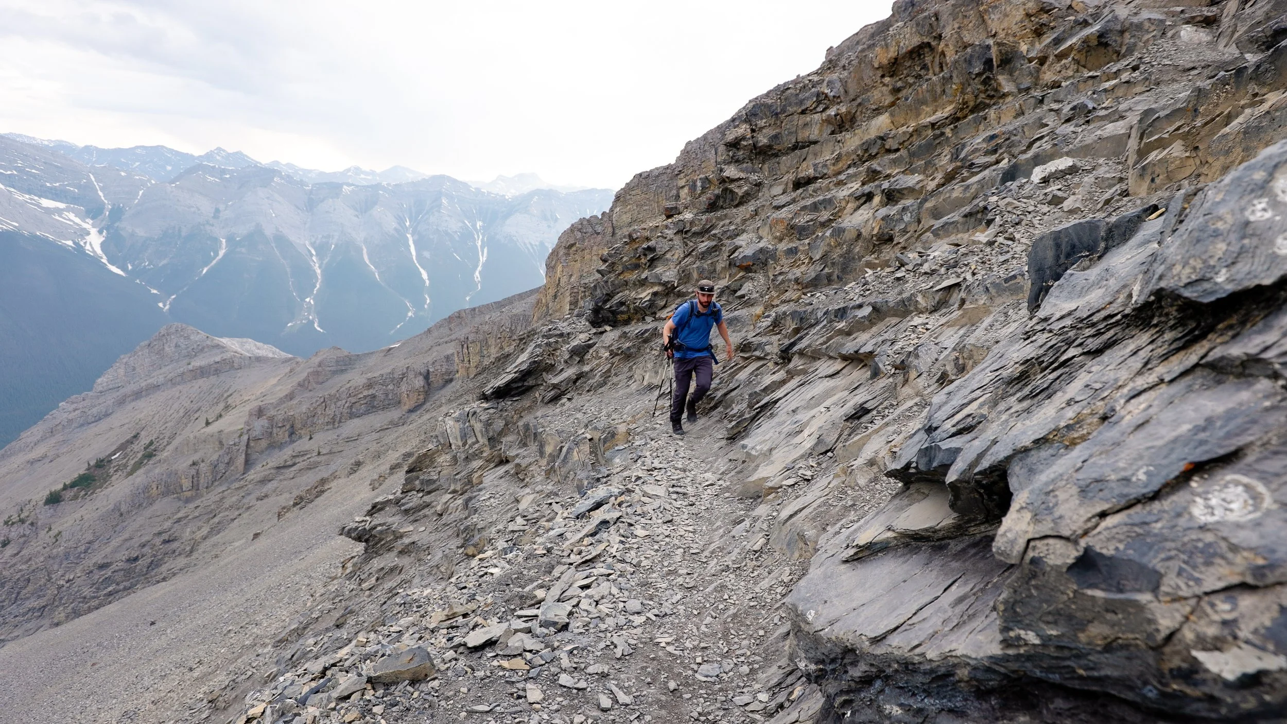
The scramble, here it gets steep enough where you’ll want to use your hands to aid you on certain sections.
The Summit and Photography
As I mentioned this hike is one of my favourite places to watch the sunset anywhere in the Bow Valley. Not only does it offer outstanding views halfway up but the summit has to be one of the best for a shorter hike. The East End of Rundle offers some really fantastic views in very direction and I’ve managed to get some amazing images from up here.
However keep in mind that if you’re shooting up here at sunset that you’ll most likely be hiking back down in the day and it is easy to get lost. We’ve bumped in to other hikers in the dark on the way down who have cut up legs from falling on scree banks they weren’t aiming to be on because they’d become disorientated. Bring a head torch if you plan to be up on any mountain later in the day and if you can track your up hill hike so you can follow it back again after dark.
Something like All Trails Plus works really well for finding routes and offline mapping allowing you to safely find your way home.
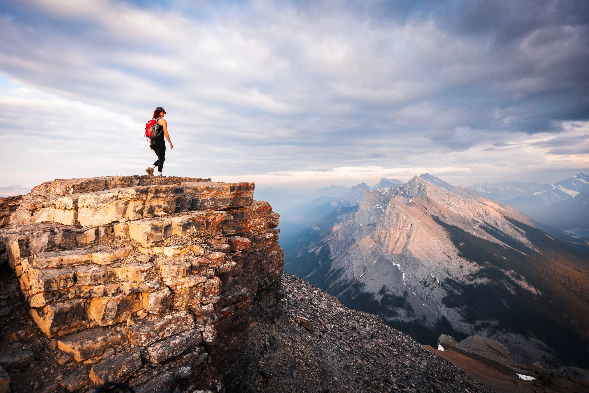
My sister stands at the summit looking back towards Ha Ling

Shooting back south off of the summit with layers and layers of mountains.
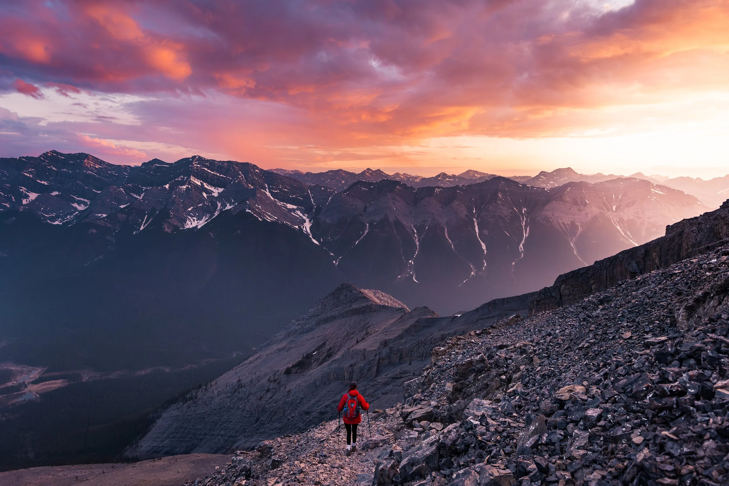
An incredible sunset as we started our ascent back down.
Things to know Before You Go
Parks and Conservation Passes: Whether you’re hiking in a national park in Canada or certain provincial parks you’ll most likely need some kind of conservation pass. A Discovery Passwill cover you for the year for all national parks in Canada whilst the Kananaskis Conservation Passcovers the provincial and wildland parks in the Kananaskis region.
Check Trail Conditions Before You Go: Trail conditions in the Rockies can change month to month and year to year. Trails close for wildlife, weather and avalanche hazards. Be sure to double check trail conditions before heading out to avoid any disappointment. You can do so here!
Leave No Trace: When hiking anywhere in the world it’s important that you practice a leave no trace philosophy. This means whatever you hike in to a trail or campground you have to be able to hike out too. There won’t be trash cans or waste disposal in the backcountry and you should never throw trash in any out houses or pit toilets. In recent years, as trails and parks become busier, litter is becoming more of a problem. Don’t add to that problem!
Bears and Wildlife! Wild life is everywhere in the Canadian Rockies, even on trails that are close to town. People and animals have been attacked by bears and other wild life on popular trails in the past so don’t take it for granted.
Most wildlife is looking to avoid human contact so no matter what type of wildlife you see be sure to keep your distance. 30 metres is the minimum recommendation for most species but under any circumstance don’t approach wildlife. Even the cuddliest of critters can be dangerous!
So as always be bear aware, make noise, hike in groups, carry bear spray and, if they’re allowed on trail, keep your dog on a leash!
Offline maps knowing where you’re going is super important as to not get lost. I recommend All Trails Plus for finding routes and offline mapping allowing you to safely find your way home.
Interested in other multi-day hikes in the Canadian Rockies or maybe day hikes?
Watch the video
Featured Posts
The east end of Rundle is one of many locations in my downloadable, offline Canadian Rockies Photography Location Guide. Over 100 locations with GPS coordinates!
Canyon Creek Ice cave is a uniquely different adventure and well worth the effort, especially if traveling by bike!