Mount Lady Macdonald
The stats
Time: 6 - 8 hours depending if you summit or not.
Distance: 10 km retrun
Elevation Gain: 1200 metres if you go all the way to the true summit.
How To Get To The Lady Mac Trailhead
Easy parking at Cougar Creek parking lot in Canmore on the east side of the highway. There’s some information boards and a toilet block. From here the trail start is very obvious, just head north along the creek past the Cougar information signs.
The Hike
Lady Mac took me by surprise! It’s a hike commonly talked about in the Bow Valley and offers some stunning views however it isn’t for everyone! This trail has some seriously steep sections gaining over 1200 metres in elevation in around 5 km and ends with some of the most exposed hiking I’ve ever done. To reach the true summit you’ll need to be experienced, careful and brave.
Once you’ve followed the trail partly down Cougar Creek you’ll see the path head off to the left, here the incline starts! The trail is very easy to follow however there is the odd off shoot but all lead back to the same place as you wind your way through the forest.
You’ll start off in the forest getting a solid work out with all the elevation gain. Once you’re above the tree line you’ll come to the Helipad, a wooden structure overlooking the town of Canmore below and a great spot for a rest and snack, a lot of people call it a day at this point. The Helipad was actually built to service a tea house, a project that got abandoned in the early 2000s. Until 2013 there were some remains of the potential tea house structure still up on the ridge line but these were removed for public safety.
Whilst you relax and take in the views you’ll be able to get a good idea of what you’re in store for. The elevation increase kicks up a notch yet again with some steep scree and rock to ascend to make it to the start of the ridge line.
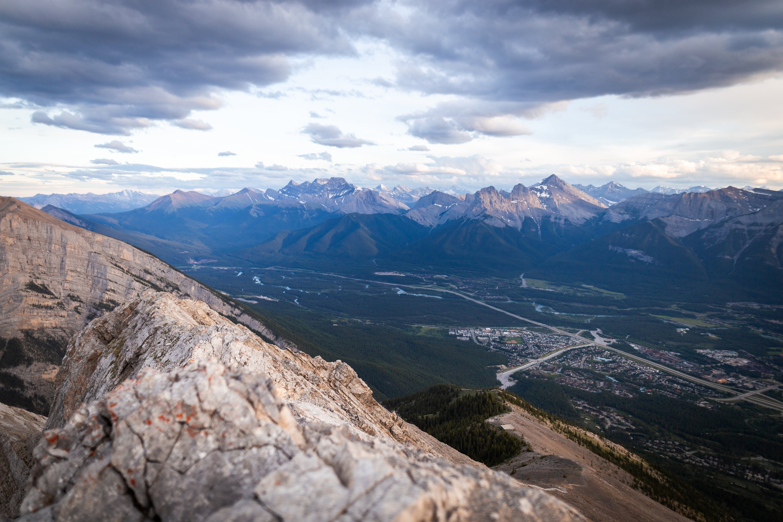
This image is taken from the top of the initial scramble above the helipad. The views from up top are pretty spectacular but this also gives you a good vantage point of the harder section of trail. If you look closely you can see the square helipad just before the tree line.
You can then follow the path that winds up the scree until you’ll need to do a little hands on scrambling.
Once at the top of the ridge line the view really opens up giving expansive vistas of the town below as well as mountains and ridges to the north, this is your last chance to turn back and I wouldn’t blame you if you did!
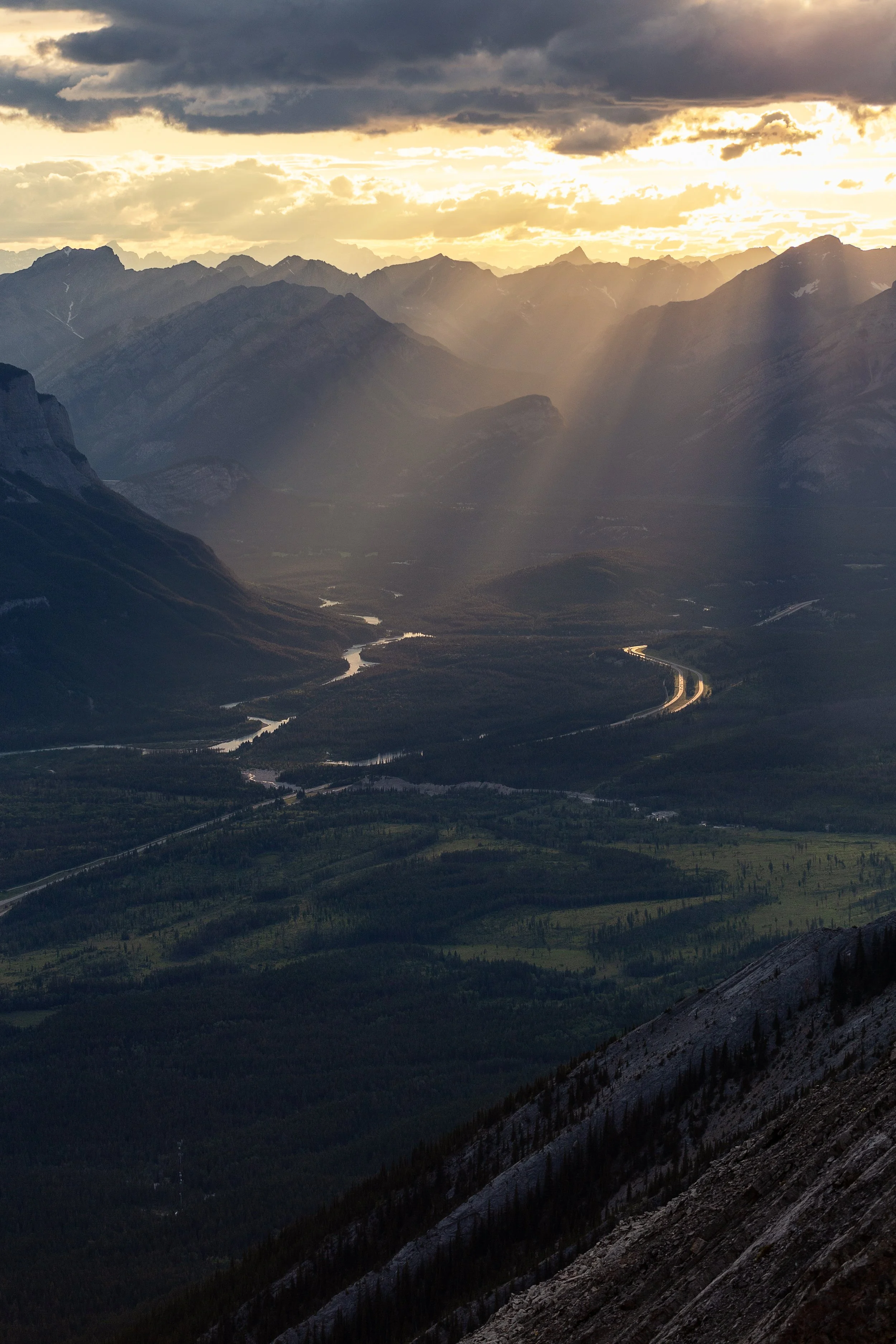
Sun beams over the Bow Valley

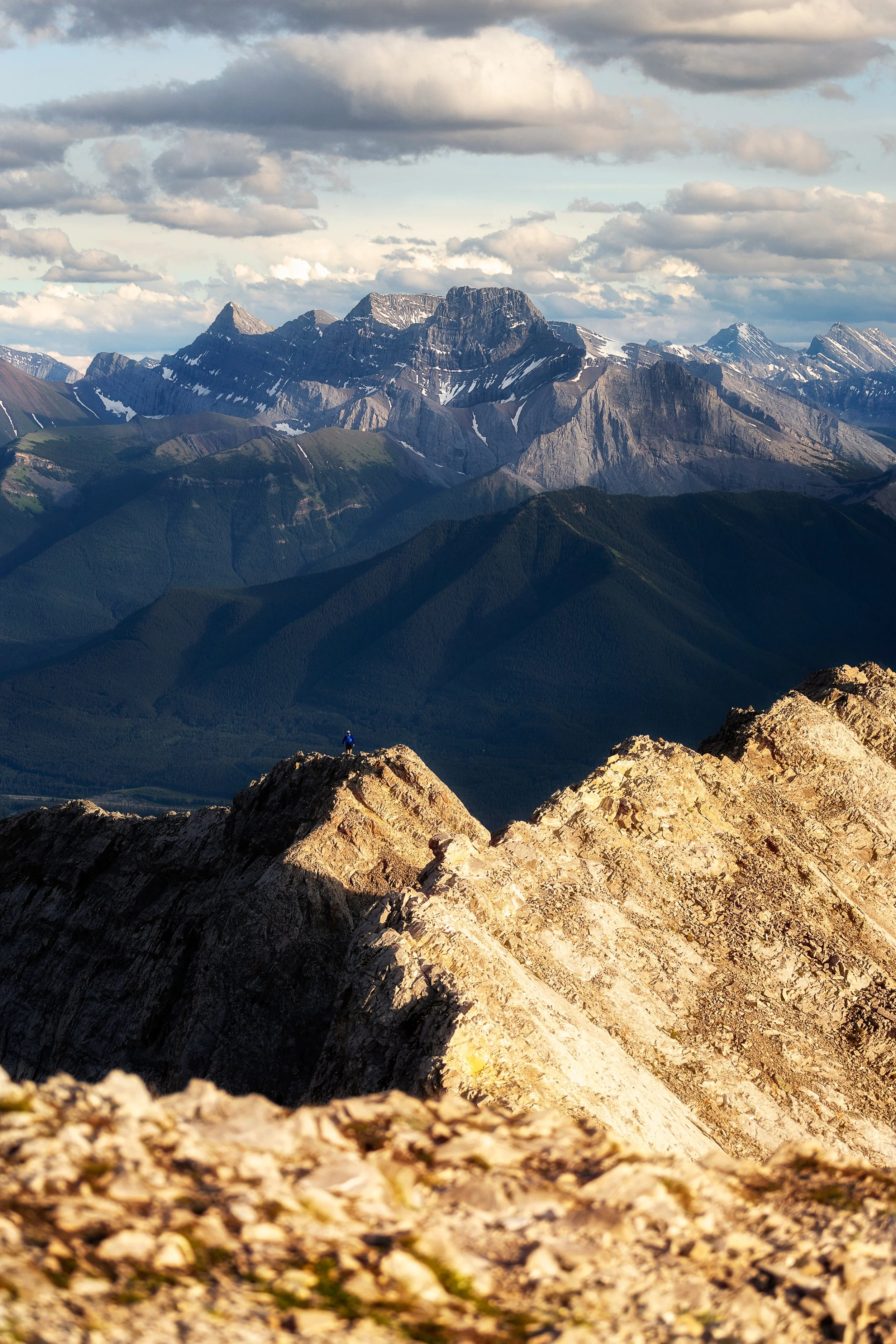
Will hikes up to the ridge line with Grotto Mountain in the background.
The true summit is at the end of a very exposed ridge line walk with plummeting drop aways. You’ll need great balance and nerve to negotiate the narrow and steep path. The views at the summit are very similar to the start of the ridge line but sometimes you just feel like you have to get to that highest point! To complete the ridge line you’ll need good, supportive boots and need to use your hands to climb and balance and be comfortable with exposure. If you have a fear of heights this last section really isn’t for you!
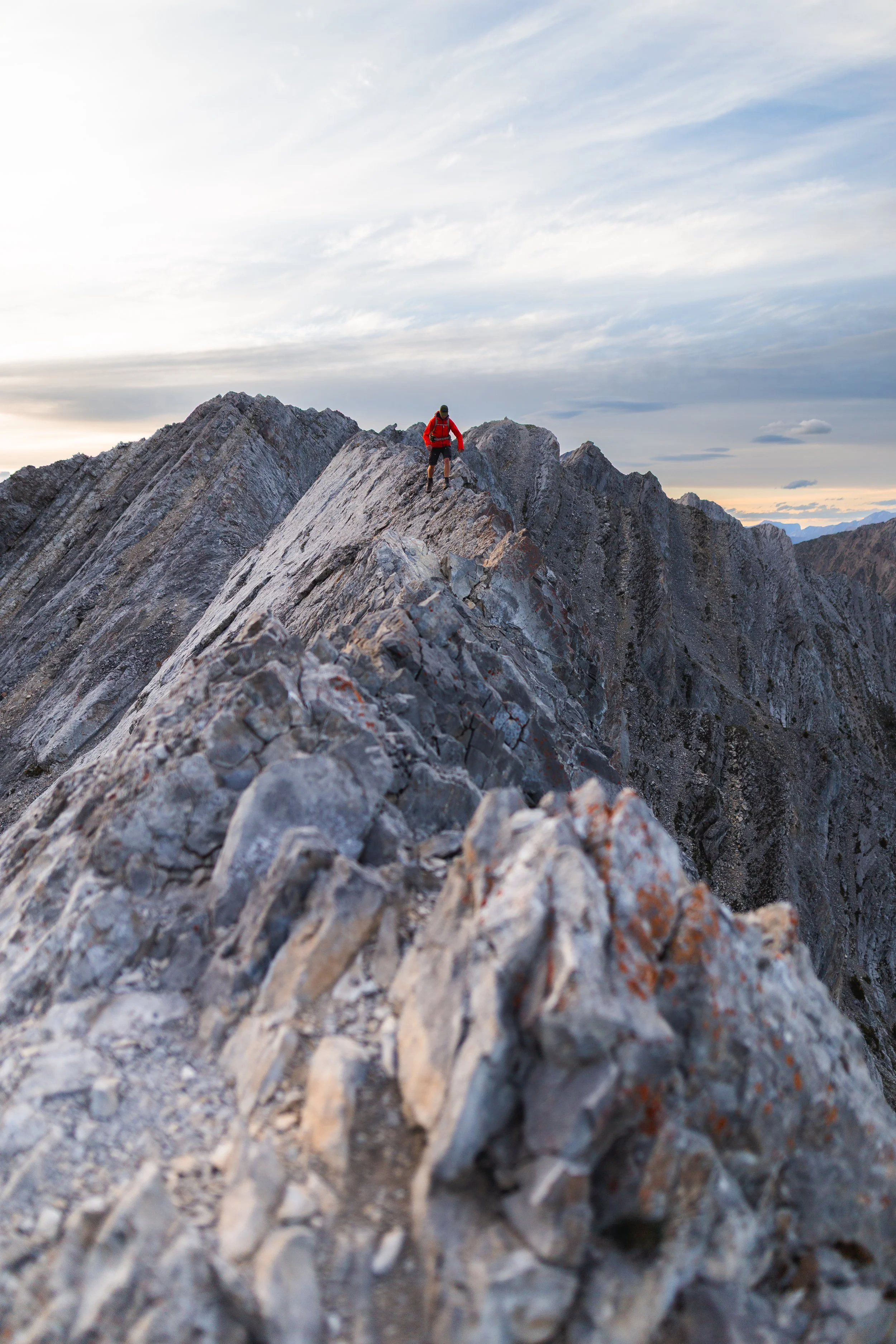
Will making his way along the knife edge ridge line, note the steep drop off on each side.
Things to know before you go
Wildlife: The start of the trail is in Cougar Creek, named that because Cougars are known to frequent the area. In fact when we hiked this trail we stayed on the summit ridge for sunset. Once we hiked back down and were in the forest it was completely dark and we were hiking with head torches. Will was adamant he caught the eyes of an animal that slinked away back into the trees in a cat like manner, possibly a Cougar!
It’s safe to say we spent the rest of the trail shouting, singing and making noise with our bear sprays at the ready!
So as always be bear and cougar aware, make noise and carry bear spray with you!
Parks and Conservation Passes: Whether you’re hiking in a national park in Canada or certain provincial parks you’ll most likely need some kind of conservation pass. A Discovery Pass will cover you for the year for all national parks in Canada whilst the Kananaskis Conservation Pass covers the provincial and wildland parks in the Kananaskis region.
Check Trail Conditions Before You Go: Trail conditions in the Rockies can change month to month and year to year. Trails close for wildlife, weather and avalanche hazards. Be sure to double check trail conditions before heading out to avoid any disappointment. You can do so here!
Leave No Trace: When hiking anywhere in the world it’s important that you practice a leave no trace philosophy. This means whatever you hike in to a trail or campground you have to be able to hike out too. There won’t be trash cans or waste disposal in the backcountry and you should never throw trash in any out houses or pit toilets. In recent years, as trails and parks become busier, litter is becoming more of a problem. Don’t add to that problem!
Offline maps knowing where you’re going is super important as to not get lost. I recommend All Trails Plus for finding routes and offline mapping allowing you to safely find your way home.
Interested in other multi-day hikes in the Canadian Rockies or maybe day hikes?